MyTopo
Addy Mountain Washington US Topo Map
Couldn't load pickup availability
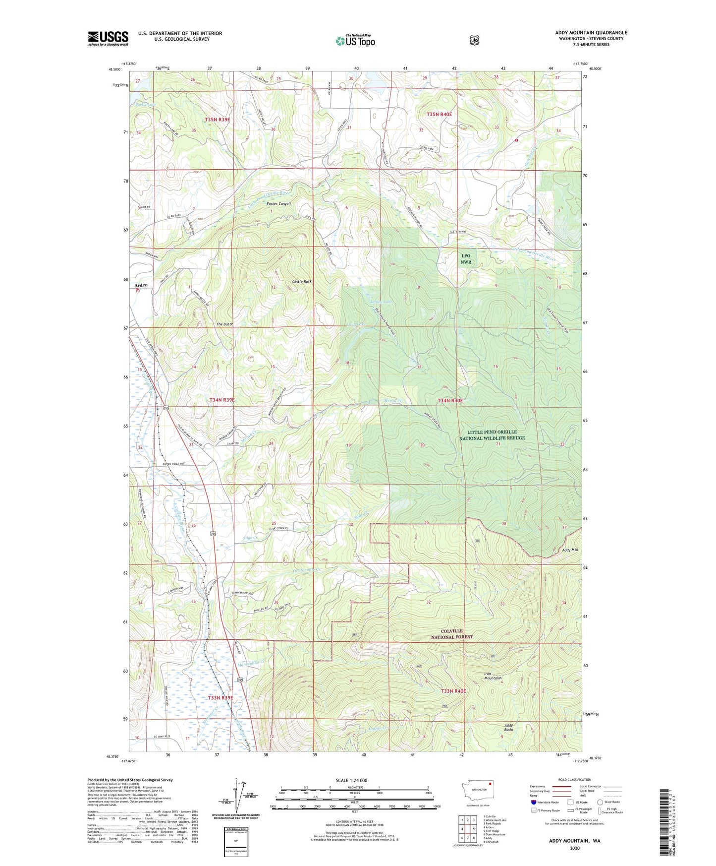
2020 topographic map quadrangle Addy Mountain in the state of Washington. Scale: 1:24000. Based on the newly updated USGS 7.5' US Topo map series, this map is in the following counties: Stevens. The map contains contour data, water features, and other items you are used to seeing on USGS maps, but also has updated roads and other features. This is the next generation of topographic maps. Printed on high-quality waterproof paper with UV fade-resistant inks.
Quads adjacent to this one:
West: Arden
Northwest: Colville
North: White Mud Lake
Northeast: Park Rapids
East: Cliff Ridge
Southeast: Chewelah
South: Addy
Southwest: Dunn Mountain
Contains the following named places: Addy Basin, Addy Mountain, Castle Rock, Country Villa Mobile Estates, Dailey Lake, Foster Canyon, Hatch Lake, Iron Mountains, Long Lake, Monaghan Creek, Moran Creek, Narcisse, Narcisse Creek, Noman Creek, Rocky Lake, Rocky Lake Recreation Site, Sherwood, Slide Creek, Stevens County, Stevens County Fire District 7 Station 72, Stevens County Fire District 7 Station 73, Stranger Creek, The Butte, Twelvemile Creek, Twelvemile School