MyTopo
Adna Washington US Topo Map
Couldn't load pickup availability
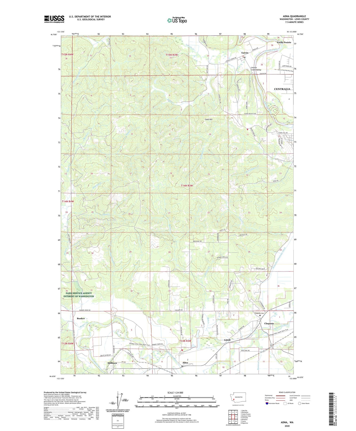
2020 topographic map quadrangle Adna in the state of Washington. Scale: 1:24000. Based on the newly updated USGS 7.5' US Topo map series, this map is in the following counties: Lewis. The map contains contour data, water features, and other items you are used to seeing on USGS maps, but also has updated roads and other features. This is the next generation of topographic maps. Printed on high-quality waterproof paper with UV fade-resistant inks.
Quads adjacent to this one:
West: Rainbow Falls
Northwest: Oakville
North: Rochester
Northeast: Violet Prairie
East: Centralia
Southeast: Napavine
South: Curtis
Southwest: Boistfort
Contains the following named places: Adna, Adna Elementary School, Adna Middle - High School, Adna Post Office, Bunker, Bunker Creek, Byron Creek, Carson Creek, Centralia High School, Claquato, Claquato Cemetery, Cook Hill, Deep Creek, Eagle Creek, Eagle Creek Dam, Fayette, Fords Prairie Census Designated Place, Gabel Creek, Galvin, Galvin Post Office, Lewis County Adventist School, Lewis County Fire District 12 Riverside Fire Authority Station 5, Lewis County Fire District 6 Adna Station 62, Lincoln Creek, Lincoln Creek Valley, Littell, Mill Creek, Millburn, Rudolph Creek, Scammon Creek, South Branch Scammon Creek, Stearns Creek, Tapp Creek, Van Ornum Creek, Wisner Creek, ZIP Codes: 98532, 98544