MyTopo
Aladdin Mountain Washington US Topo Map
Couldn't load pickup availability
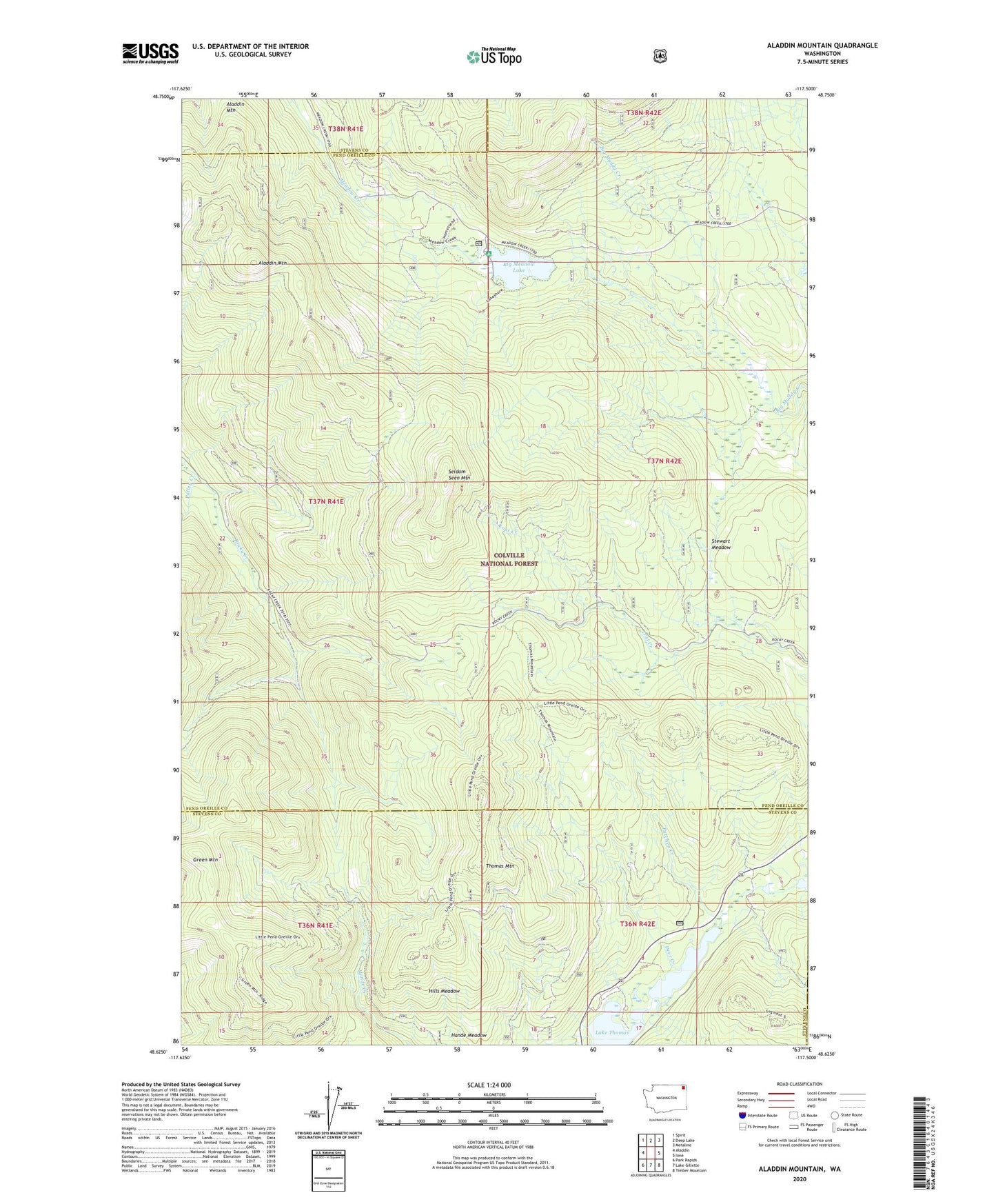
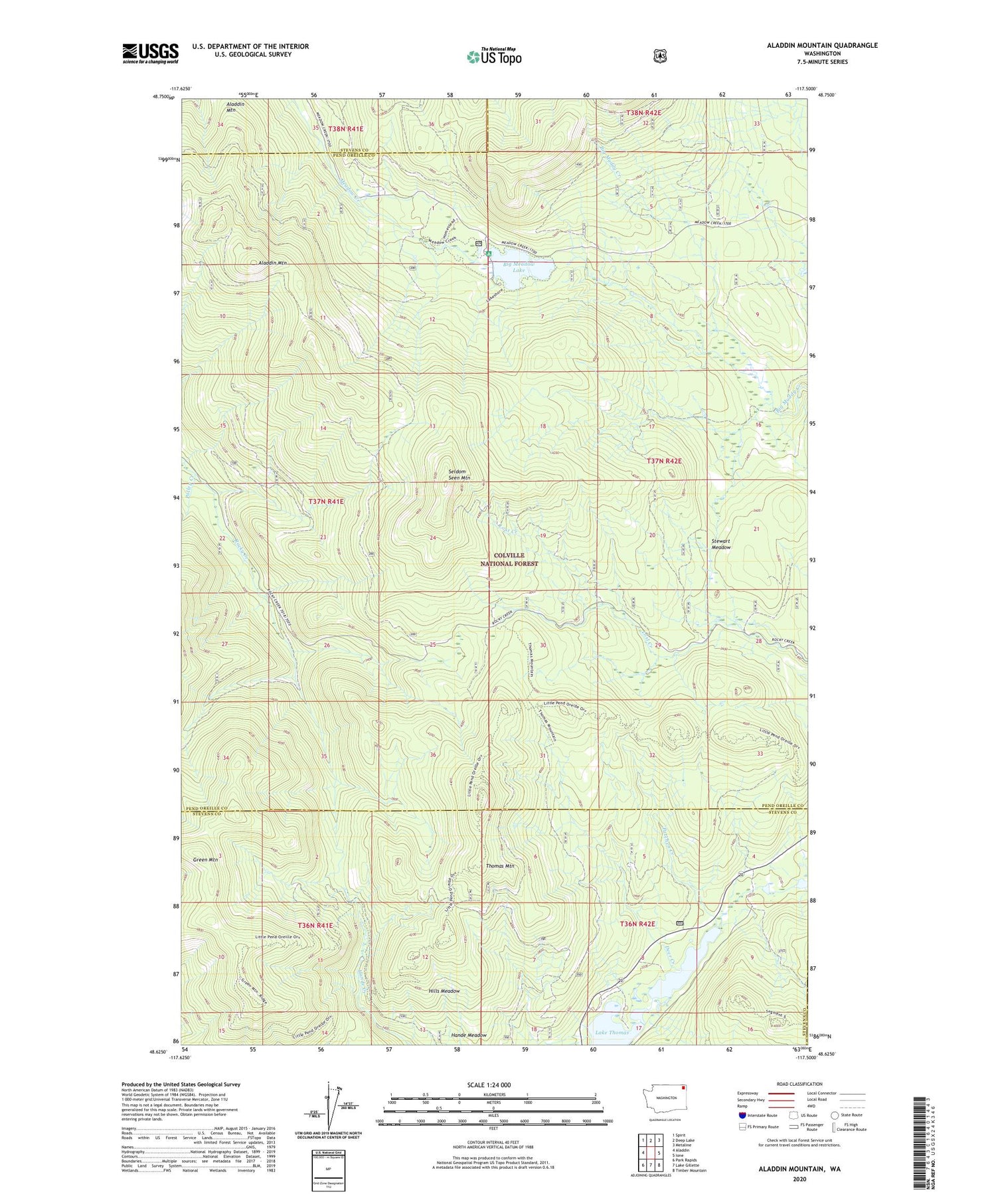
2020 topographic map quadrangle Aladdin Mountain in the state of Washington. Scale: 1:24000. Based on the newly updated USGS 7.5' US Topo map series, this map is in the following counties: Pend Oreille, Stevens. The map contains contour data, water features, and other items you are used to seeing on USGS maps, but also has updated roads and other features. This is the next generation of topographic maps. Printed on high-quality waterproof paper with UV fade-resistant inks.
Quads adjacent to this one:
West: Aladdin
Northwest: Spirit
North: Deep Lake
Northeast: Metaline
East: Ione
Southeast: Timber Mountain
South: Lake Gillette
Southwest: Park Rapids
Contains the following named places: Aladdin Mountain, Big Meadow Lake, Big Meadow Lake Campground, Deer Creek, Green Mountain, Heather Lake Dam, Hills Meadow, Lake Heritage, Lasota Mine, Little Pend Oreille Lakes, Middleport Mine, Patchen Creek, Polley Creek, Princess Pine Camp, Rocky Creek Mine, Seldom Seen Mountain, Stewart Meadow, Thomas Mountain