
MyTopo
Alameda Flat Washington US Topo Map
Couldn't load pickup availability
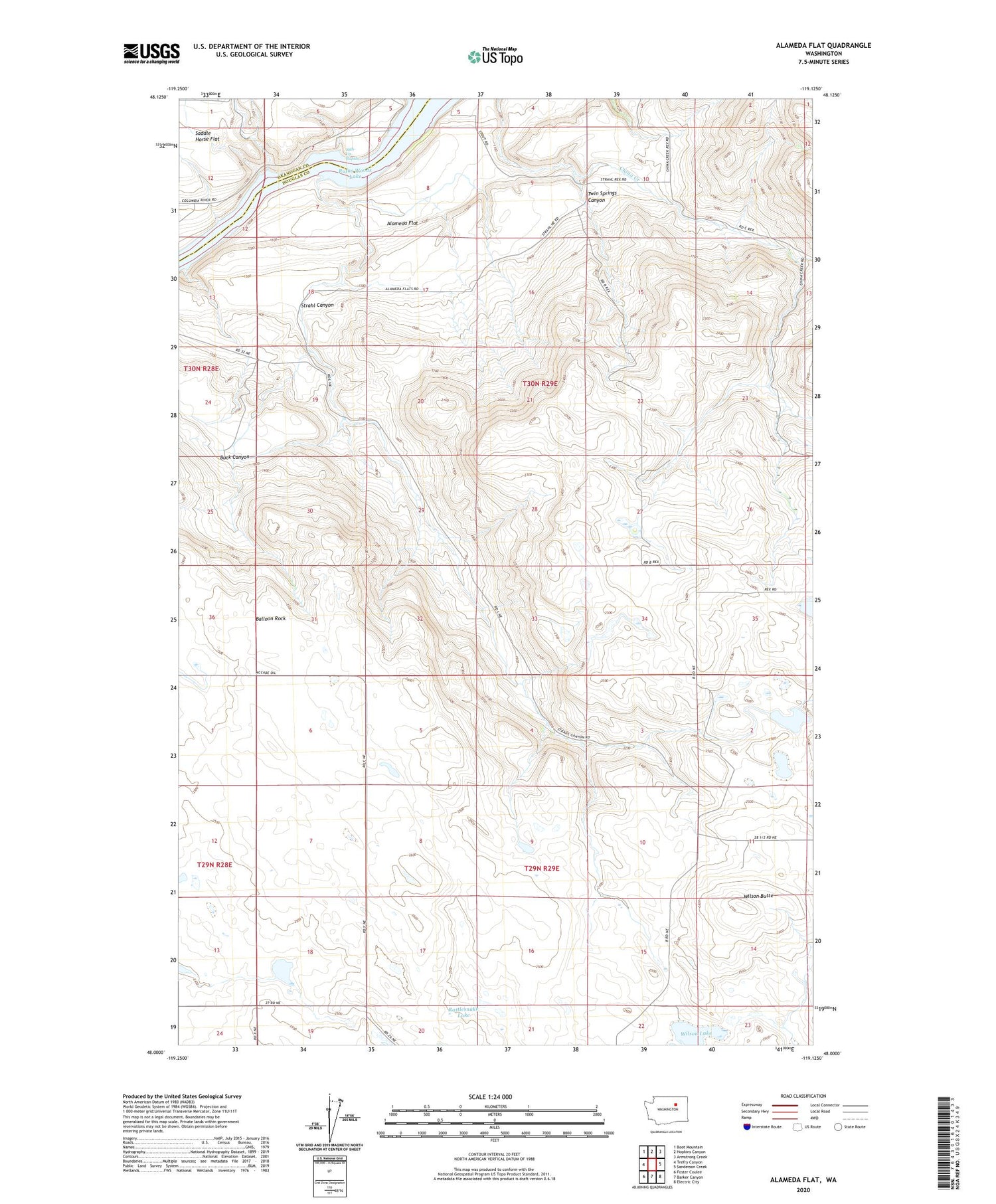
2020 topographic map quadrangle Alameda Flat in the state of Washington. Scale: 1:24000. Based on the newly updated USGS 7.5' US Topo map series, this map is in the following counties: Douglas, Okanogan. The map contains contour data, water features, and other items you are used to seeing on USGS maps, but also has updated roads and other features. This is the next generation of topographic maps. Printed on high-quality waterproof paper with UV fade-resistant inks.
Quads adjacent to this one:
West: Trefry Canyon
Northwest: Boot Mountain
North: Hopkins Canyon
Northeast: Armstrong Creek
East: Sanderson Creek
Southeast: Electric City
South: Barker Canyon
Southwest: Foster Coulee
Contains the following named places: Alameda Flat, Balloon Rock, Buck Canyon, Mah-kin Rapids, Osborne Corner, Rattlesnake Lake, Rex School, Strahl Canyon, Twin Springs Canyon, Wilson Butte, Wilson Lake


