MyTopo
Albion Washington US Topo Map
Couldn't load pickup availability
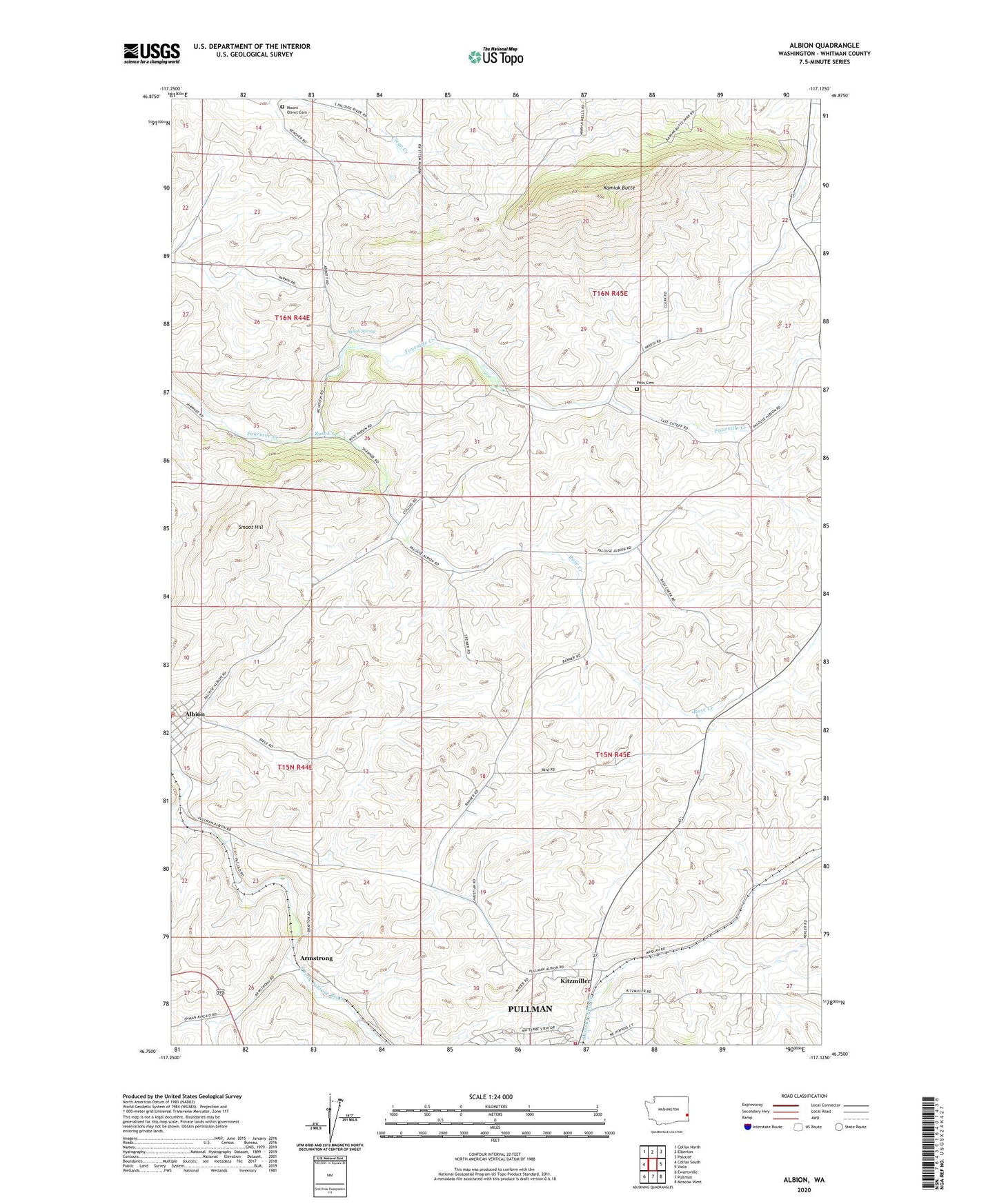
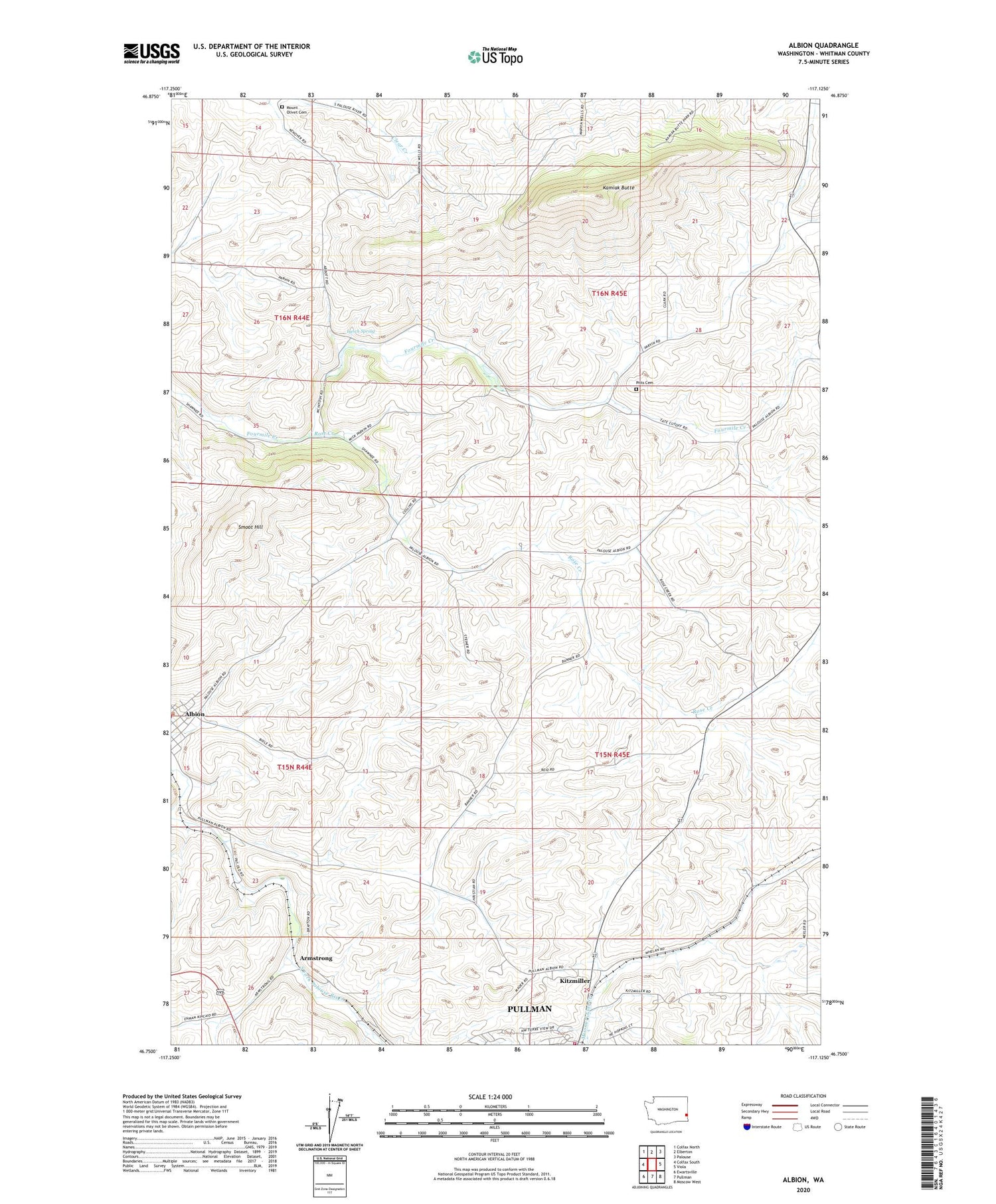
2020 topographic map quadrangle Albion in the state of Washington. Scale: 1:24000. Based on the newly updated USGS 7.5' US Topo map series, this map is in the following counties: Whitman. The map contains contour data, water features, and other items you are used to seeing on USGS maps, but also has updated roads and other features. This is the next generation of topographic maps. Printed on high-quality waterproof paper with UV fade-resistant inks.
Quads adjacent to this one:
West: Colfax South
Northwest: Colfax North
North: Elberton
Northeast: Palouse
East: Viola
Southeast: Moscow West
South: Pullman
Southwest: Ewartsville
Contains the following named places: Armstrong, Eggers Airport, Kamiak Butte, Kamiak Butte County Park, Kitzmiller, KWSU-TV (Pullman), Lynch Spring, Mount Olivet Cemetery, Pitts Cemetery, Pullman Fire Department Station 32, Rose Creek, Smoot Hill