MyTopo
Ashnola Pass Washington US Topo Map
Couldn't load pickup availability
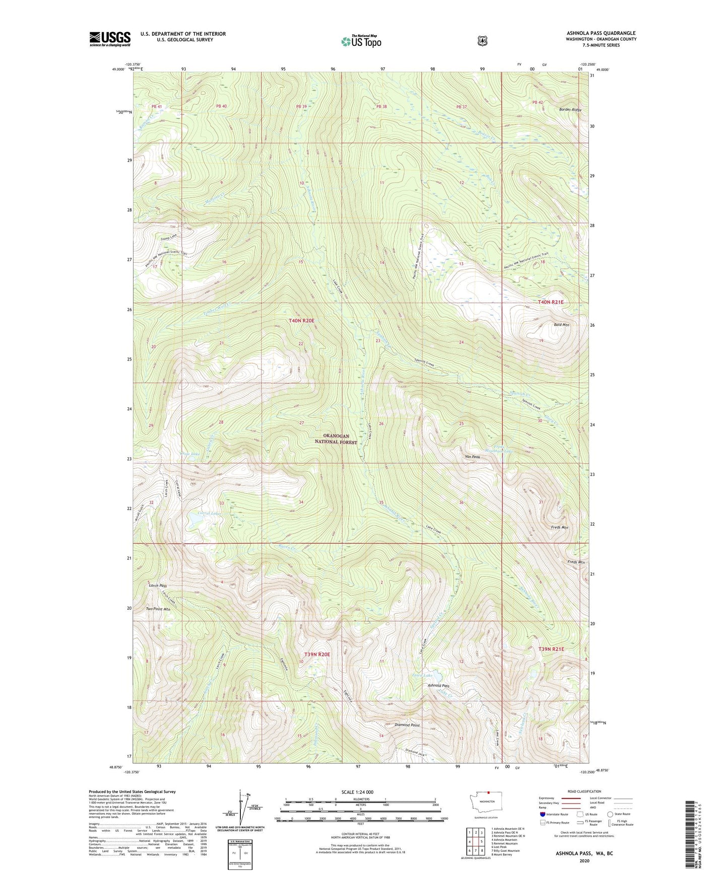
2020 topographic map quadrangle Ashnola Pass in the state of Washington. Scale: 1:24000. Based on the newly updated USGS 7.5' US Topo map series, this map is in the following counties: Okanogan. The map contains contour data, water features, and other items you are used to seeing on USGS maps, but also has updated roads and other features. This is the next generation of topographic maps. Printed on high-quality waterproof paper with UV fade-resistant inks.
Quads adjacent to this one:
West: Ashnola Mountain
Northwest: Ashnola Mountain OE N
North: Ashnola Pass OE N
Northeast: Remmel Mountain OE N
East: Remmel Mountain
Southeast: Mount Barney
South: Billy Goat Mountain
Southwest: Lost Peak
Contains the following named places: Ashnola Pass, Baker Brown Cabin, Bald Mountain, Beaver Creek, Bob Creek, Corral Lake, Crow Lake, Diamond Point, Fawn Lake, Freds Mountain, Freds Mountain Lake, Gabril Creek, Glory Creek, Larch Pass, Martina Creek, Raven Creek, Spanish Creek, Spotted Creek, Timber Wolf Creek, Van Peak