MyTopo
Basin City Washington US Topo Map
Couldn't load pickup availability
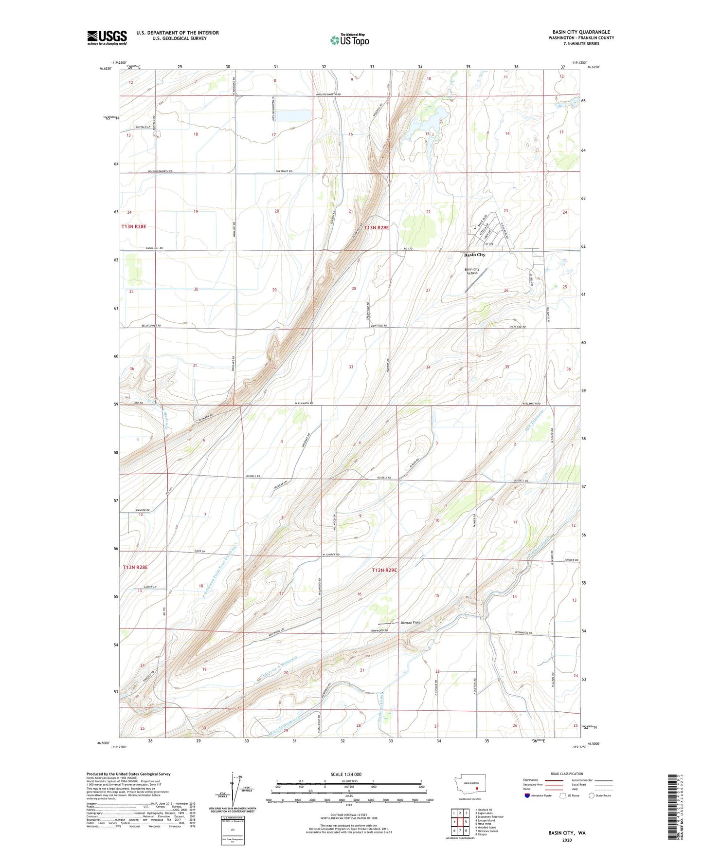
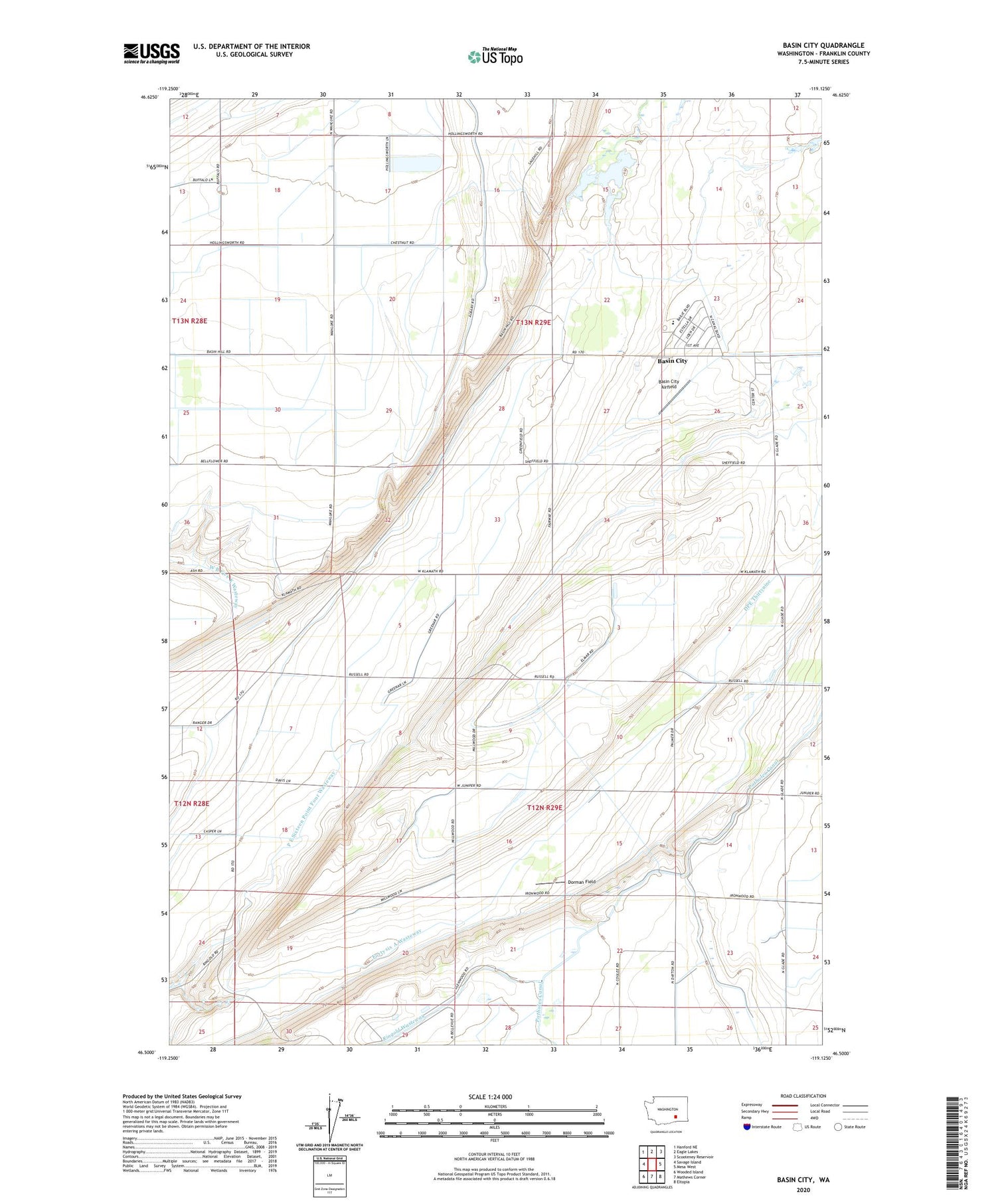
2020 topographic map quadrangle Basin City in the state of Washington. Scale: 1:24000. Based on the newly updated USGS 7.5' US Topo map series, this map is in the following counties: Franklin. The map contains contour data, water features, and other items you are used to seeing on USGS maps, but also has updated roads and other features. This is the next generation of topographic maps. Printed on high-quality waterproof paper with UV fade-resistant inks.
Quads adjacent to this one:
West: Savage Island
Northwest: Hanford NE
North: Eagle Lakes
Northeast: Scooteney Reservoir
East: Mesa West
Southeast: Eltopia
South: Mathews Corner
Southwest: Wooded Island
Contains the following named places: Basin City, Basin City Airfield, Basin City Census Designated Place, Basin City Elementary School, Dorman Field, Fortysix A Wasteway, Franklin County Public Hospital District 1 Ambulance Service, P E Sixteen Point Four Wasteway, ZIP Code: 99343