
MyTopo
Wynoochee Valley NW Washington US Topo Map
Couldn't load pickup availability
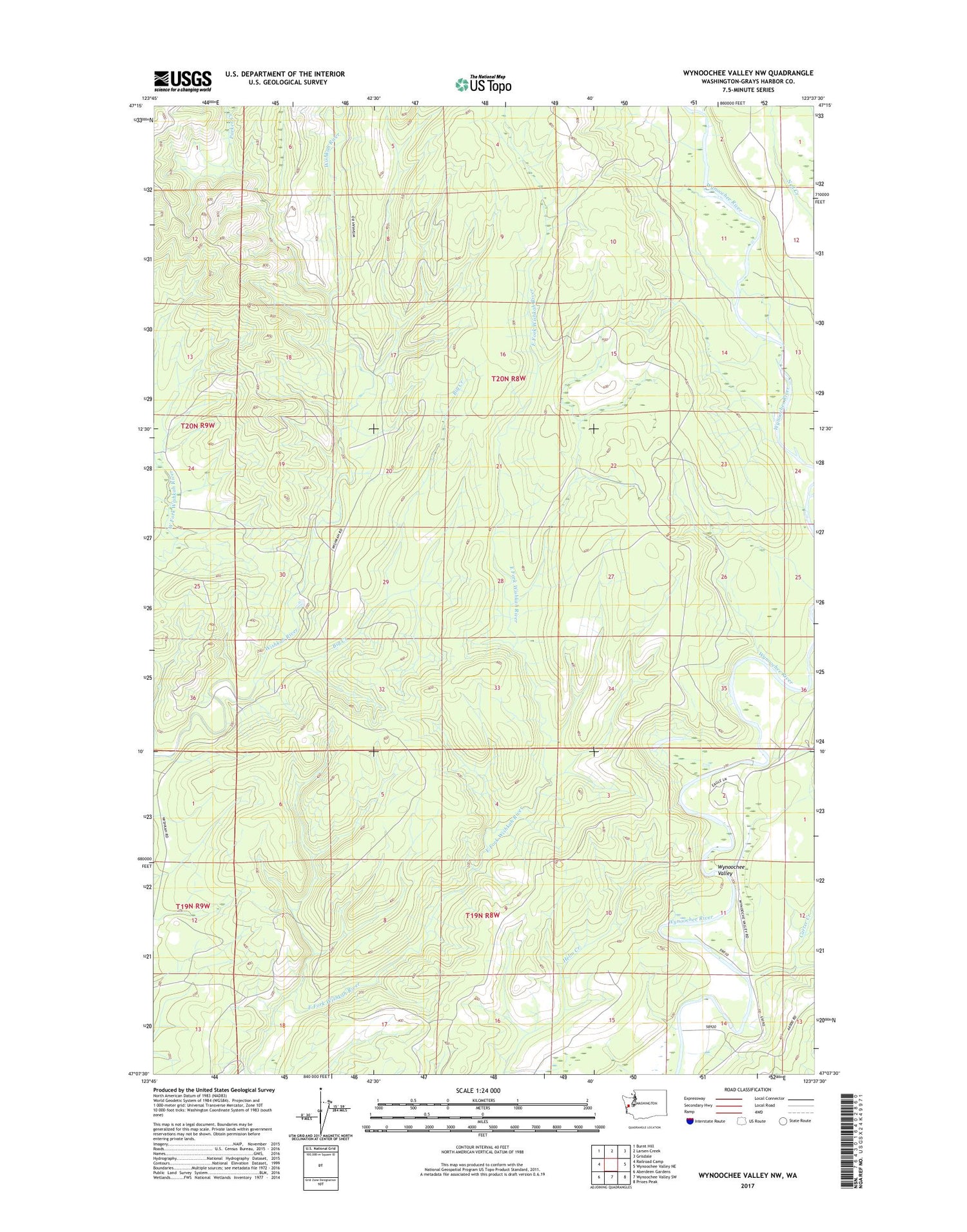
2020 topographic map quadrangle Wynoochee Valley NW in the state of Washington. Scale: 1:24000. Based on the newly updated USGS 7.5' US Topo map series, this map is in the following counties: Grays Harbor. The map contains contour data, water features, and other items you are used to seeing on USGS maps, but also has updated roads and other features. This is the next generation of topographic maps. Printed on high-quality waterproof paper with UV fade-resistant inks.
Quads adjacent to this one:
West: Railroad Camp
Northwest: Burnt Hill
North: Larsen Creek
Northeast: Grisdale
East: Wynoochee Valley NE
Southeast: Prices Peak
South: Wynoochee Valley SW
Southwest: Aberdeen Gardens
Contains the following named places: Big Creek, Carter Creek, Olympic State Wildlife Recreation Area, Parker Creek, Wishkah Quarry


