MyTopo
Yesmowit Canyon Washington US Topo Map
Couldn't load pickup availability
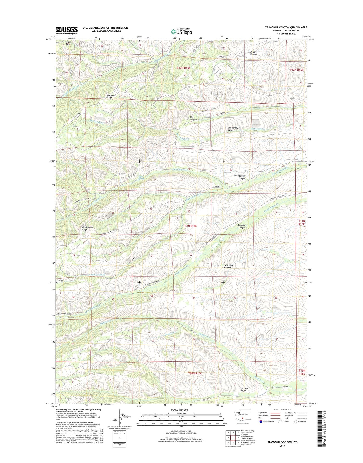
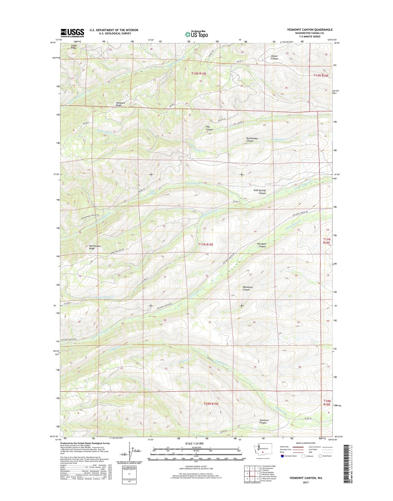
2020 topographic map quadrangle Yesmowit Canyon in the state of Washington. Scale: 1:24000. Based on the newly updated USGS 7.5' US Topo map series, this map is in the following counties: Yakima. The map contains contour data, water features, and other items you are used to seeing on USGS maps, but also has updated roads and other features. This is the next generation of topographic maps. Printed on high-quality waterproof paper with UV fade-resistant inks.
Quads adjacent to this one:
West: Piscoe Meadow
Northwest: Foundation Ridge
North: Pine Mountain
Northeast: Tampico
East: Medicine Valley
Southeast: Fort Simcoe
South: Willy Dick Canyon
Southwest: Lost Horse Plateau
Contains the following named places: Diamond Dick Creek, Rattlesnake Canyon, Soda Springs, Spencer Creek, Yesmowit Canyon