
MyTopo
Alderson West Virginia US Topo Map
Couldn't load pickup availability
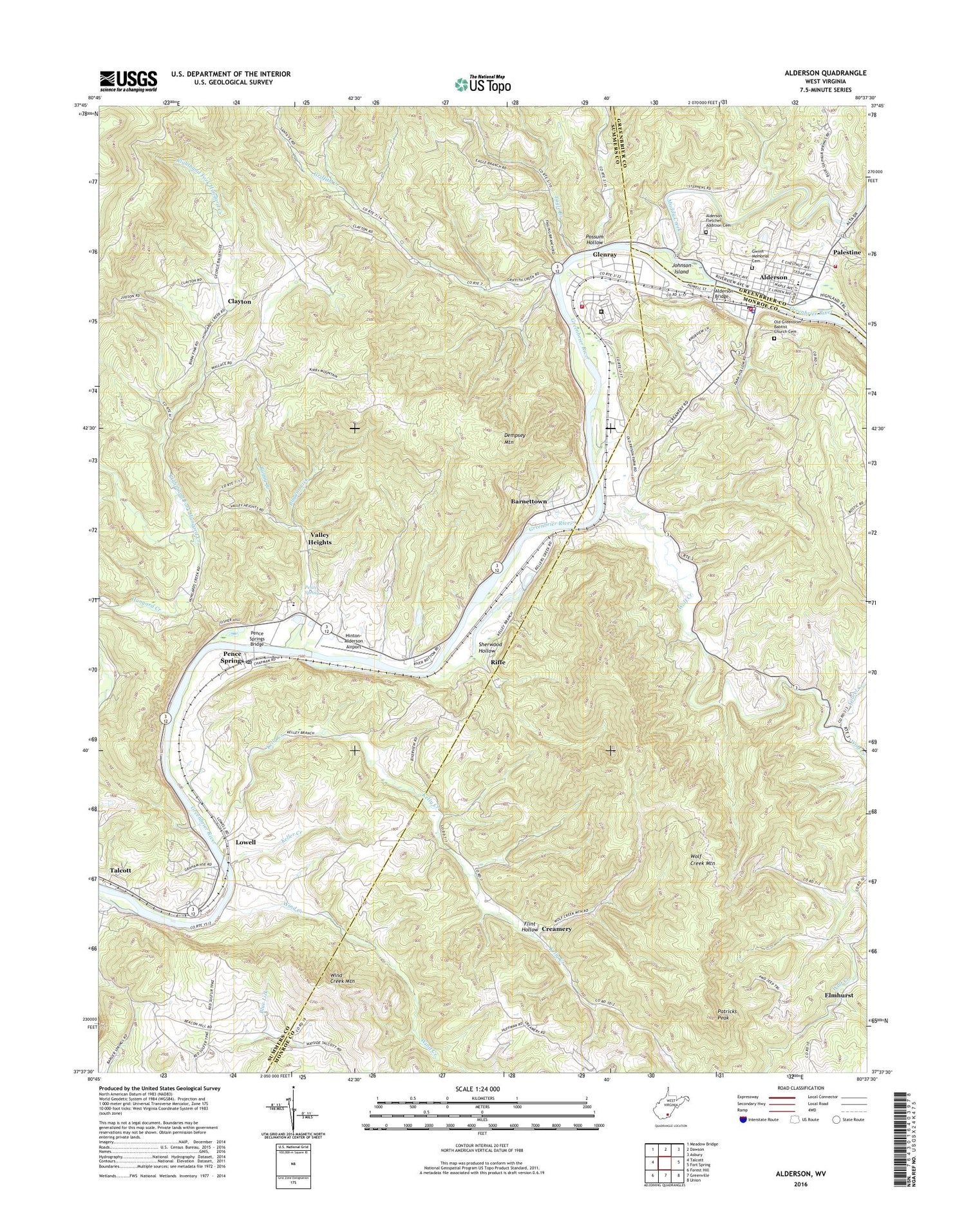
2019 topographic map quadrangle Alderson in the state of West Virginia. Scale: 1:24000. Based on the newly updated USGS 7.5' US Topo map series, this map is in the following counties: Summers, Monroe, Greenbrier. The map contains contour data, water features, and other items you are used to seeing on USGS maps, but also has updated roads and other features. This is the next generation of topographic maps. Printed on high-quality waterproof paper with UV fade-resistant inks.
Quads adjacent to this one:
West: Talcott
Northwest: Meadow Bridge
North: Dawson
Northeast: Asbury
East: Fort Spring
Southeast: Union
South: Greenville
Southwest: Forest Hill
Contains the following named places: Alderson, Alderson Bridge, Alderson Church of God, Alderson Elementary School, Alderson Federal Prison Camp Federal Fire Department 25, Alderson Fletcher Addition Cemetery, Alderson Police Department, Alderson Post Office, Alderson Public Library, Alderson Volunteer Fire Department Station 10, Aldersons Ferry, Barnettown, Big Cove School, Boyd School, Buggar Lick, Buggy Branch, Bush School, Clayton, Clayton Missionary Baptist Church, Creamery, Crossroads School, Dempsey Mountain, Eagle Branch, Egypt, Elmhurst, Federal Fire Department, Federal Prison Camp Alderson, Flat Mountain Church, Flint Hollow, Flints Baptist Chapel, Glenray, Glenray Post Office, Grahams Ferry, Greenbrier Academy for Girls, Griffith Creek, Griffith Creek Church, Griffith Creek School, Gwinn Memorial Cemetery, Haynes Ferry, Hinton-Alderson Airport, Holiness Church, Jarrett School, Johnson Island, Keller Church, Keller Creek, Kelly Creek, Kirby School, Laurel Creek, Lowell, Mount Hope School, Mount Pleasant School, Mountain State High School, Muddy Creek, Old Greenbrier Babtist Church Cemetery, Old Greenbrier Baptist Church, Palestine, Patricks Peak, Pence Spring, Pence Springs, Pence Springs Bridge, Pence Springs Community Church, Pence Springs Hotel Historic District, Pence Springs Post Office, Possum Hollow, Riffe, Righthand Fork Hungard Creek, Riverside School, Riverview Church, Riverview School, Santafee, Santifee, Sherwood Hollow, Town of Alderson, Tri - County Volunteer Fire Department, Trinity Church, Valley Heights, Wind Creek, Wind Creek Mountain, Wolf Creek, Wolf Creek District, Wolf Creek Mountain, Wolf Creek Station, ZIP Codes: 24962, 24981


