MyTopo
Alton West Virginia US Topo Map
Couldn't load pickup availability
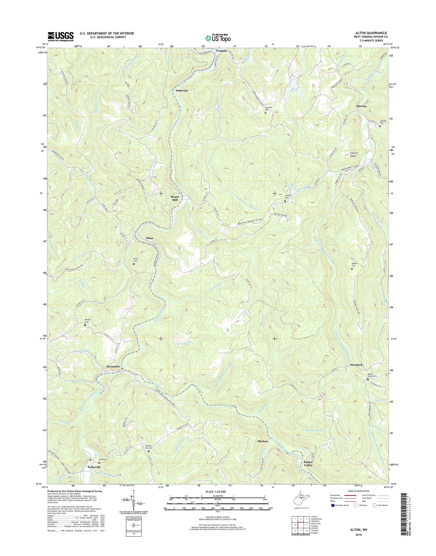
2019 topographic map quadrangle Alton in the state of West Virginia. Scale: 1:24000. Based on the newly updated USGS 7.5' US Topo map series, this map is in the following counties: Upshur. The map contains contour data, water features, and other items you are used to seeing on USGS maps, but also has updated roads and other features. This is the next generation of topographic maps. Printed on high-quality waterproof paper with UV fade-resistant inks.
Quads adjacent to this one:
West: Rock Cave
Northwest: Adrian
North: Buckhannon
Northeast: Ellamore
East: Cassity
Southeast: Adolph
South: Pickens
Southwest: Goshen
Contains the following named places: Alec Run, Alexander, Alton, Alton Cemetery, Alton United Brethren Church, Ash Camp, Beans Mill, Bear Camp School, Bearcamp Run, Bens Run, Big Run, Brooks Hill Cemetery, Brooks School, Burr School, Carpenter School, Chapel Cemetery, Chemical, Church Knob, Cold Run, Cutright Church, Cutright School, Harmany Church, Hemlock, Herods Run, Imperial, Indian Camp Church, Indian Camp Run, Indian Camp School, Jackson Fork, James Curry Public Library, Jenks Fork, Jenks Fork School, Lanham Cemetery, Left Fork Buckhannon River, Left Fork Right Fork Buckhannon River, Leonard Run, Leonard Run School Spring, Lick Run, Maher Cemetery, Marple Chapel Cemetery, Marple School, Millsite Run, Mount Olive Cemetery, Mount Olive Methodist Episcopal Church, Palace Valley, Panther Creek, Queens, Reger Run, Right Fork Buckhannon River, Right Fork Tenmile Creek, Ross Cemetery, Rough Run, Selbyville, Selbyville Volunteer Fire Department Station 7, Shahan, Simmons Run, Smooth Rock Lick Run, Stockerts, Sugar Run, Swamp Run, Tenmile, Tenmile Cemetery, Tenmile Church, Upper Rough Run, Upper Tenmile School, Washington District, ZIP Code: 26237