MyTopo
Anthony West Virginia US Topo Map
Couldn't load pickup availability
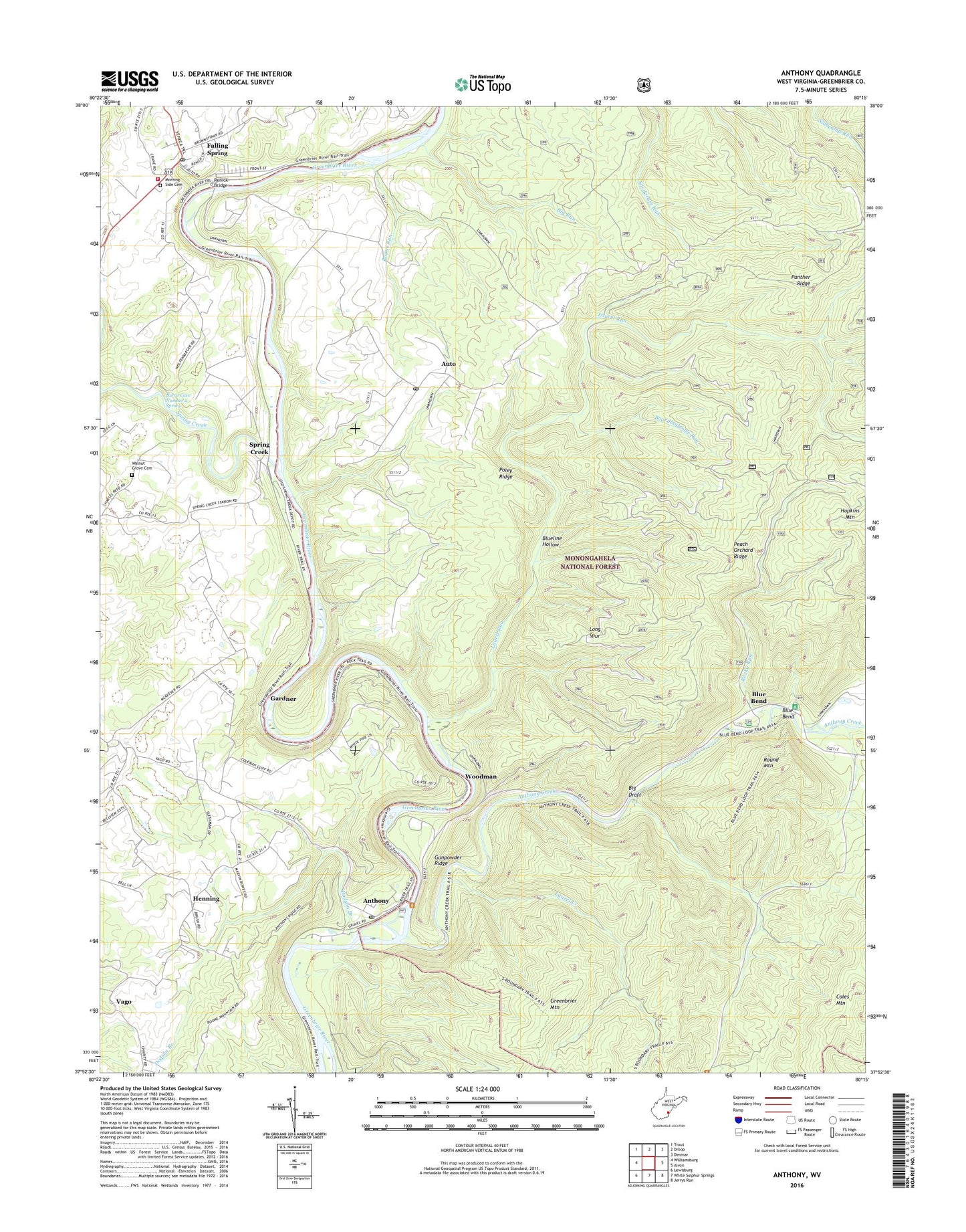
2019 topographic map quadrangle Anthony in the state of West Virginia. Scale: 1:24000. Based on the newly updated USGS 7.5' US Topo map series, this map is in the following counties: Greenbrier. The map contains contour data, water features, and other items you are used to seeing on USGS maps, but also has updated roads and other features. This is the next generation of topographic maps. Printed on high-quality waterproof paper with UV fade-resistant inks.
Quads adjacent to this one:
West: Williamsburg
Northwest: Trout
North: Droop
Northeast: Denmar
East: Alvon
Southeast: Jerrys Run
South: White Sulphur Springs
Southwest: Lewisburg
Contains the following named places: Anthony, Anthony Baptist Church, Anthony Boat Launch, Anthony Creek, Anthony Post Office, Auto, Auto Post Office, Big Draft, Big Draft Wilderness, Big Run, Big Run Trail, Blue Bend, Blue Bend Campground, Blue Bend Loop Trail, Blueline Hollow, Blueline Trail, Boardinghouse Run, Boggs Run, Burdett School, Burns Cave Number 2 Spring, Civil War Trail, Clendenin School, Coles Mountain Trail, Dodson Branch, Eastern District, Enon Baptist Church, Falling Spring, Falling Spring School, Gabbert School, Gardner, Gilboa School, Greenbrier River Trail, Greenbrier Youth Camp, Gunpowder Ridge, Gunpowder Ridge Overlook, Henning, Henning Church of God, Henning School, Hopkins Mountain, Laurel Creek, Laurel Run, Laurel Run Trail, Long Spur, Morning Side Cemetery, Panther Ridge, Peach Orchard Ridge, Peach Orchard Trail, Pleasant View School, Poley Ridge, Red Run, Renick Bridge, Renick Post Office, Renick Volunteer Fire Department, Rocky Run, Round Mountain, South Boundary Trail, Spring Creek, Town of Falling Spring, Vago, Walnut Grove Cemetery, Walnut Grove Church, Woodland School, Woodman