MyTopo
Asbury West Virginia US Topo Map
Couldn't load pickup availability
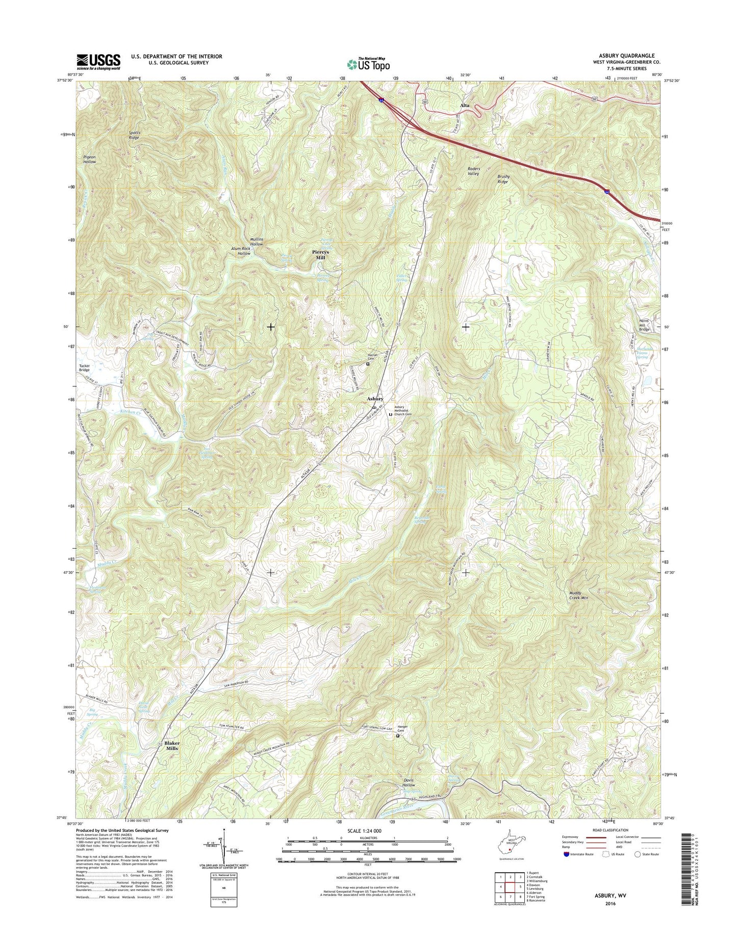
2019 topographic map quadrangle Asbury in the state of West Virginia. Scale: 1:24000. Based on the newly updated USGS 7.5' US Topo map series, this map is in the following counties: Greenbrier. The map contains contour data, water features, and other items you are used to seeing on USGS maps, but also has updated roads and other features. This is the next generation of topographic maps. Printed on high-quality waterproof paper with UV fade-resistant inks.
Quads adjacent to this one:
West: Dawson
Northwest: Rupert
North: Cornstalk
Northeast: Williamsburg
East: Lewisburg
Southeast: Ronceverte
South: Fort Spring
Southwest: Alderson
Contains the following named places: Alta, Alum Rock Hollow, Alum Run, Asbury, Asbury Methodist Church Cemetery, Asbury Post Office, Baker School, Big Spring, Blaker Mills, Brushy Ridge School, Curry School, David Nash Spring, Davis - Stuart School, Davis Hollow, Davis Spring, Davis Stuart School, Dye Spring, Early Spring, Fairview School, Feamster Memorial Freewill Baptist Church, Fearnster School, Fleshman Spring, Fry School, Fuller Spring, George School, Hanger Cemetery, Hanger School, Harrah Cemetery, Harvey Spring, Hawver School, Herns Mill Bridge, Highland Baptist Church, Hillview School, Janes Chapel, Jim Fleshman Spring, Kitchen Creek, Kramer School, McQueen School, Mill Creek, Morlunda Farms Spring, Mount Zion Church, Muddy Creek Church, Muddy Creek Mountain, Mullins Hollow, North House Museum, Persinger School, Piercy Spring, Piercys Cave Spring, Piercys Mill, Pigeon Hollow, Pine Grove School, Raders Valley, Renick Creek, Reynolds Spring, Rich Hollow School, Seep Spring, Spotts Ridge, Tucker Bridge, West Point Baptist Church, Woods Memorial Church, WRON-FM (Ronceverte), ZIP Code: 24916