MyTopo
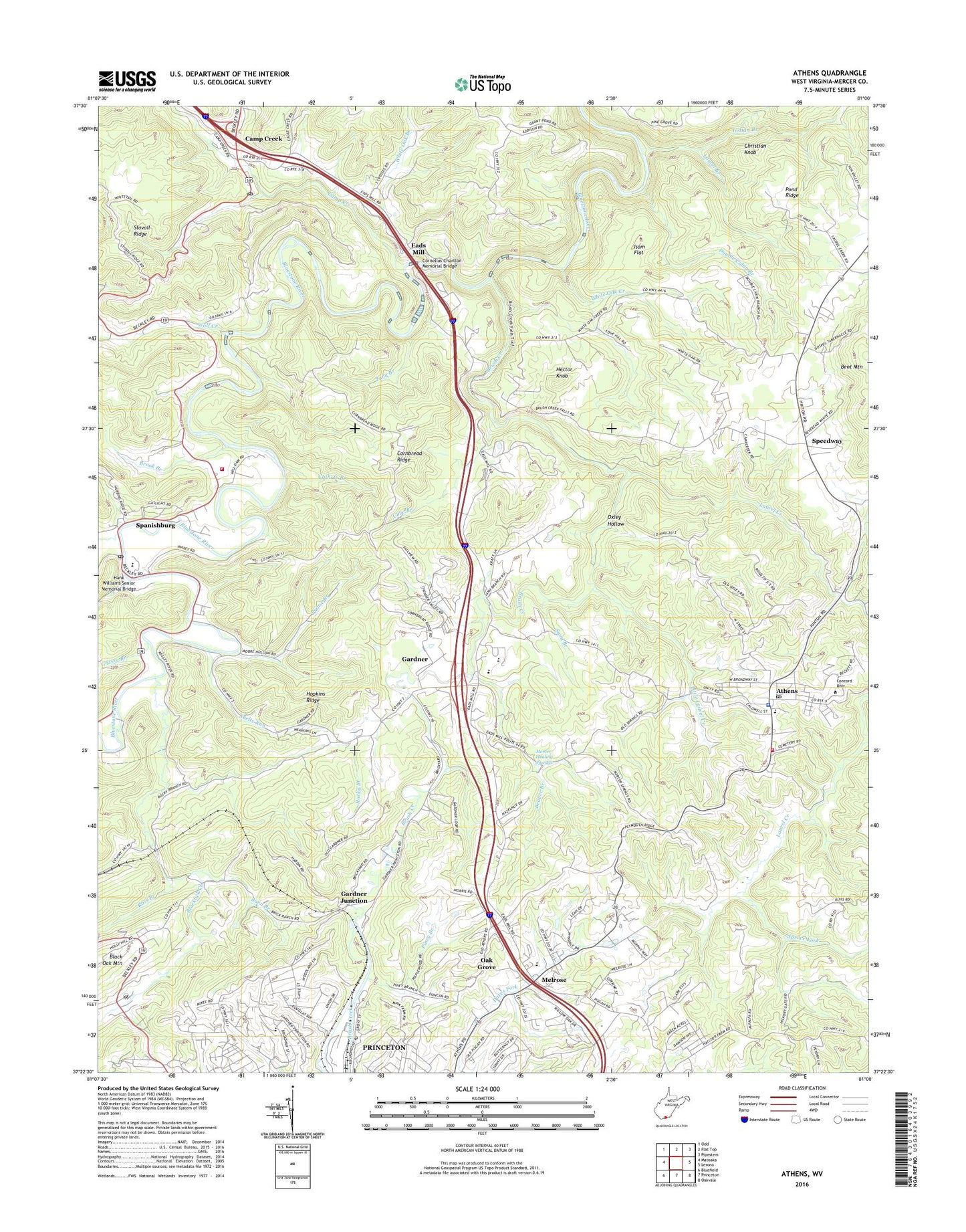
Athens West Virginia US Topo Map
Couldn't load pickup availability
2019 topographic map quadrangle Athens in the state of West Virginia. Scale: 1:24000. Based on the newly updated USGS 7.5' US Topo map series, this map is in the following counties: Mercer. The map contains contour data, water features, and other items you are used to seeing on USGS maps, but also has updated roads and other features. This is the next generation of topographic maps. Printed on high-quality waterproof paper with UV fade-resistant inks.
Quads adjacent to this one:
West: Matoaka
Northwest: Odd
North: Flat Top
Northeast: Pipestem
East: Lerona
Southeast: Oakvale
South: Princeton
Southwest: Bluefield
Contains the following named places: Alum Point School, Anderson Field, Athens, Athens Baptist Church, Athens Elementary School, Athens High School, Athens Police Department, Athens Post Office, Athens United Methodist Church, Athens Volunteer Fire Department, Athens Water Supply Dam, Ball School, Barber School, Barn Branch, Beaver Branch, Bethel Church, Blacklick Creek, Bluestone Valley Volunteer Fire Department, Brook Branch, Brush Creek, Bush Flat School, Callaghan Stadium, Camp Creek, Camp Creek Post Office, Camp Creek School, Cathole Branch, Christian Knob, Concord University, Concord University Police Department, Cornbread Ridge, Cornelius Charlton Memorial Bridge, Cove Branch, Daves Fork-Christians Fork Structure One Dam, Daves Fork-Christians Fork Structure Two Dam, District III, Double Cabin Branch, Eads Mill, Ellison School, Gardner, Gardner Junction, Grassy Branch, Hank Williams Senior Memorial Bridge, Hector Knob, Hopkins Ridge, Hopkins School, Indian Branch, Isom Flat, Kyle Bowling School, Larmon School, Laurel Branch, Laurel Creek, Little Laurel Creek, Low Gap School, Meadow Dell School, Melrose, Melrose Elementary School, Melrose Presbyterian Church, Mercer County, Mercer County Early Learning Center, Mercer Healing Springs, Monk Conn Ford, Oak Grove, Oak Grove School, Oxley Hollow, Oxley School, Painters Chapel, Pikeview High School, Pikeview Middle School, Piney Branch, Pipestem Drive-In Theatre, Pisgah Church, Pond Ridge, Prince Branch, Princeton Rescue Squad Incorporated Station 3, Rich Creek, Rich Creek Church, Rocky Branch, Ross Branch, Sand Branch, Sharps Turn School, Silver Springs Baptist Church, Silver Springs Elementary School, Skelts Run, Spanishburg, Spanishburg Church, Spanishburg High School, Spanishburg Post Office, Spanishburg School, Speedway, Spruce Fork, Tony Branch, Town of Athens, Trace Creek, Unity School, WAEY-AM (Princeton), WAEY-FM (Princeton), White Oak Branch, White Oak Creek, Wolf Creek, ZIP Codes: 24712, 25922