MyTopo
Auburn West Virginia US Topo Map
Couldn't load pickup availability
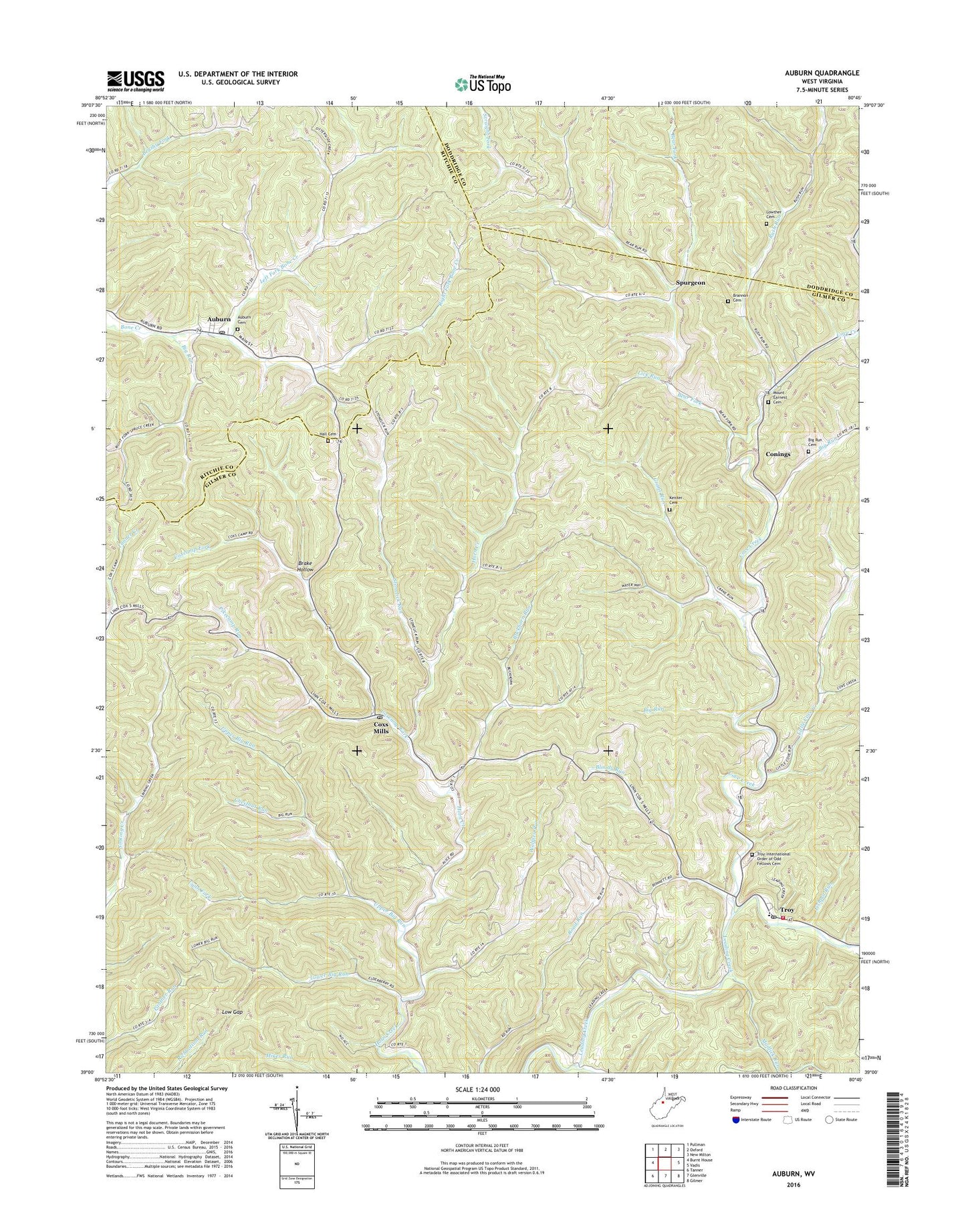
2019 topographic map quadrangle Auburn in the state of West Virginia. Scale: 1:24000. Based on the newly updated USGS 7.5' US Topo map series, this map is in the following counties: Gilmer, Ritchie, Doddridge. The map contains contour data, water features, and other items you are used to seeing on USGS maps, but also has updated roads and other features. This is the next generation of topographic maps. Printed on high-quality waterproof paper with UV fade-resistant inks.
Quads adjacent to this one:
West: Burnt House
Northwest: Pullman
North: Oxford
Northeast: New Milton
East: Vadis
Southeast: Gilmer
South: Glenville
Southwest: Tanner
Contains the following named places: Auburn, Auburn Community Cemetery, Auburn Post Office, Bear Fork, Bear Fork School, Big Run, Big Run Cemetery, Bloody Run, Bloody Run School, Brake Hollow, Brannon Cemetery, Buckhorn Run, Buckhorn School, Chestnut Run, Conings, Cove Creek, Coxcamp Fork, Coxs Mills, Coxs Mills Post Office, Crane Run, De Kalb-Troy District, Ellis Run, Fishpot Run, Gilmer County Volunteer Fire Department Troy Station, Hall Cemetery, Horn Creek Church, Keister Cemetery, Left Fork Bone Creek, Lick Run, Lick Run School, Little Cove Creek, Low Gap, Low Gap School, Lower Big Run, Lower Rush Run School, Lowther Cemetery, Lynn Fork, Moonrise School, Mount Earnest Cemetery, Mount Earnest Church, Mount Union Church, Mudlick Run, Osborne School, Pawpaw School, Pikecamp Run, Pleasant Valley Church, Right Fork Bone Creek, Rocky Pond School, Rush Run, Springston School, Spurgeon, Stonelick Run, Town of Auburn, Troy, Troy Elementary School, Troy IOOF Community Cemetery, Troy Post Office, Upper Big Run, Upper Big Run School, Upper Rush Run School, Wolfpen Run, ZIP Codes: 26342, 26443