MyTopo
Aurora West Virginia US Topo Map
Couldn't load pickup availability
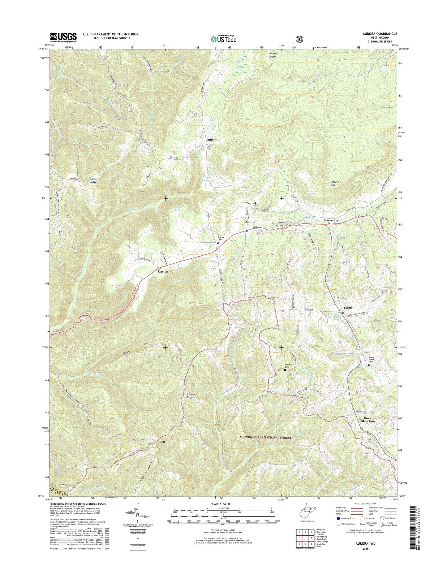
2019 topographic map quadrangle Aurora in the state of West Virginia. Scale: 1:24000. Based on the newly updated USGS 7.5' US Topo map series, this map is in the following counties: Preston, Tucker. The map contains contour data, water features, and other items you are used to seeing on USGS maps, but also has updated roads and other features. This is the next generation of topographic maps. Printed on high-quality waterproof paper with UV fade-resistant inks.
Quads adjacent to this one:
West: Rowlesburg
Northwest: Kingwood
North: Terra Alta
Northeast: Oakland
East: Table Rock
Southeast: Davis
South: Lead Mine
Southwest: Saint George
Contains the following named places: Accident Cemetery, Accident School, Amboy, Amboy Church, Amboy School, Aurora, Aurora Census Designated Place, Aurora Elementary School, Aurora Post Office, Aurora United Methodist Church, Aurora Volunteer Fire Department, Beachy Cemetery, Bear Run, Belleview Cemetery, Belleview School, Boiling Spring, Breedlove, Bretside School, Brookside, Brookside Brethren Church, Brushy Knobs, Cabbage Run, Carmel, Cash Valley School, Cathedral State Park, Cathedral State Park Museum, Dayton, Eglon, Eglon Post Office, Elmer Grimm Lake Dam, Forest Dale School, Grange Hall School, Hockert School, Horse Shoe Run, Horse Shoe Run Post Office, Lace White Spring, Lantz Ridge, Maple Grove Church, Maple Spring Cemetery, Maple Spring Church, Mount Grove Volunteer Fire Department, Mount Olivet, Old Indian Spring, Saint Pauls Lutheran Church, Sell, Shaffer Mountain, Stemple Ridge, Stemple Ridge Church, Stemple Ridge School, Texas Church, Thunderstruck Run, Union Ambulance Service, Union District, White, ZIP Codes: 26705, 26716