
MyTopo
Bancroft West Virginia US Topo Map
Couldn't load pickup availability
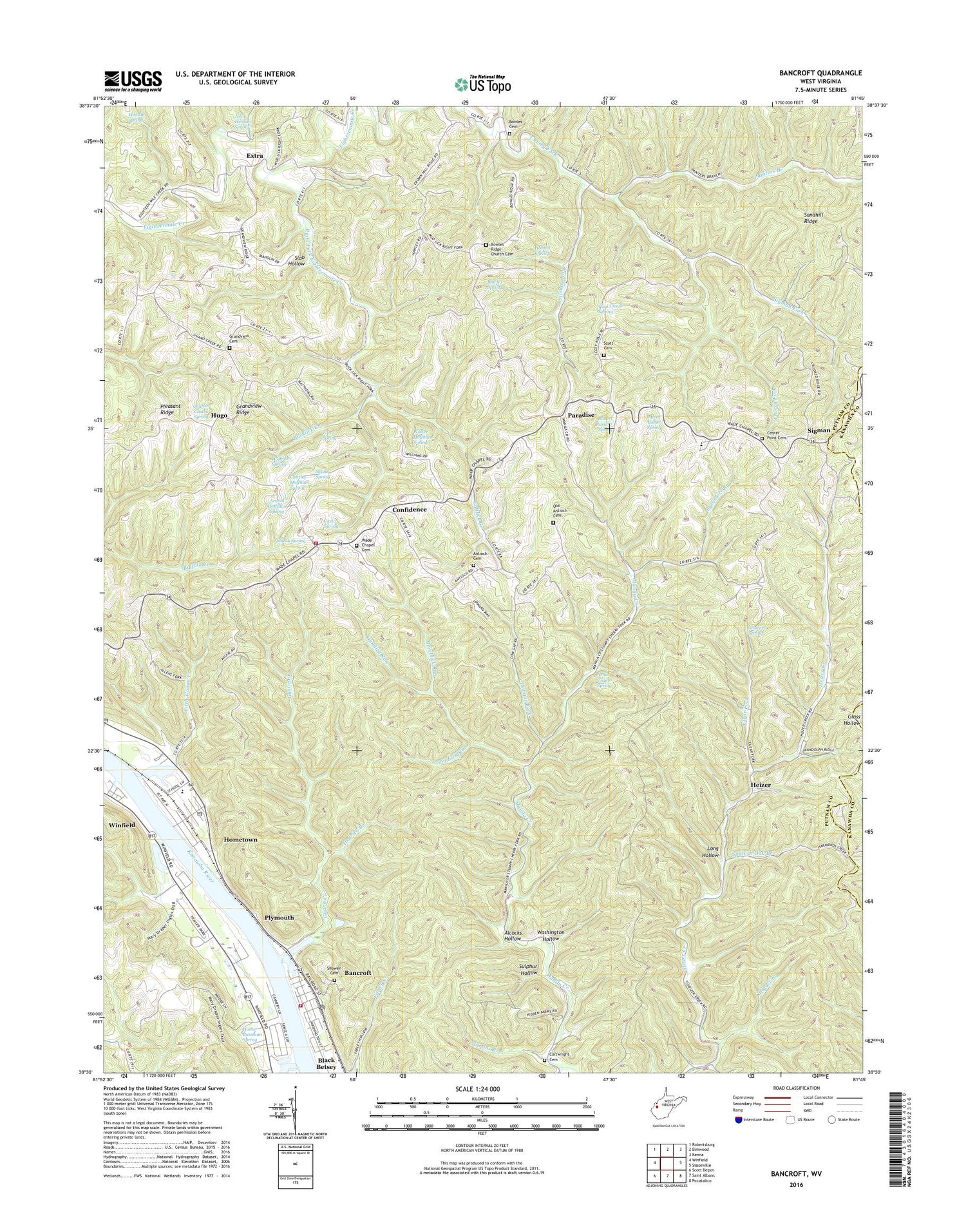
2019 topographic map quadrangle Bancroft in the state of West Virginia. Scale: 1:24000. Based on the newly updated USGS 7.5' US Topo map series, this map is in the following counties: Putnam, Kanawha. The map contains contour data, water features, and other items you are used to seeing on USGS maps, but also has updated roads and other features. This is the next generation of topographic maps. Printed on high-quality waterproof paper with UV fade-resistant inks.
Quads adjacent to this one:
West: Winfield
Northwest: Robertsburg
North: Elmwood
Northeast: Kenna
East: Sissonville
Southeast: Pocatalico
South: Saint Albans
Southwest: Scott Depot
Contains the following named places: Alcocks Hollow, Amherst/Plymouth Wildlife Management Area, Arnie Craigo Spring, Arnold Hoffman Spring, Bancroft, Bancroft Post Office, Bancroft Town Hall, Bancroft Volunteer Fire Department, Beechlick Run, Bigger Branch, Bowles Cemetery, Bowles Ridge Church, Bowles Spring, Bronco Junction Asthmatic Camp, Bucklick Creek, Cartwright Cemetery, Casto Spring, Center Point Cemetery, Center Point Church, Charles Castro Spring, Charles Hoffman Spring, Clear Fork, Confidence, Confidence Elementary School, Crown Hill School, District 1, Extra, Grandview Cemetery, Grandview Church, Grandview Ridge, Guano Creek, Gumlick Run, Hedrick Branch, Heizer, Henson Spring, Hoffman Spring, Holiday Park, Homer Bateman Spring, Hometown, Hometown Census Designated Place, Hometown Elementary School, Hometown Post Office, Hooten Spring, Hugo, John Henson Spring, Johnson Shoal Light, Lincoln School, Lindsey Branch, Little Guano Creek, Lone Oak Church, Long Hollow, Lowgap Fork, Martins Branch, Maxil Fisher Spring, New Antioch Cemetery, New Antioch Church, Oklahoma School, Old Antioch Cemetery, Painters Branch, Paradise, Paul Crago Spring, Pleasant Grove Church, Plymouth, Pocatalico District, Red House Post Office, Right Fork Eighteenmile Creek, Robert Parkins Spring, Route 34 Volunteer Fire Department, Saltlick Creek, Sandhill Ridge, Sandhill School, Scott Cemetery, Second Branch, Shank Spring, Shawnee Estates, Showen Cemetery, Sigman, Sigman Fork, Slab Hollow, Spanish Oak Branch, Spring Valley Branch, Stowers Spring, Stumpy Run, Sulphur Hollow, Sycamore Branch, Thornhill Addition, Tom Lick Run, Town of Bancroft, Wade Chapel, Wade Chapel Cemetery, Walter Hoffman Spring, Washington Hollow, Webb Landing, Webb Landing Post Light, Winfield Church of Christ, Winfield Way, Witt Spring, ZIP Codes: 25011, 25109, 25124, 25159


