MyTopo
Burnsville West Virginia US Topo Map
Couldn't load pickup availability
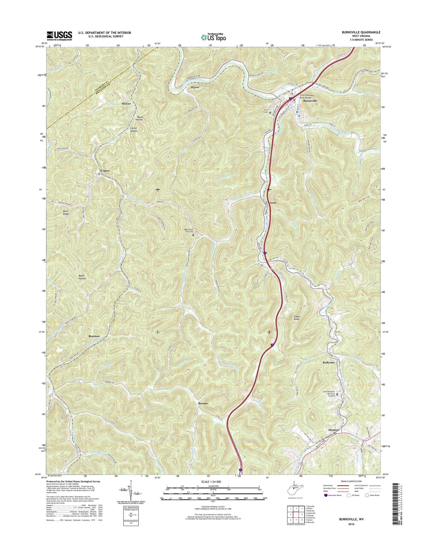
2019 topographic map quadrangle Burnsville in the state of West Virginia. Scale: 1:24000. Based on the newly updated USGS 7.5' US Topo map series, this map is in the following counties: Braxton, Gilmer. The map contains contour data, water features, and other items you are used to seeing on USGS maps, but also has updated roads and other features. This is the next generation of topographic maps. Printed on high-quality waterproof paper with UV fade-resistant inks.
Quads adjacent to this one:
West: Cedarville
Northwest: Glenville
North: Gilmer
Northeast: Peterson
East: Orlando
Southeast: Newville
South: Sutton
Southwest: Gassaway
Contains the following named places: Arnett, Beech Fork, Berry Fork, Bonnie, Bower, Bower Run, Bragg Run, Braxton, Braxton County Emergency Ambulance Service Authority, Browns Run, Buck Ridge, Buffalo Creek, Buffington Run, Bull Fork, Burns Run, Burnsville, Burnsville Elementary School, Burnsville Police Department, Burnsville Post Office, Burnsville Public Library, Burnsville School, Burnsville Volunteer Fire Department, Carter Hollow, Cedar Creek School, Cloat Run, Copen, Copen Post Office, Copen Run Church, Cutlip Church, Dumpling Run, Exchange, Gabel Knob, Gem, Grass Run, Heaters, Heaters Post Office, Hutchinson School, Hyers, Hyers Run, K of P Cemetery, Little Kanawha Memorial Gardens, Little Kanawha River Bridge, Maggie Hoover Memorial Methodist Episcopal Church South, Marsh Run, McCauley Run, O'Brien Fork, Oil Creek, Paddys Run, Perkins Fork, Pleasant Hill Church, Providence Church, Right Fork Cedar Creek, Right Fork O'Brien Fork, Right Fork Saltlick Creek, Right Hand Fork Cemetery, Rollyson, Saltlick Creek, Scott Fork, Shaver Fork, Shock Hollow, Slabcamp Run, Squires School, Stouts Mills Church, Stouts Run, Town of Burnsville, Union Chapel, Venison Fork, Westfall Fork, Williams Run, Wolfpen Run, ZIP Codes: 26335, 26615, 26619