MyTopo
Alexander Lake Wisconsin US Topo Map
Couldn't load pickup availability
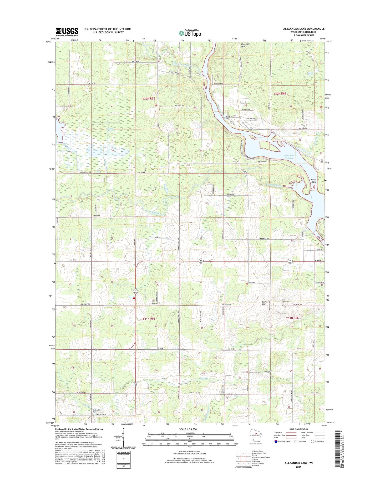
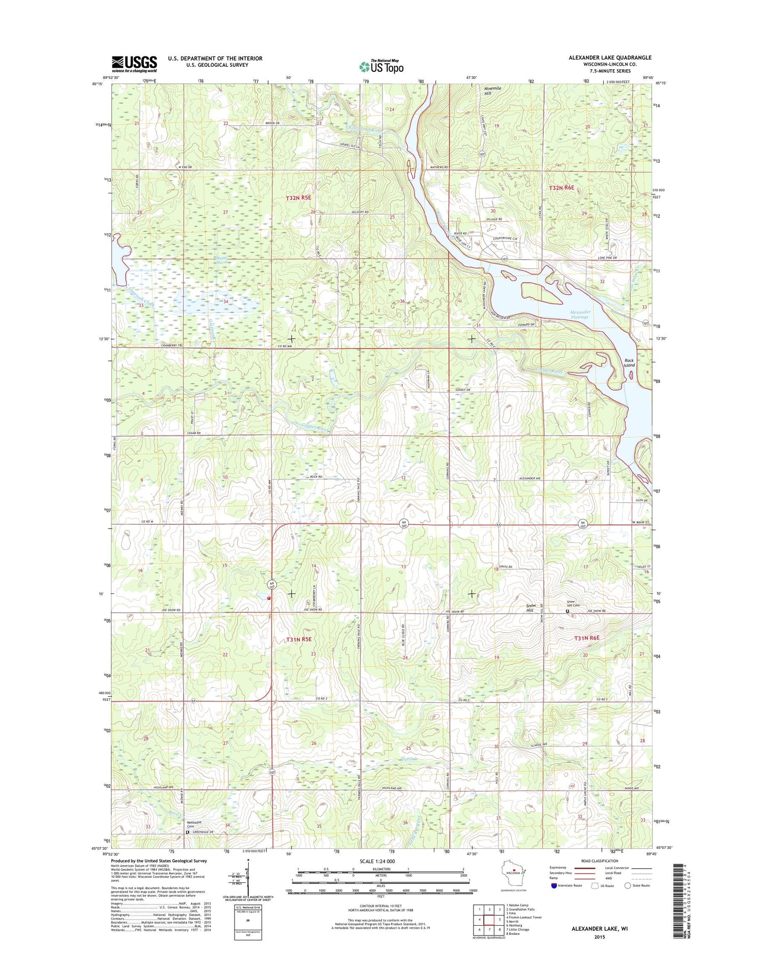
2018 topographic map quadrangle Alexander Lake in the state of Wisconsin. Scale: 1:24000. Based on the newly updated USGS 7.5' US Topo map series, this map is in the following counties: Lincoln. The map contains contour data, water features, and other items you are used to seeing on USGS maps, but also has updated roads and other features. This is the next generation of topographic maps. Printed on high-quality waterproof paper with UV fade-resistant inks.
Quads adjacent to this one:
West: Fromm Lookout Tower
Northwest: Natzke Camp
North: Grandfather Falls
Northeast: Irma
East: Merrill
Southeast: Brokaw
South: Little Chicago
Southwest: Hamburg
Contains the following named places: Alexander Dam, Alexander Lake, Alexander WP200 Dam, Bagga Marsh, Copper River, Copper School, Corning School, Corning Townhall, Corning Volunteer Fire Department, Elm Grove School, Farming Dale School, Garrison Creek, Grace Church, Harding Townhall, Joe Snow Creek, Methodist Cemetery, New Wood River, Ninemile Hill, Pine Grove School, Prairie View School, Rock Island, Saint Pauls Church, Scott Elementary School, Snow Hill, Snow Hill Cemetery, Snow Hill School, ZIP Code: 54452