MyTopo
Algoma Wisconsin US Topo Map
Couldn't load pickup availability
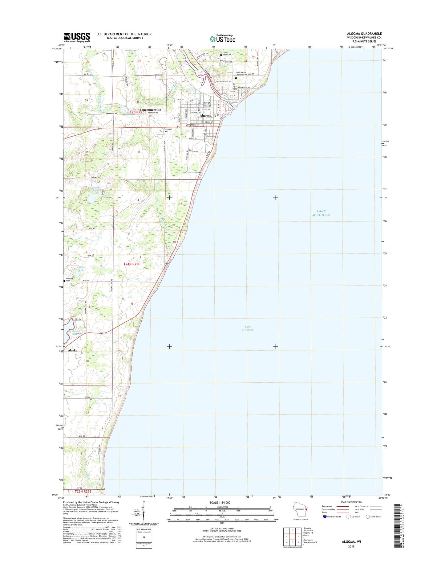
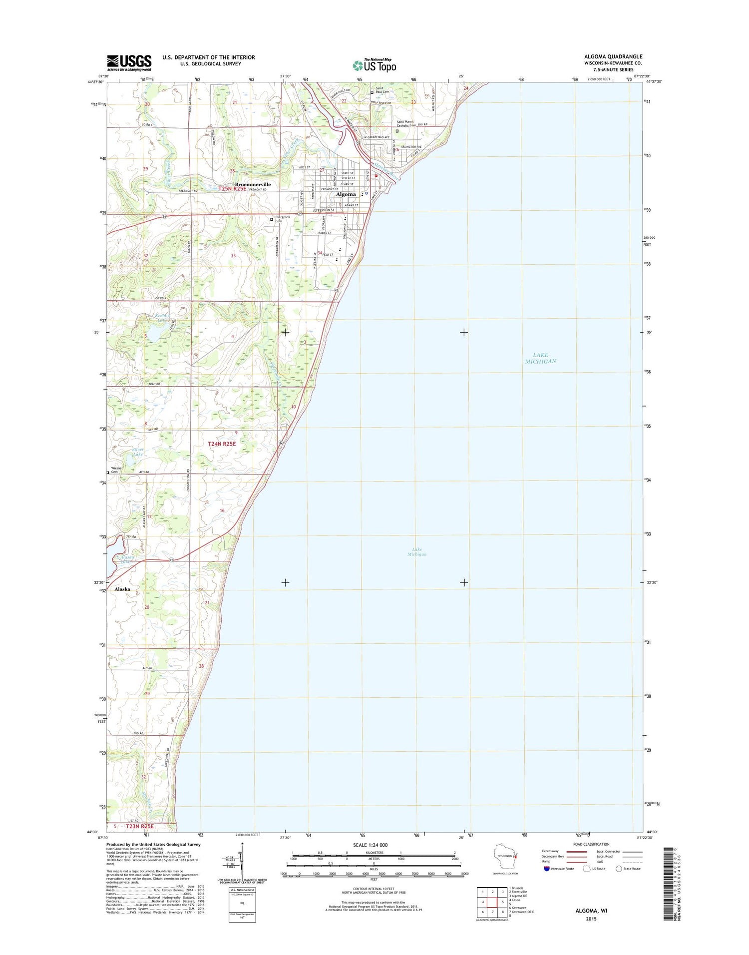
2018 topographic map quadrangle Algoma in the state of Wisconsin. Scale: 1:24000. Based on the newly updated USGS 7.5' US Topo map series, this map is in the following counties: Kewaunee. The map contains contour data, water features, and other items you are used to seeing on USGS maps, but also has updated roads and other features. This is the next generation of topographic maps. Printed on high-quality waterproof paper with UV fade-resistant inks.
Quads adjacent to this one:
West: Casco
Northwest: Brussels
North: Forestville
Northeast: Algoma NE
South: Kewaunee OE E
Southwest: Kewaunee
Contains the following named places: 61 Reservoir, Ahnapee River, Alapma Boat Club, Algoma, Algoma Elementary School, Algoma Fire Department - Algoma Rescue Squad, Algoma High School, Algoma Marina Incorporated, Algoma Police Department, Algoma Post Office, Algoma United Methodist Church, Algoma Utilities Commission, Algoma Wastewater Treatment Plant, Bruemmerville, Calvary Assembly of God Church, City of Algoma, East Alaska Lake, Episcopal Church of Saint Agnes by the Lake, Evergreen Cemetery, Henry Iwen Dam, K and D Greenhouse, Kewaunee County Park, Krohns Lake, Mashek Creek, Newman Park, Perry Park, Peterson Park, Saint Mary School, Saint Mary's Catholic Cemetery, Saint Marys Catholic Church, Saint Paul Cemetery, Saint Pauls Evangelical Lutheran Church, Saint Paul's Evangelical Lutheran School, Silver Creek, Silver Creek School, Silver Lake, Threemile Creek, Town of Pierce, Wiesner Cemetery, Wings of Eagles Christian Academy, ZIP Code: 54201