MyTopo
Allenton Wisconsin US Topo Map
Couldn't load pickup availability
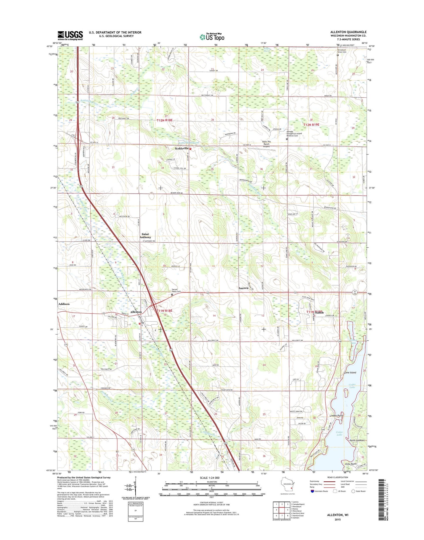
2018 topographic map quadrangle Allenton in the state of Wisconsin. Scale: 1:24000. Based on the newly updated USGS 7.5' US Topo map series, this map is in the following counties: Washington. The map contains contour data, water features, and other items you are used to seeing on USGS maps, but also has updated roads and other features. This is the next generation of topographic maps. Printed on high-quality waterproof paper with UV fade-resistant inks.
Quads adjacent to this one:
West: Nenno
Northwest: Lomira
North: Campbellsport
Northeast: Kewaskum
East: West Bend
Southeast: Jackson
South: Hartford East
Southwest: Hartford West
Contains the following named places: Addison, Addison Elementary School, Albright United Brethren Cemetery, Allenton, Allenton Census Designated Place, Allenton Creek, Allenton Elementary School, Allenton Post Office, Allenton Volunteer Fire Department, Aurora, Brittany Farms, Cedar Lake, Dominion Valley Farm, Dornacker Prairie Acres, Echo Point, Four Way Farms, Garden View Dairy, Gilbert Lake, Goeller Family Farms, Hahn Sky Ranch Airport, Highview Farm, Ihlenfeld Farms, Kedinger Farms, Kewaskum Union Cemetery, Kohlsville, Kohlsville Millpond, Kohlsville School, Kohlsville Volunteer Fire Department, L - J Farms, Limestone Creek, Linden Point, Lone Island, Nabob, Point Lookout, Proeber Dairy, Sacred Heart Cemetery, Saint Anthony, Saint Johns School, Saint Peters Church, Schelle Pit, Sunset Farms, Town of Addison, Town of Wayne, Twisted Pine Farm, Wayne Creek, Wayne Marsh, WBWI-FM (West Bend), Whispering View Farm, ZIP Code: 53002