
MyTopo
Alma Center Wisconsin US Topo Map
Couldn't load pickup availability
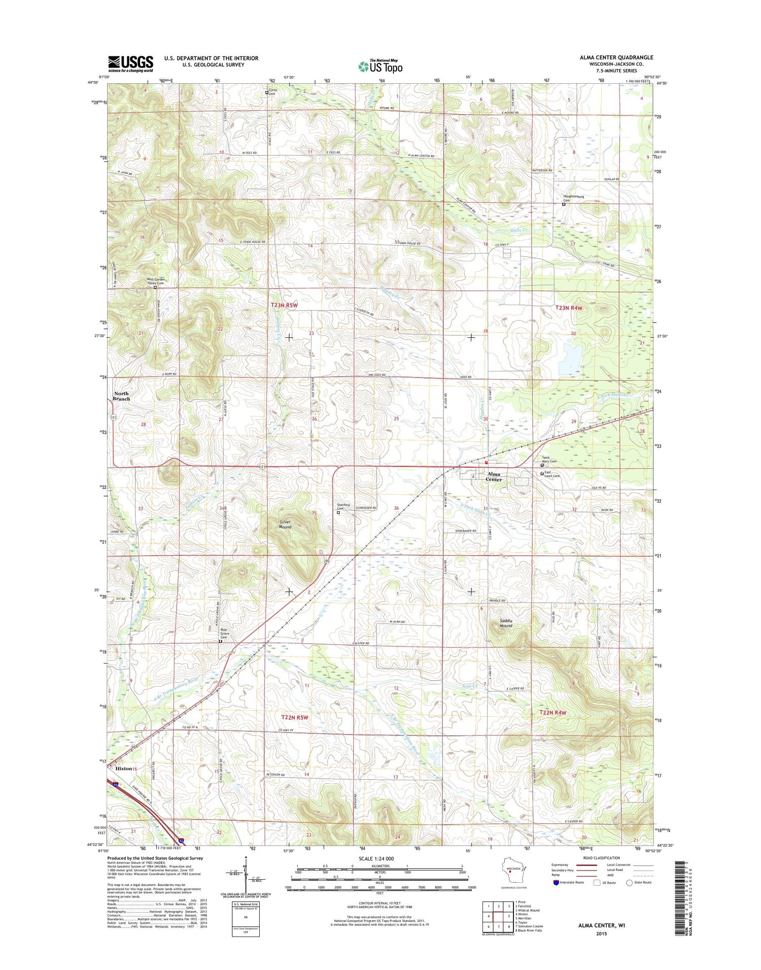
2018 topographic map quadrangle Alma Center in the state of Wisconsin. Scale: 1:24000. Based on the newly updated USGS 7.5' US Topo map series, this map is in the following counties: Jackson. The map contains contour data, water features, and other items you are used to seeing on USGS maps, but also has updated roads and other features. This is the next generation of topographic maps. Printed on high-quality waterproof paper with UV fade-resistant inks.
Quads adjacent to this one:
West: Hixton
Northwest: Price
North: Fairchild
Northeast: Wildcat Mound
East: Merrillan
Southeast: Black River Falls
South: Stenulson Coulee
Southwest: Taylor
Contains the following named places: Alma Center, Alma Center Post Office, Alma Center Volunteer Fire Department, Amo Creek, Avon Road Jersey Farm, Curtis Cemetery, East Lawn Cemetery, Hayden Creek, Hixton Park, Houghtonburg Cemetery, Houghtonburg School, Judkins Creek, Judkins School, Leverett School, Lincoln Junior - Senior High School, Lincoln Junior / Senior High School, Lower North Branch School, North Branch, North Branch Trempealeau River, Pole Grove Cemetery, Pole Grove School, Pomroy School, Saddle Mound, Saint Marys Cemetery, Silver Mound, South Alma School, South Branch Trempealeau River, Stanford Cemetery, Town of Garden Valley, Town of Hixton, Village of Alma Center, West Garden Valley Cemetery, West Garden Valley Church, ZIP Code: 54611


