MyTopo
Almond Wisconsin US Topo Map
Couldn't load pickup availability
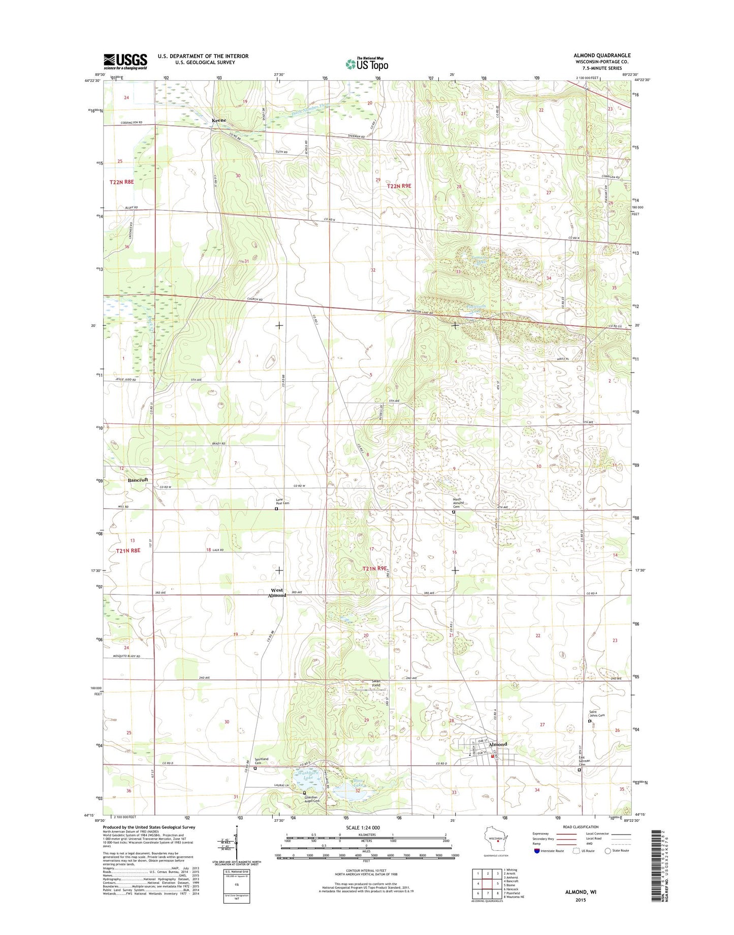
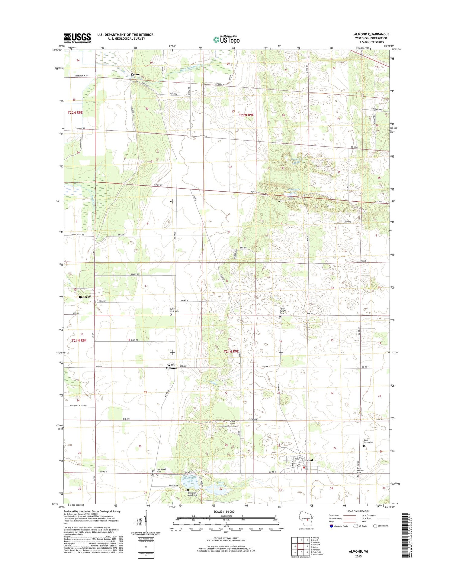
2018 topographic map quadrangle Almond in the state of Wisconsin. Scale: 1:24000. Based on the newly updated USGS 7.5' US Topo map series, this map is in the following counties: Portage. The map contains contour data, water features, and other items you are used to seeing on USGS maps, but also has updated roads and other features. This is the next generation of topographic maps. Printed on high-quality waterproof paper with UV fade-resistant inks.
Quads adjacent to this one:
West: Bancroft
Northwest: Whiting
North: Arnott
Northeast: Amherst
East: Blaine
Southeast: Wautoma NE
South: Plainfield
Southwest: Hancock
Contains the following named places: Almond, Almond Bancroft Elementary School, Almond Bancroft High School, Almond Bancroft Middle School, Almond Post Office, Almond Volunteer Fire Department, Bass Lake, East German Cemetery, Frost Park, Guardian Angel Cemetery, Keene, Keene School, Lone Pine Cemetery, North Almond Cemetery, Patterson Lake, Saint Johns Cemetery, Saint Martins Church, Saint Pauls Church, Spiritland Cemetery, Sunnyside School, Swan Field, Tamarack Lake, Town of Almond, Town of Buena Vista, Village of Almond, Washburn Lake, West Almond