
MyTopo
Alvin Wisconsin US Topo Map
Couldn't load pickup availability
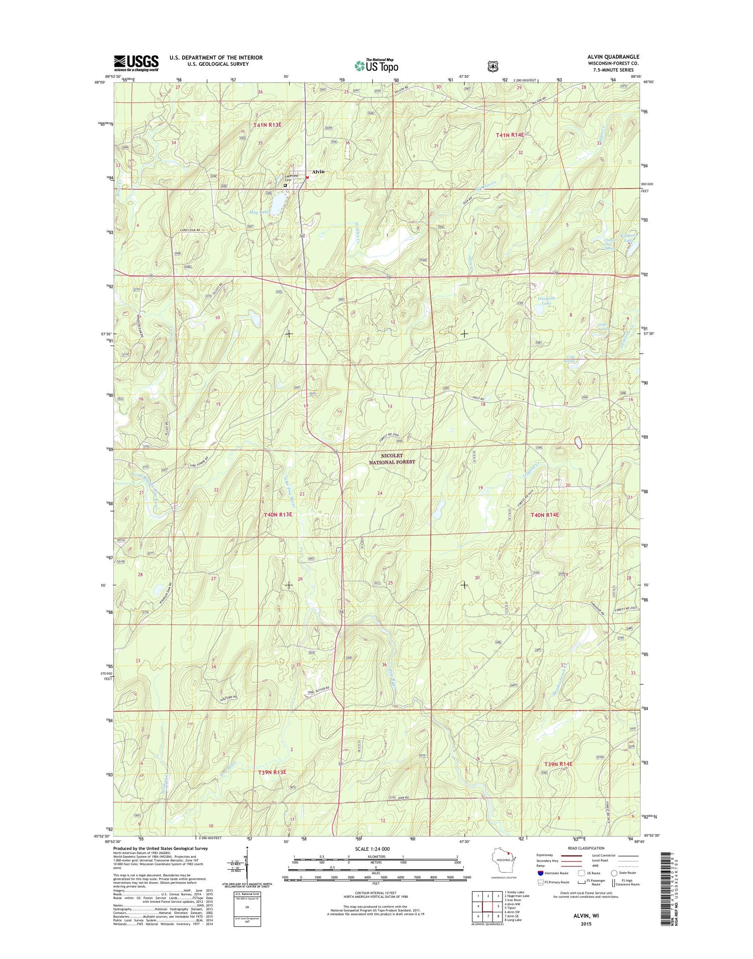
2018 topographic map quadrangle Alvin in the state of Wisconsin. Scale: 1:24000. Based on the newly updated USGS 7.5' US Topo map series, this map is in the following counties: Forest. The map contains contour data, water features, and other items you are used to seeing on USGS maps, but also has updated roads and other features. This is the next generation of topographic maps. Printed on high-quality waterproof paper with UV fade-resistant inks.
Quads adjacent to this one:
West: Alvin NW
Northwest: Smoky Lake
North: Hagerman Lake
Northeast: Iron River
East: Tipler
Southeast: Long Lake
South: Alvin SE
Southwest: Alvin SW
Contains the following named places: Alvin, Alvin Creek, Alvin Creek Impoundment, Alvin Volunteer Fire and Rescue, Charlie Otto Spring, Cold Spring, Killborn Lake, Lakeview Cemetery, May Lake, North Branch Pine River, Onimish Lake, Pine River Lookout Tower, Ritter Lake, Town of Alvin, West Allen Creek, Wildcat Creek, Windsor Dam Campground, Zieler Spring


