MyTopo
Amberg Wisconsin US Topo Map
Couldn't load pickup availability
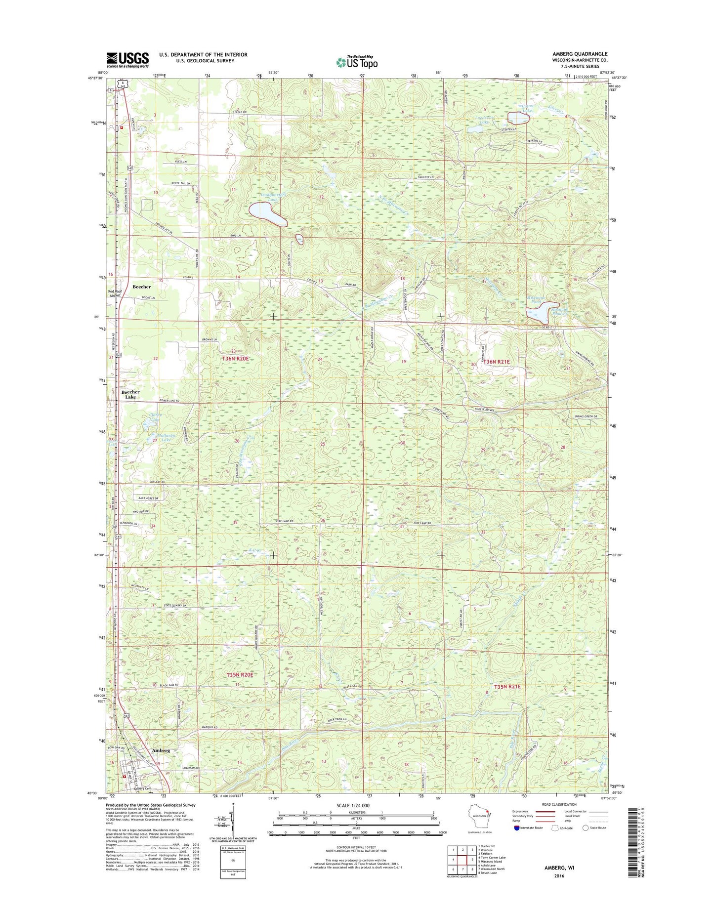
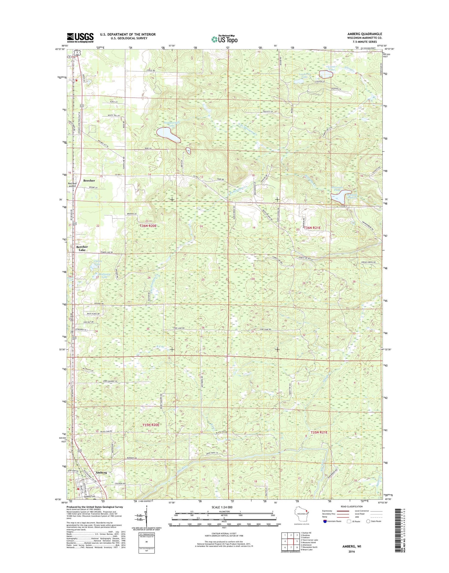
2018 topographic map quadrangle Amberg in the state of Wisconsin. Scale: 1:24000. Based on the newly updated USGS 7.5' US Topo map series, this map is in the following counties: Marinette. The map contains contour data, water features, and other items you are used to seeing on USGS maps, but also has updated roads and other features. This is the next generation of topographic maps. Printed on high-quality waterproof paper with UV fade-resistant inks.
Quads adjacent to this one:
West: Town Corner Lake
Northwest: Dunbar NE
North: Pembine
Northeast: Faithorn
East: Miscauno Island
Southeast: Resort Lake
South: Wausaukee North
Southwest: Athelstane
Contains the following named places: Amberg, Amberg Cemetery, Amberg Census Designated Place, Amberg Post Office, Amberg Volunteer Fire Department, Beecher, Beecher Creek, Beecher Lake, Clarey Lake, Coles School, Cotas Lake, Dixon School, Dunbar - Pembine - Beecher Fire Department, Faith School, Golden Lake, Headquarters Lake, K C Creek, Luedevitz Lake, Miscauno Cedar Swamp State Natural Area, Miscauno Pond, Miscauno Pond Dam, Miscauno State Public Hunting Grounds, Mullaney Lake, Munot Quarry, North Branch Miscauno Creek, Papoose Lake, Pembine - Dunbar - Beecher Rescue Squad, Pike Hill Spur, Reformatory Quarry, Slough Creek, South Branch Miscauno Creek, Town of Beecher, ZIP Code: 54102