
MyTopo
Aniwa Wisconsin US Topo Map
Couldn't load pickup availability
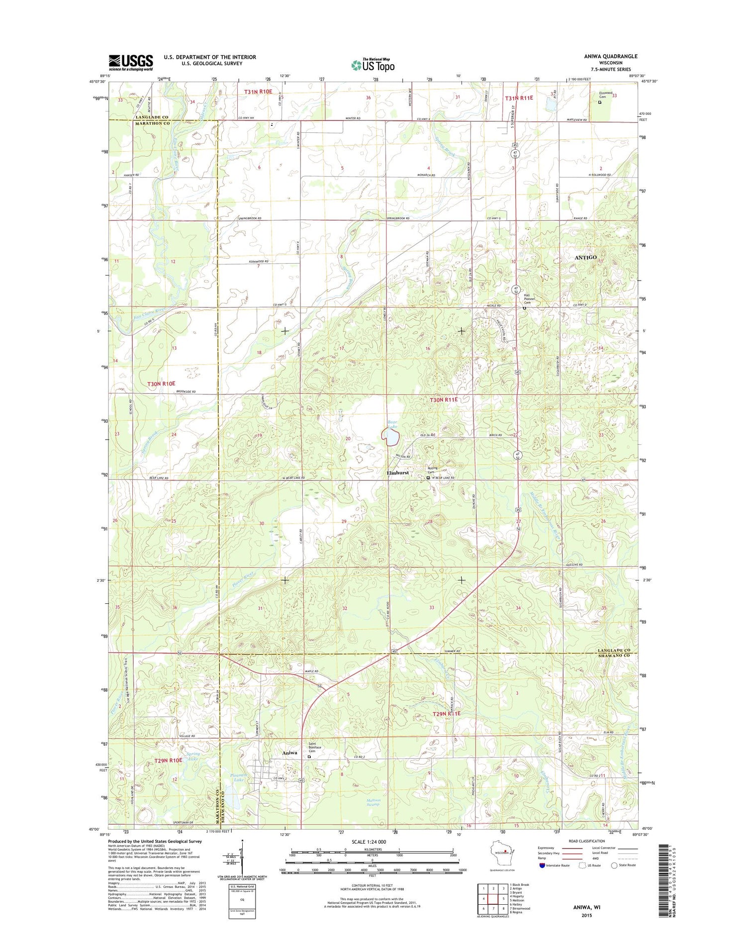
2018 topographic map quadrangle Aniwa in the state of Wisconsin. Scale: 1:24000. Based on the newly updated USGS 7.5' US Topo map series, this map is in the following counties: Langlade, Marathon, Shawano. The map contains contour data, water features, and other items you are used to seeing on USGS maps, but also has updated roads and other features. This is the next generation of topographic maps. Printed on high-quality waterproof paper with UV fade-resistant inks.
Quads adjacent to this one:
West: Hogarty
Northwest: Black Brook
North: Antigo
Northeast: Bryant
East: Mattoon
Southeast: Regina
South: Birnamwood
Southwest: Hatley
Contains the following named places: Aniwa, Aniwa Post Office, Antigo Air Force Station, Antigo City Landfill, Bear Lake, Eau Claire Valley School, Elmhurst, Elmhurst Cemetery, Elmwood Cemetery, Fernwood School, Hall Pioneer Cemetery, Mattoon Swamp, Oldens Creek, Pleasant Lake, Pleasant View Elementary School, Rolling Townhall, Saint Boniface Cemetery, Spring Lake, Sunnyside School, Town of Rolling, Village of Aniwa, WATK-AM (Antigo), ZIP Code: 54409


