MyTopo
Anvil Lake Wisconsin US Topo Map
Couldn't load pickup availability
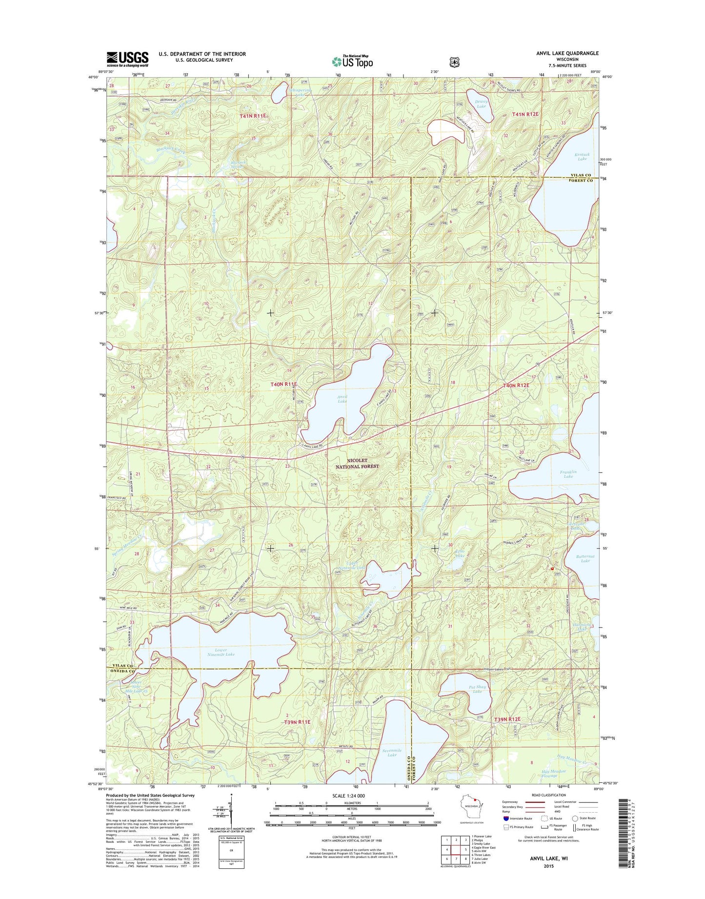
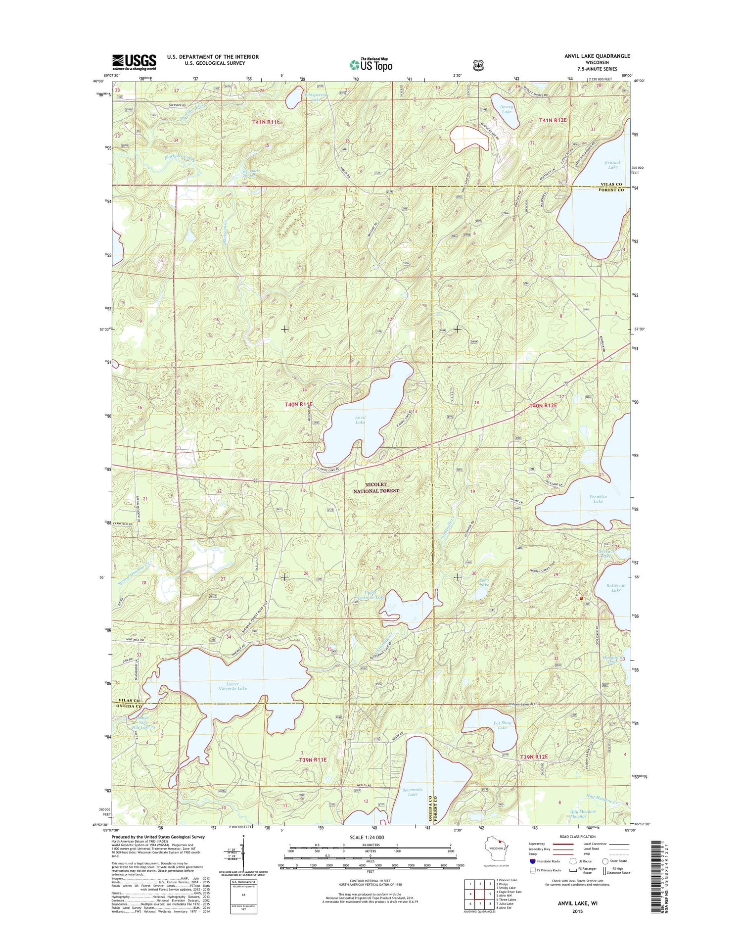
2018 topographic map quadrangle Anvil Lake in the state of Wisconsin. Scale: 1:24000. Based on the newly updated USGS 7.5' US Topo map series, this map is in the following counties: Vilas, Forest, Oneida. The map contains contour data, water features, and other items you are used to seeing on USGS maps, but also has updated roads and other features. This is the next generation of topographic maps. Printed on high-quality waterproof paper with UV fade-resistant inks.
Quads adjacent to this one:
West: Eagle River East
Northwest: Pioneer Lake
North: Phelps
Northeast: Smoky Lake
East: Alvin NW
Southeast: Alvin SW
South: Julia Lake
Southwest: Three Lakes
Contains the following named places: Anvil Lake, Anvil Lake Campground, Anvil Lake Lookout Tower, Anvil Lake Trail System, Blackjack Creek, Blackjack Springs, Blackjack Springs Wilderness, Dewey Lake, Eastern Continental Divide Point of Interest, Echo Lake, Franklin Lake, Franklin Lake Campground, Gertrude Lake, Hiles Fire Department - Station 2, Imogene Lake, Lower Nine Mile Dam, Lower Nine Mile Lake 25, Lower Ninemile Lake, Military Road Point of Interest, Pat Shay Lake, Pine-Oak Grove State Natural Area, Sanborn School, Sevenmile Lake, Sevenmile Lake Campground, Upper Ninemile Lake, Whispering Lake