
MyTopo
Arkdale NE Wisconsin US Topo Map
Couldn't load pickup availability
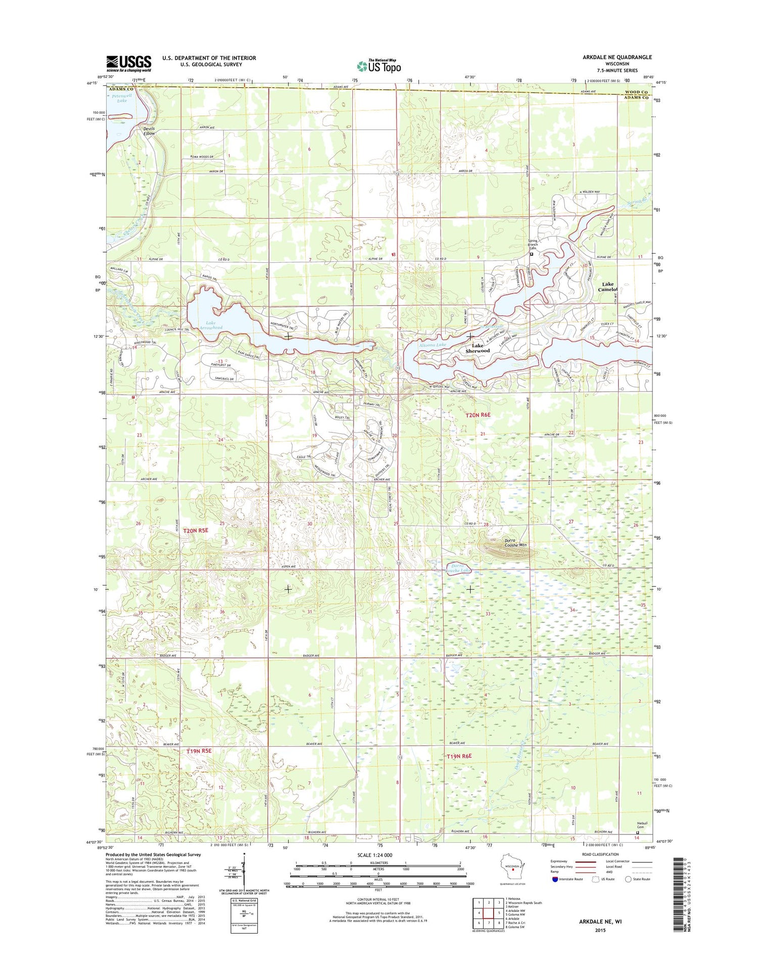
2018 topographic map quadrangle Arkdale NE in the state of Wisconsin. Scale: 1:24000. Based on the newly updated USGS 7.5' US Topo map series, this map is in the following counties: Adams, Wood. The map contains contour data, water features, and other items you are used to seeing on USGS maps, but also has updated roads and other features. This is the next generation of topographic maps. Printed on high-quality waterproof paper with UV fade-resistant inks.
Quads adjacent to this one:
West: Arkdale NW
Northwest: Nekoosa
North: Wisconsin Rapids South
Northeast: Kellner
East: Coloma NW
Southeast: Coloma SW
South: Roche A Cri
Southwest: Arkdale
Contains the following named places: 70 Reservoir, Altoona Lake 830, Chester School, Devils Elbow, Dorra Cooshe Mount, Dorra Cooshe Mountain, Dorro Couche Lake, Dorro Couche Lookout Tower, Lake Arrowhead, Lake Arrowhead 3WR1493 Dam, Lake Arrowhead Census Designated Place, Lake Camelot 3WR324 Dam, Lake Camelot Census Designated Place, Lake Sherwood, Lake Sherwood Census Designated Place, Nekoosa Lookout Tower, New Rome, Niebull Cemetery, Niebull School, Rome, Rome Fire Department, Rome Police Department, Rome Township Fire Department, Sherwood 3WR1125 Dam, Spring Branch, Spring Branch Cemetery, Town of Rome, Zion Church


