MyTopo
Athens Wisconsin US Topo Map
Couldn't load pickup availability
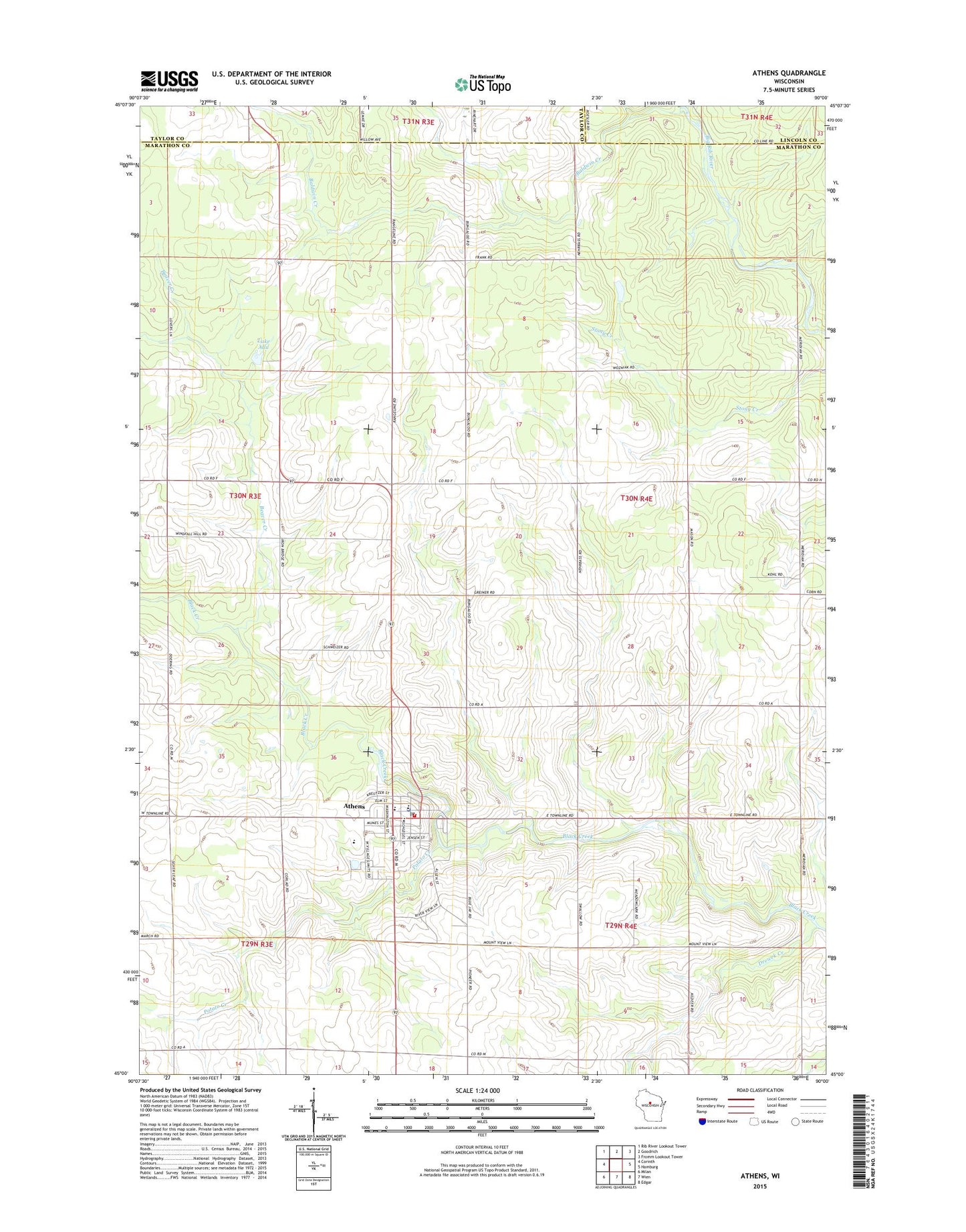
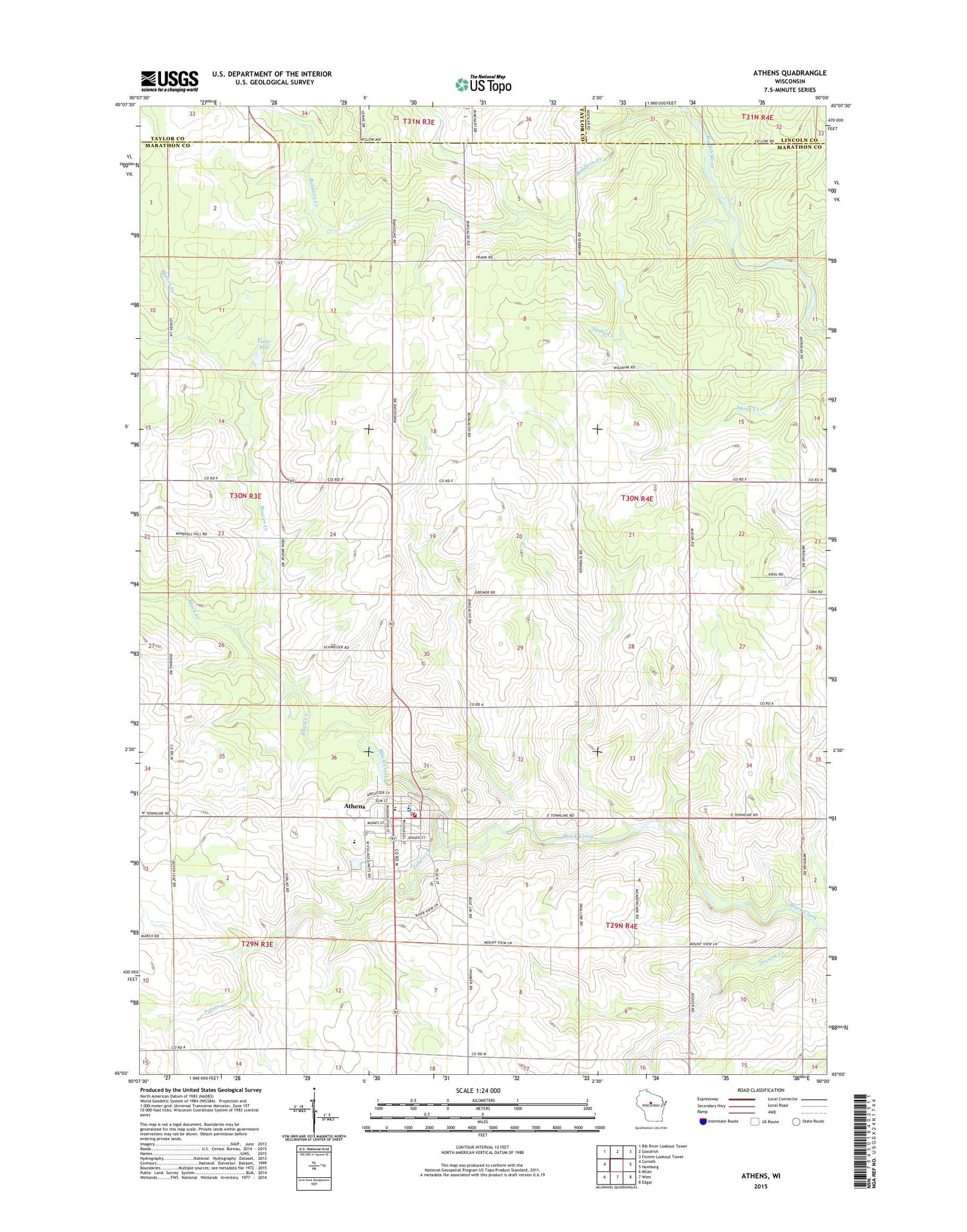
2018 topographic map quadrangle Athens in the state of Wisconsin. Scale: 1:24000. Based on the newly updated USGS 7.5' US Topo map series, this map is in the following counties: Marathon, Taylor, Lincoln. The map contains contour data, water features, and other items you are used to seeing on USGS maps, but also has updated roads and other features. This is the next generation of topographic maps. Printed on high-quality waterproof paper with UV fade-resistant inks.
Quads adjacent to this one:
West: Corinth
Northwest: Rib River Lookout Tower
North: Goodrich
Northeast: Fromm Lookout Tower
East: Hamburg
Southeast: Edgar
South: Wien
Southwest: Milan
Contains the following named places: Athens, Athens Area Fire and Ambulance Department, Athens Assembly of God Church, Athens Christian Fellowship Church, Athens County Park, Athens Elementary School, Athens High School, Athens Middle School, Athens Police Department, Athens Post Office, Athens Wastewater Treatment Plant, Baldwin Creek, Baldwin Hill School, Beaver Creek, Beaver Creek School, Belanger Dairy Farm, Drewek Creek, Fairview School, Forest Home Farm, Forth Dairy Farm, Guden Farms, Hoffman School, Jaris Hills Farms, Ladd School, Lake Allu, Lotzer Farms, Marathon County Public Library Athens Branch, Meridian Heights Farm, Potato Creek, R B Dairy Farm, Rausch Farms, Saint Anthony School, Saint Anthonys Catholic Church, Stoney Acres Farm, Town of Halsey, Trinity Lutheran School, Village of Athens, Wells School, Wiese Farms, ZIP Code: 54411