MyTopo
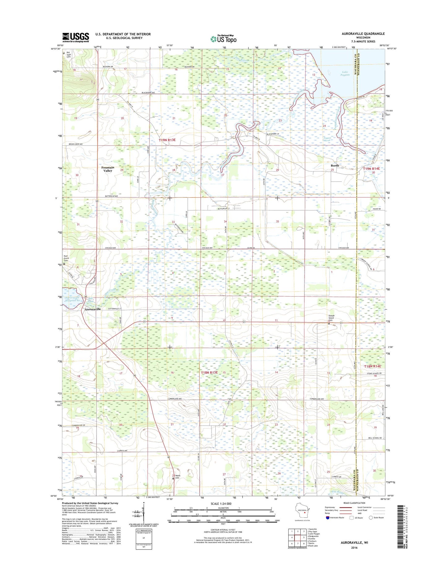
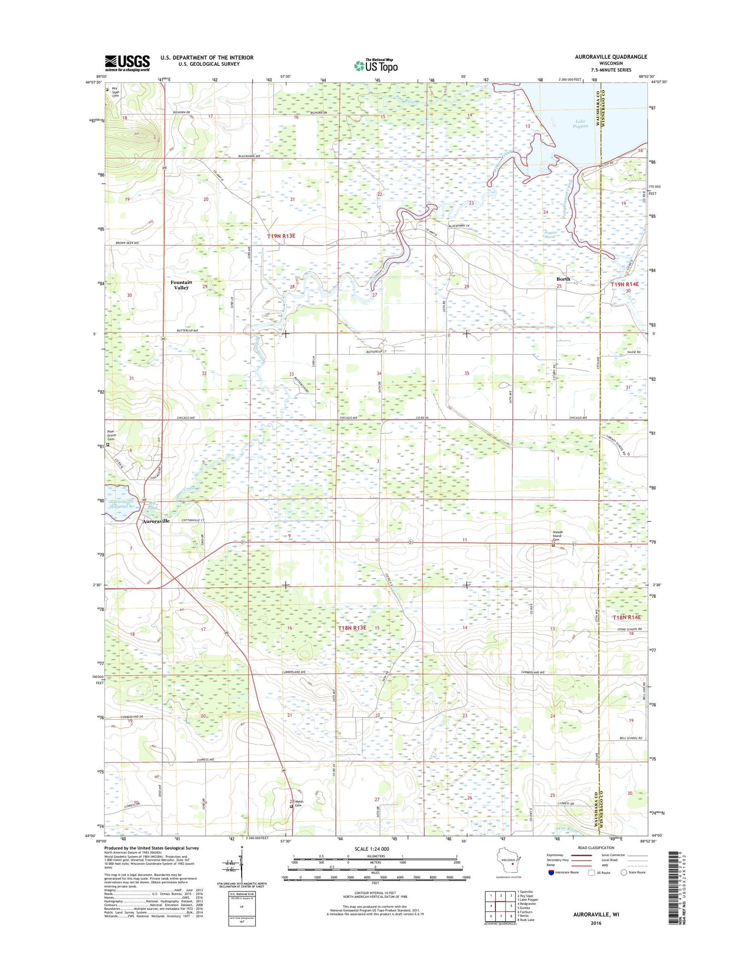
Auroraville Wisconsin US Topo Map
Couldn't load pickup availability
2018 topographic map quadrangle Auroraville in the state of Wisconsin. Scale: 1:24000. Based on the newly updated USGS 7.5' US Topo map series, this map is in the following counties: Waushara, Winnebago. The map contains contour data, water features, and other items you are used to seeing on USGS maps, but also has updated roads and other features. This is the next generation of topographic maps. Printed on high-quality waterproof paper with UV fade-resistant inks.
Quads adjacent to this one:
West: Redgranite
Northwest: Saxeville
North: Poy Sippi
Northeast: Lake Poygan
East: Eureka
Southeast: Rush Lake
South: Berlin
Southwest: Fairburn
Contains the following named places: Auroraville, Auroraville 2WP588 Dam, Borth, Fountain Valley, Immanuel Church, Leach Farms Heliport, Mill Pond, Pine Grove Cemetery, Pine River, Poygan Marsh, Pumpkinseed Creek, Shead Island Cemetery, Town of Aurora, Town of Poy Sippi, Trinity Church, Welsh Cemetery, Willow Creek, Zink Airport