
MyTopo
Baldwin East Wisconsin US Topo Map
Couldn't load pickup availability
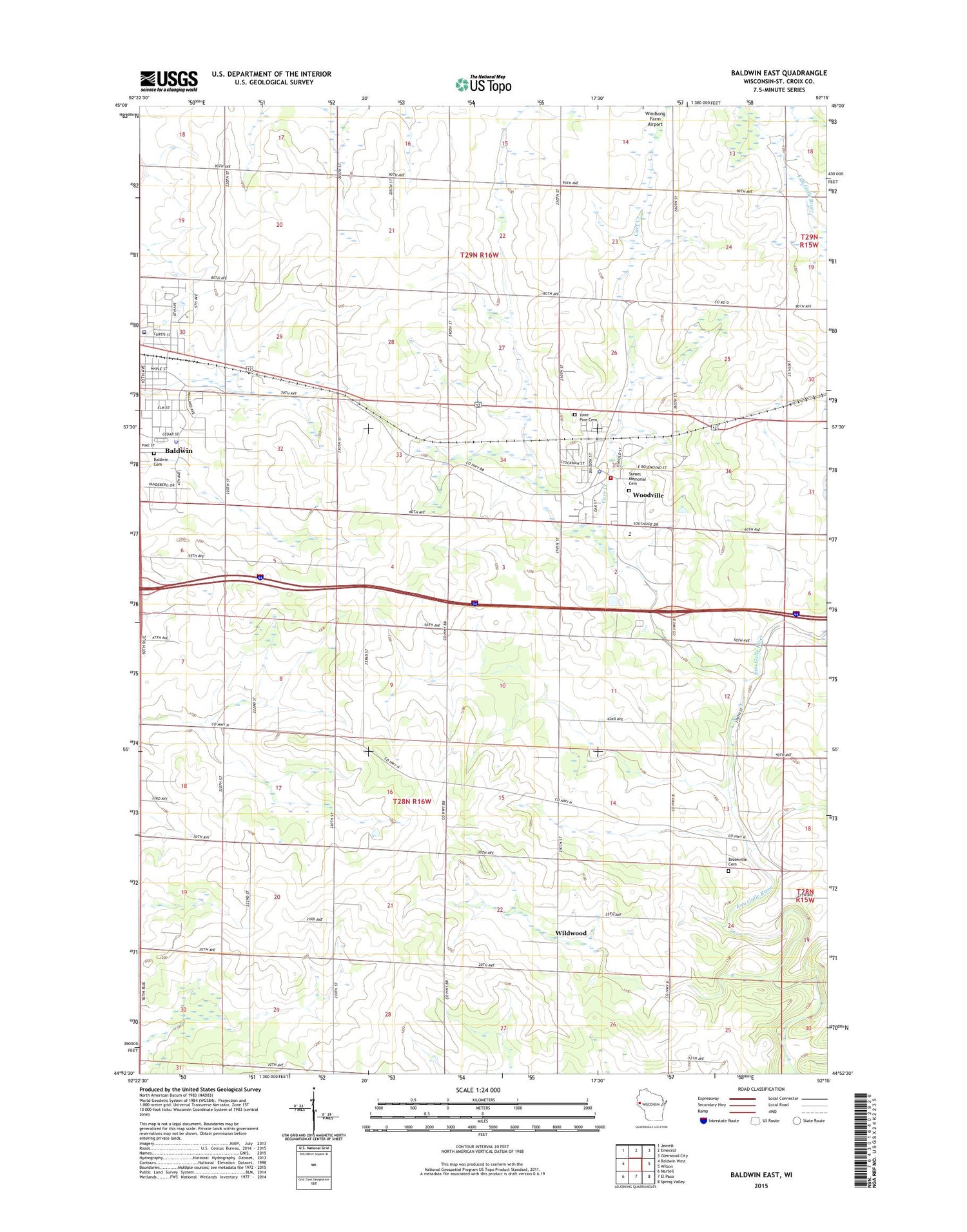
2018 topographic map quadrangle Baldwin East in the state of Wisconsin. Scale: 1:24000. Based on the newly updated USGS 7.5' US Topo map series, this map is in the following counties: St. Croix. The map contains contour data, water features, and other items you are used to seeing on USGS maps, but also has updated roads and other features. This is the next generation of topographic maps. Printed on high-quality waterproof paper with UV fade-resistant inks.
Quads adjacent to this one:
West: Baldwin West
Northwest: Jewett
North: Emerald
Northeast: Glenwood City
East: Wilson
Southeast: Spring Valley
South: El Paso
Southwest: Martell
Contains the following named places: Baldwin, Baldwin Ambulance Service, Baldwin Area Medical Center, Baldwin Cemetery, Baldwin Greenhouse, Baldwin Police Department, Baldwin Post Office, Baldwin Townhall, Birchdale School, Brookville Cemetery, Brookville School, Carr Creek, Christian Reformed Church, Dahl, Deringer Mobile Home Park, East Baldwin School, Eau Galle Townhall, Flyplassen Airport, Hoover School, Immanuel Church, Lone Pine Cemetery, Loyalty School, Pleasant Grove School, Riverside School, Spooner Quarry, Sunnyside School, Sunset Memorial Cemetery, Town of Baldwin, Town of Eau Galle, Tydalen School, United Fire and Rescue District Woodville Station, Viking Middle School, Village of Baldwin, Village of Woodville, Wildwood, Woodville, Woodville Municipal Mobile Home Park, Woodville Police Department, Woodville Post Office, ZIP Codes: 54002, 54028


