MyTopo
Bancroft Wisconsin US Topo Map
Couldn't load pickup availability
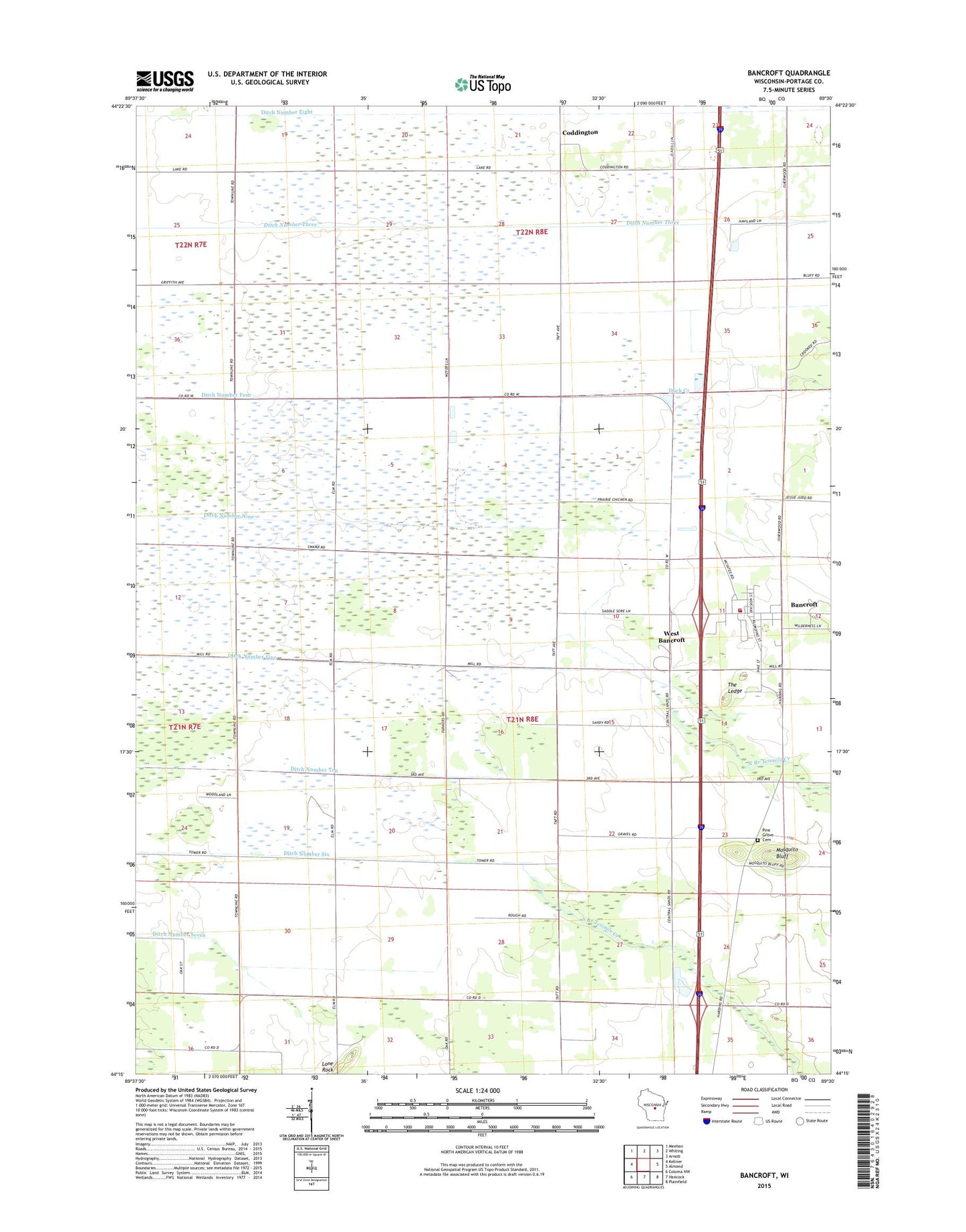
2018 topographic map quadrangle Bancroft in the state of Wisconsin. Scale: 1:24000. Based on the newly updated USGS 7.5' US Topo map series, this map is in the following counties: Portage. The map contains contour data, water features, and other items you are used to seeing on USGS maps, but also has updated roads and other features. This is the next generation of topographic maps. Printed on high-quality waterproof paper with UV fade-resistant inks.
Quads adjacent to this one:
West: Kellner
Northwest: Meehan
North: Whiting
Northeast: Arnott
East: Almond
Southeast: Plainfield
South: Hancock
Southwest: Coloma NW
Contains the following named places: Bancroft, Bancroft Census Designated Place, Bancroft Pine Grove Fire Department, Bancroft Post Office, Bluff School, Coddington, Ditch Number Eight, Ditch Number Five, Ditch Number Four, Ditch Number Nine, Ditch Number Seven, Ditch Number Six, Ditch Number Ten, Ditch Number Three, Duck Creek, Lone Rock, Mosquito Bluff, Pine Grove Cemetery, The Ledge, Town of Pine Grove, West Bancroft, ZIP Code: 54921