MyTopo
Wrightstown Wisconsin US Topo Map
Couldn't load pickup availability
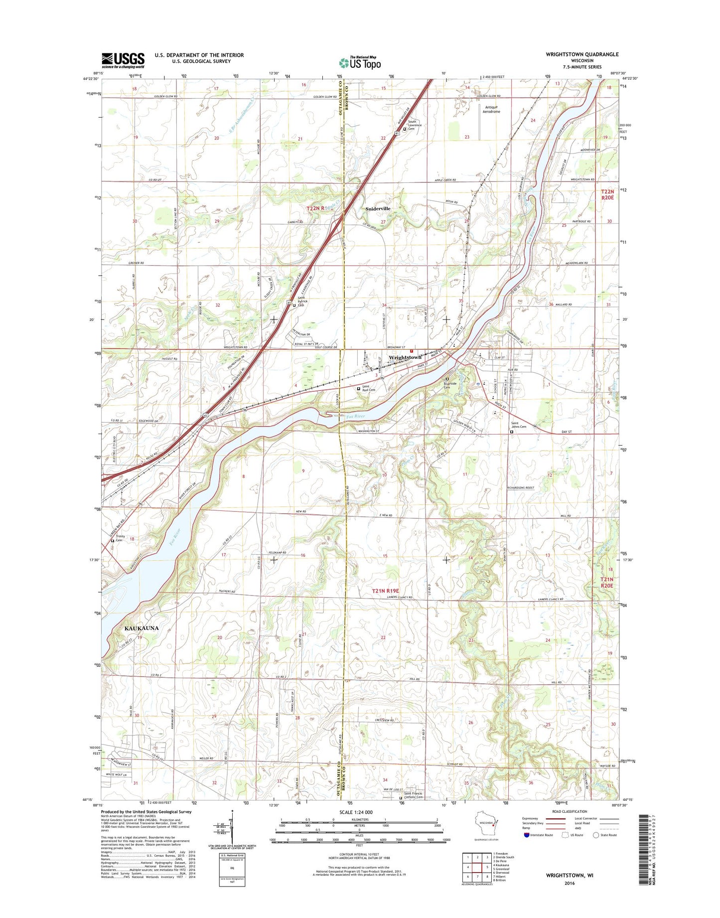
2018 topographic map quadrangle Wrightstown in the state of Wisconsin. Scale: 1:24000. Based on the newly updated USGS 7.5' US Topo map series, this map is in the following counties: Outagamie, Brown. The map contains contour data, water features, and other items you are used to seeing on USGS maps, but also has updated roads and other features. This is the next generation of topographic maps. Printed on high-quality waterproof paper with UV fade-resistant inks.
Quads adjacent to this one:
West: Kaukauna
Northwest: Freedom
North: Oneida South
Northeast: De Pere
East: Greenleaf
Southeast: Brillion
South: Hilbert
Southwest: Sherwood
Contains the following named places: 6233 Reservoir, Antique Aerodrome, Apple Creek, Ashwaubenon School, Briggs School, Brightside Dairy, Countryside Golf Club, Lock 5, Michaelson School, Mid Vallee Golf Course, New Horizons Dairy, Oak Grove School, Plum Creek, Rapide Croche Dam, Rapids Croche Dam, Riverside Cemetery, Saint Clare Elementary School, Saint Francis Catholic Cemetery, Saint John Lutheran School, Saint Johns Cemetery, Saint Patrick Cemetery, Saint Paul Cemetery, Seven Oaks Dairy, Sniderville, South Lawrence Cemetery, Star Orchard, Town of Buchanan, Town of Kaukauna, Trinity Lutheran Cemetery, United Meadows Dairy, Van Rossum Dairy, Village of Wrightstown, WEZR-FM (Brillion), WKFX-FM (Kaukauna), Wrightstown, Wrightstown Elementary School, Wrightstown Fire Department, Wrightstown High School, Wrightstown Middle School, Wrightstown Police Department, Wrightstown Post Office, ZIP Codes: 54130, 54180