
MyTopo
Aladdin Wyoming US Topo Map
Couldn't load pickup availability
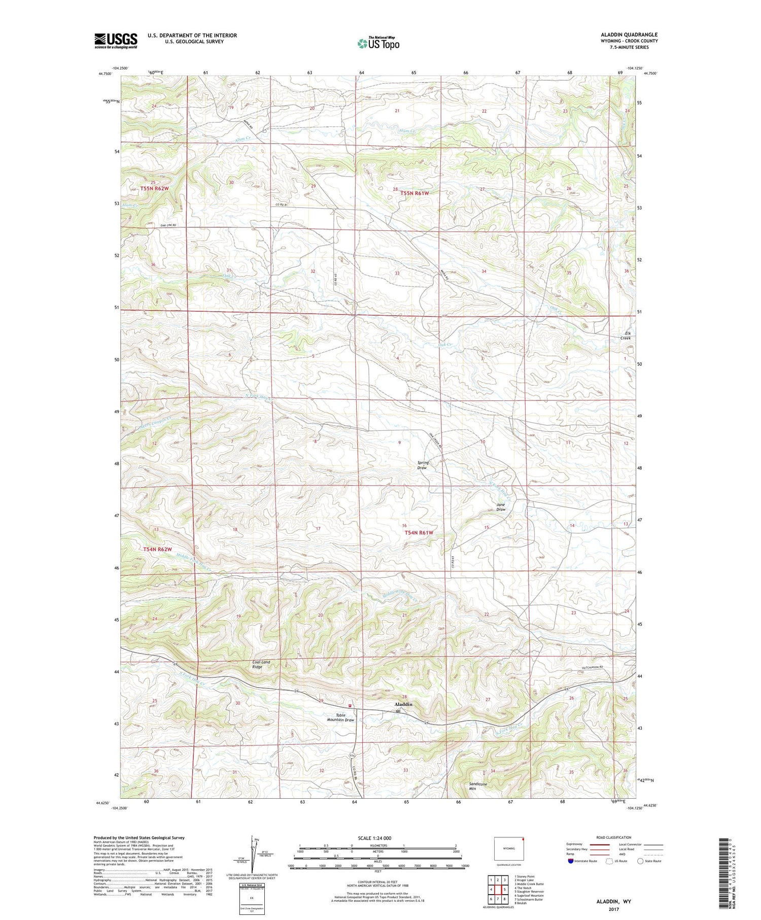
2021 topographic map quadrangle Aladdin in the state of Wyoming. Scale: 1:24000. Based on the newly updated USGS 7.5' US Topo map series, this map is in the following counties: Crook. The map contains contour data, water features, and other items you are used to seeing on USGS maps, but also has updated roads and other features. This is the next generation of topographic maps. Printed on high-quality waterproof paper with UV fade-resistant inks.
Quads adjacent to this one:
West: The Notch
Northwest: Stoney Point
North: Kruger Lake
Northeast: Middle Creek Butte
East: Slaughter Reservoir
Southeast: Beulah
South: Schoolmarm Butte
Southwest: Sugarloaf Mountain
Contains the following named places: A H Claim Mine, Akers Canyon Creek, Aladdin, Aladdin Post Office, Alum Creek, Coal Land Ridge, Elk Creek, Four Corners, Four Oaks School, Hall Ranch, Homestake Property Mine, Jane Draw, Oak Creek Two Mine, Richards and Myers Property Mine, Rocky Draw Creek, Spring Draw, Stillwell Mine, Table Mountain Draw, ZIP Code: 82710


