MyTopo
Alcova Wyoming US Topo Map
Couldn't load pickup availability
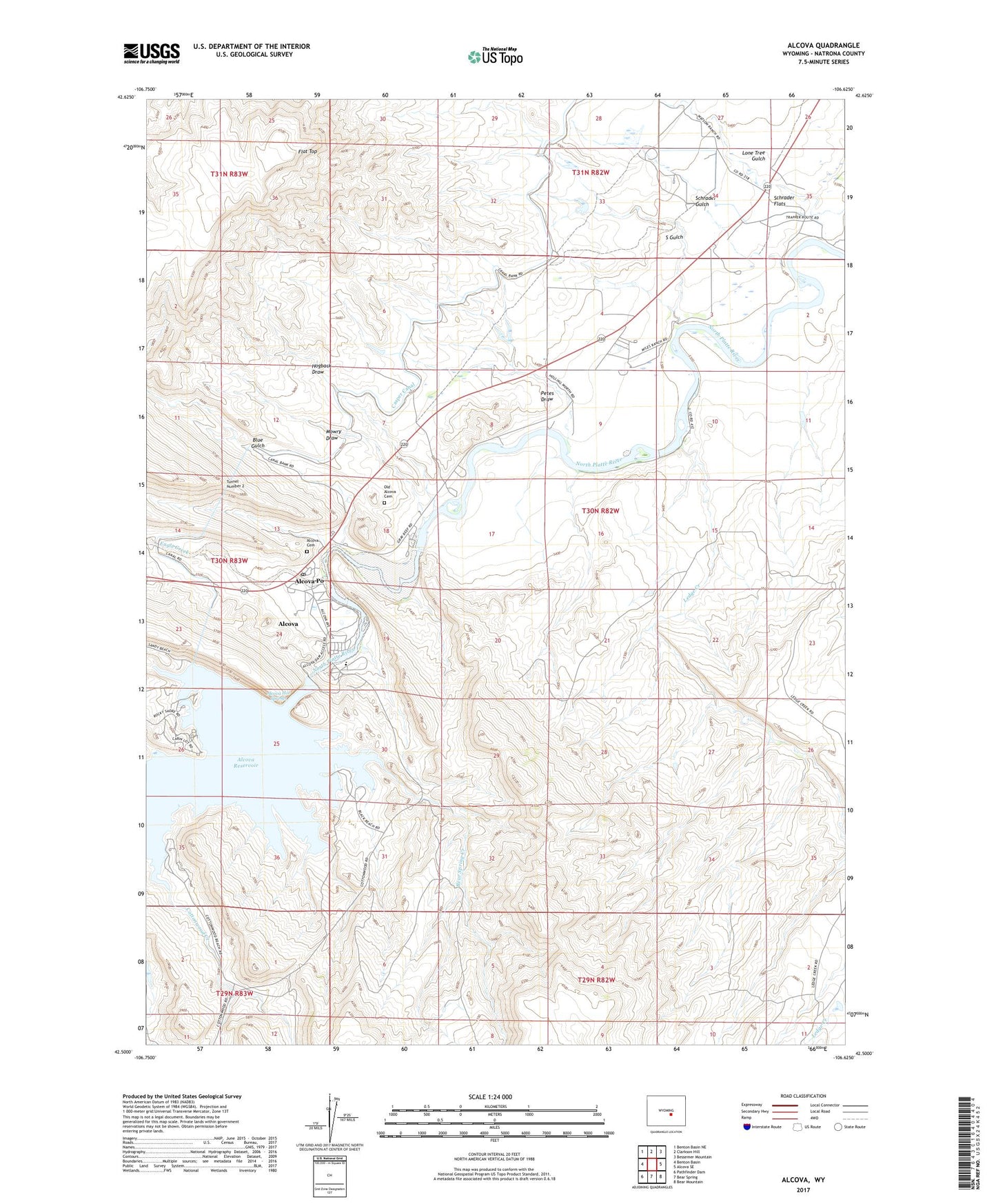
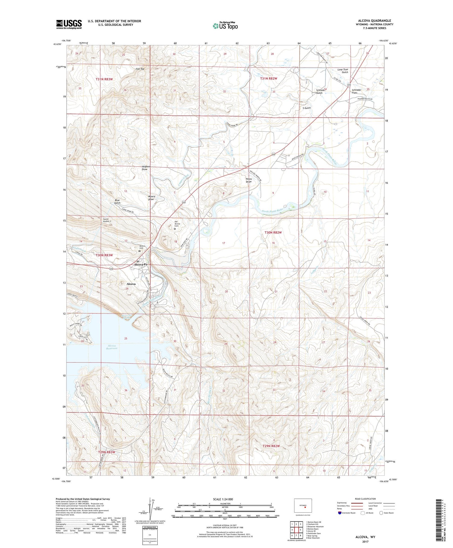
2021 topographic map quadrangle Alcova in the state of Wyoming. Scale: 1:24000. Based on the newly updated USGS 7.5' US Topo map series, this map is in the following counties: Natrona. The map contains contour data, water features, and other items you are used to seeing on USGS maps, but also has updated roads and other features. This is the next generation of topographic maps. Printed on high-quality waterproof paper with UV fade-resistant inks.
Quads adjacent to this one:
West: Benton Basin
Northwest: Benton Basin NE
North: Clarkson Hill
Northeast: Bessemer Mountain
East: Alcova SE
Southeast: Bear Mountain
South: Bear Spring
Southwest: Pathfinder Dam
Contains the following named places: Alcova, Alcova Area Mine, Alcova Cemetery, Alcova Census Designated Place, Alcova Dam, Alcova Hot Springs, Alcova Po, Alcova Post Office, Alcova Reservoir, Alcova School, Bear Spring Creek, Blue Gulch, Cottonwood Creek, Eagle Creek, Flat Top, Gray Reef Dam, Gray Reef Reservoir, H C Dam, H C Reservoir, Hogback Draw, Ledge Creek, Lone Tree Gulch, Mowry Draw, Old Alcova Cemetery, Petes Draw, River Bend School, Rollins Dam, Rollins Reservoir, S Gulch, Schrader Flats, Schrader Gulch, Tunnel Number 2