MyTopo
Alcova SE Wyoming US Topo Map
Couldn't load pickup availability
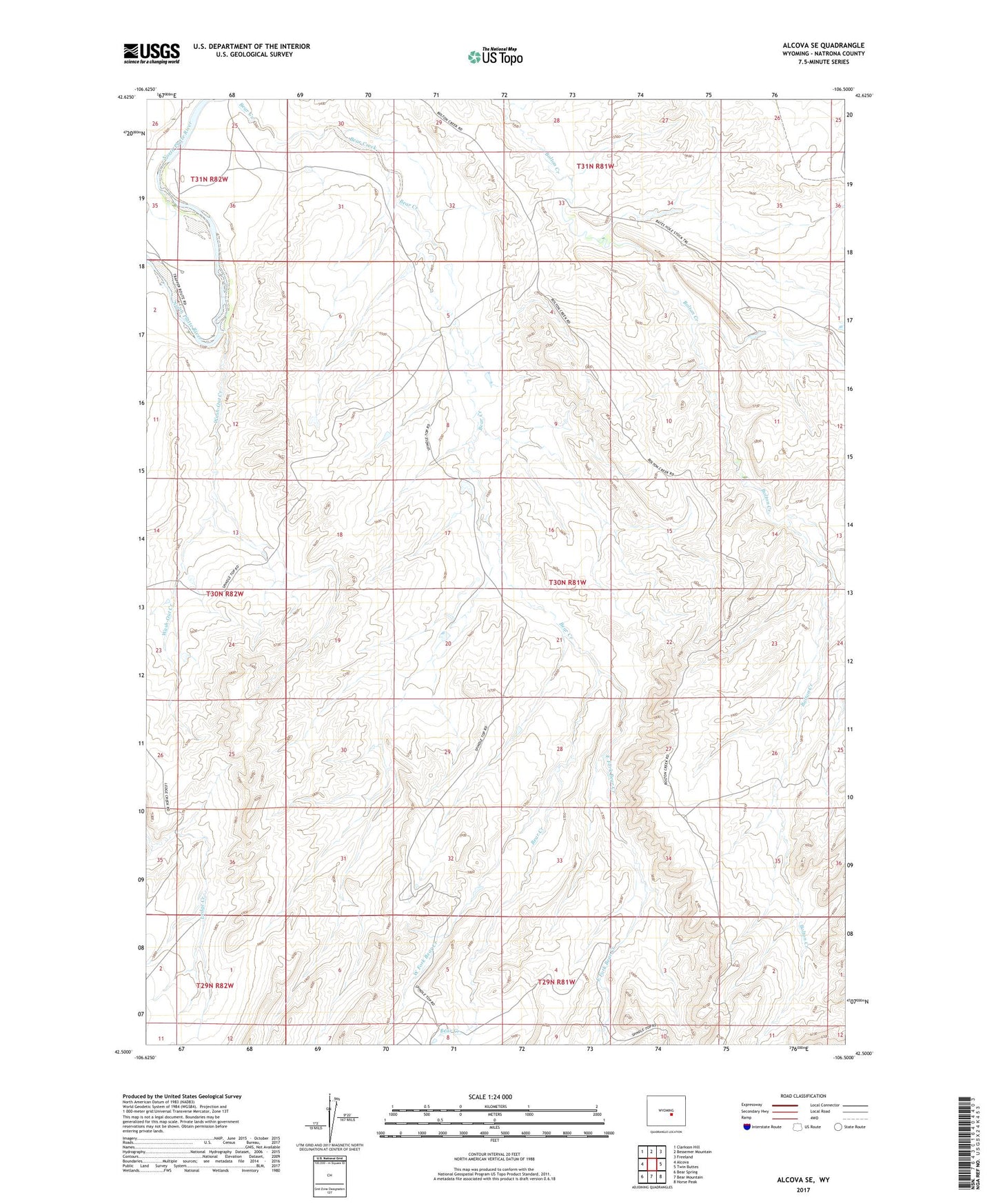
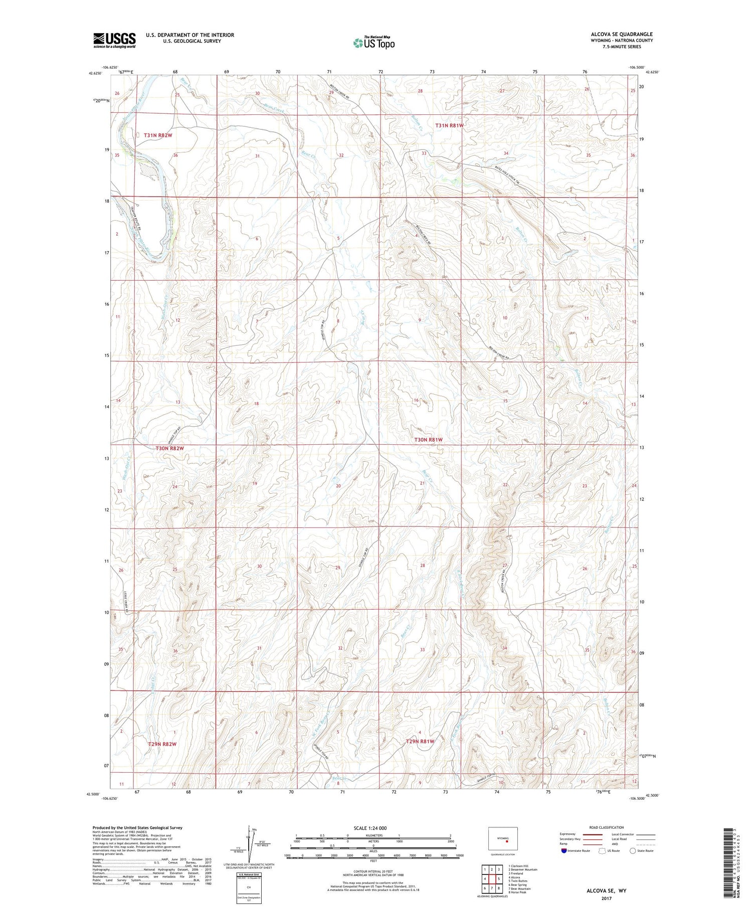
2021 topographic map quadrangle Alcova SE in the state of Wyoming. Scale: 1:24000. Based on the newly updated USGS 7.5' US Topo map series, this map is in the following counties: Natrona. The map contains contour data, water features, and other items you are used to seeing on USGS maps, but also has updated roads and other features. This is the next generation of topographic maps. Printed on high-quality waterproof paper with UV fade-resistant inks.
Quads adjacent to this one:
West: Alcova
Northwest: Clarkson Hill
North: Bessemer Mountain
Northeast: Freeland
East: Twin Buttes
Southeast: Horse Peak
South: Bear Mountain
Southwest: Bear Spring
Contains the following named places: Bates Hole Stock Trail, Bolton Creek Oil Field, East Fork Bear Creek, Spindle Top Oil Field, Wash-Out Creek, West Fork Bear Creek