
MyTopo
Alpine Wyoming US Topo Map
Couldn't load pickup availability
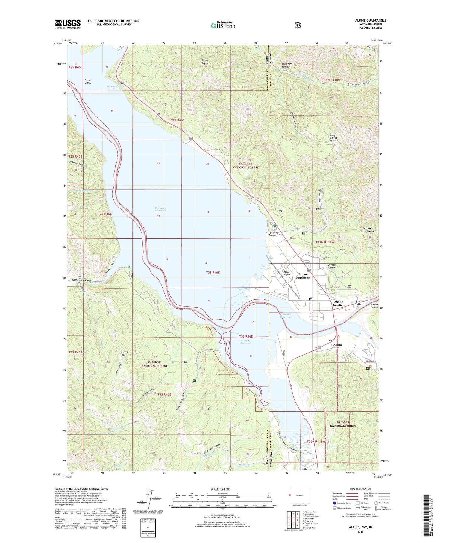
2021 topographic map quadrangle Alpine in the states of Idaho, Wyoming. Scale: 1:24000. Based on the newly updated USGS 7.5' US Topo map series, this map is in the following counties: Lincoln, Bonneville. The map contains contour data, water features, and other items you are used to seeing on USGS maps, but also has updated roads and other features. This is the next generation of topographic maps. Printed on high-quality waterproof paper with UV fade-resistant inks.
Quads adjacent to this one:
West: Poker Peak
Northwest: Palisades Dam
North: Mount Baird
Northeast: Observation Peak
East: Ferry Peak
Southeast: Stewart Peak
South: Etna
Southwest: Tincup Mountain
Contains the following named places: Alpine, Alpine Airport, Alpine Campground, Alpine Fire Department, Alpine Hot Springs, Alpine Junction, Alpine Northeast Census Designated Place, Alpine Northwest Census Designated Place, Alpine Post Office, Alpine Summer Home Area, Bitters Creek, Bitters Peak, Burns Creek, Driveway Canyon, Grand Canyon Boat Landing, Grand Valley, Greys River, Hoffman Campground, Indian Creek, Indian Creek Boat Ramp, Jordan Canyon, Little Box Canyon, Long Spring Basin, Long Spring Canyon, McCoy Creek, McCoy Creek Campground, McNeel Creek, North Fork Trout Creek, Palisades Reservoir, Salt River, Spencer Call Sand and Gravel Pit, Spring Run, Town of Alpine, Trout Creek, Williams Creek


