
MyTopo
Alsop Lake Wyoming US Topo Map
Couldn't load pickup availability
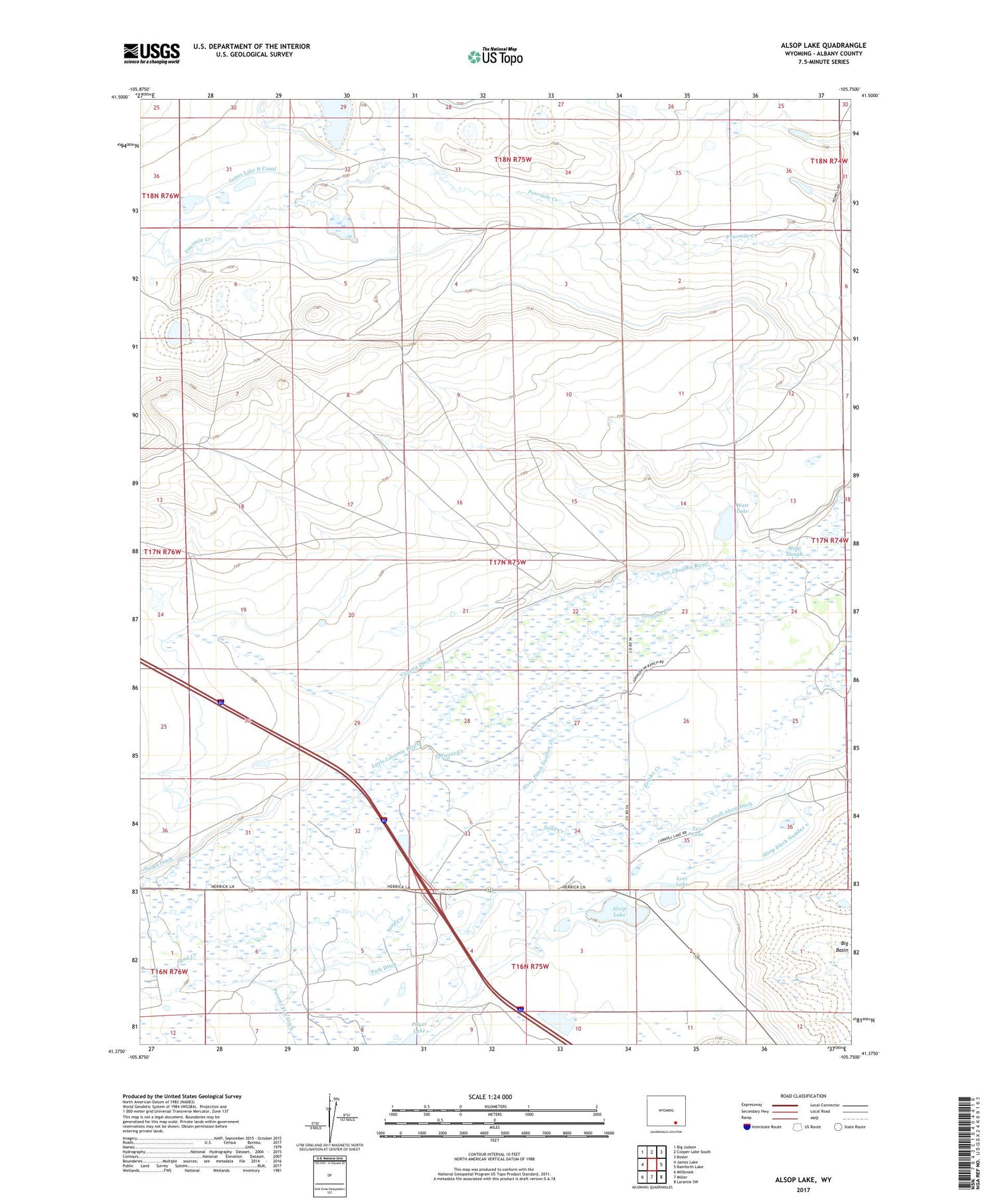
2021 topographic map quadrangle Alsop Lake in the state of Wyoming. Scale: 1:24000. Based on the newly updated USGS 7.5' US Topo map series, this map is in the following counties: Albany. The map contains contour data, water features, and other items you are used to seeing on USGS maps, but also has updated roads and other features. This is the next generation of topographic maps. Printed on high-quality waterproof paper with UV fade-resistant inks.
Quads adjacent to this one:
West: James Lake
Northwest: Big Judson
North: Cooper Lake South
Northeast: Bosler
East: Bamforth Lake
Southeast: Laramie SW
South: Miller
Southwest: Millbrook
Contains the following named places: Alsop Ditch Number 1, Alsop Ditch Number 2, Alsop Lake, Alsop Slough, Bath Brothers Ranch, Carroll Alsop Ditch, Fanning Ranch, Herrick Oil Field, James Lake North Canal, Johnson Ranch, Kisler Ranch, Little Laramie Oil Field, Lori Lake, Maddock Ranch, Park Ditch, Sand Creek, Scott Ranch, Snake Ditch, Sprague Creek, Sprague Lane School, Sprague Ranch, Teri Lake, Victoria Ditch, Watt Lake, Wessel Ranch, Zeigler Creek


