MyTopo
Alva Wyoming US Topo Map
Couldn't load pickup availability
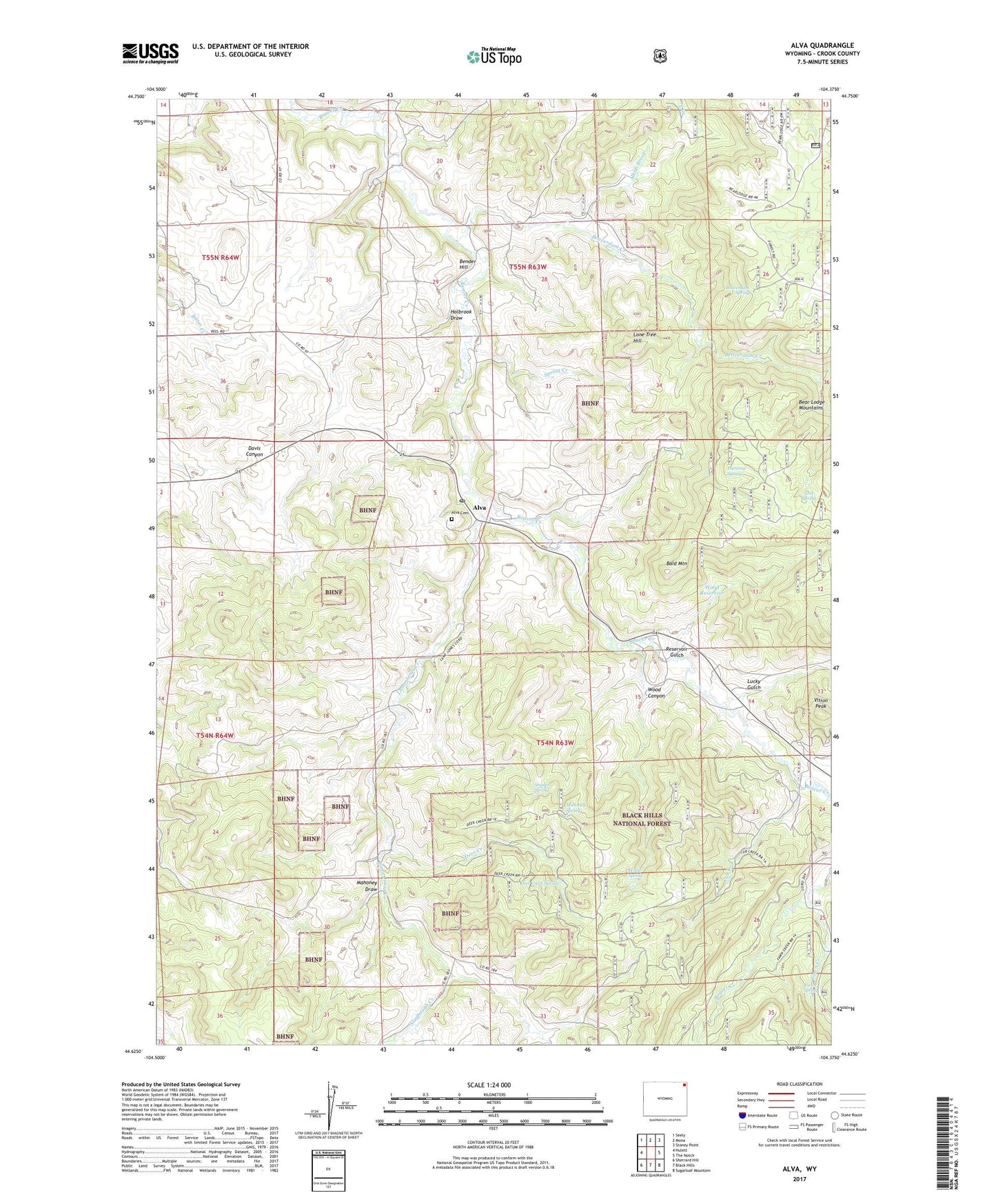
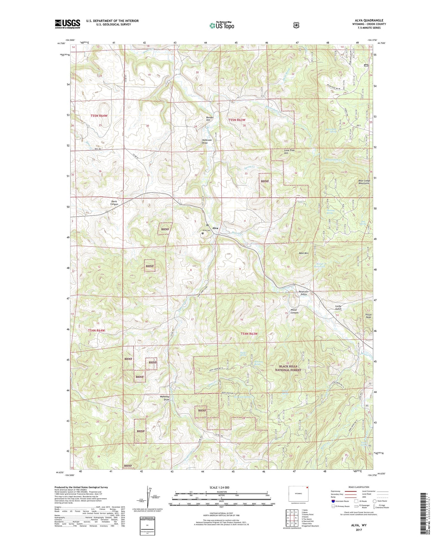
2021 topographic map quadrangle Alva in the state of Wyoming. Scale: 1:24000. Based on the newly updated USGS 7.5' US Topo map series, this map is in the following counties: Crook. The map contains contour data, water features, and other items you are used to seeing on USGS maps, but also has updated roads and other features. This is the next generation of topographic maps. Printed on high-quality waterproof paper with UV fade-resistant inks.
Quads adjacent to this one:
West: Hulett
Northwest: Seely
North: Mona
Northeast: Stoney Point
East: The Notch
Southeast: Sugarloaf Mountain
South: Black Hills
Southwest: Sherrard Hill
Contains the following named places: Alkali Brook, Alva, Alva Cemetery, Alva Post Office, Bald Mountain, Beaverdam Creek, Beaverdam Spring, Bender Hill, Cub Creek, Deer Creek, Deer Creek Spring, Driskell Pit, Fawn Creek, Fawn Spring, French Dam, French Reservoir, Holbrook Draw, Lame Jones Creek, Lame Jones School, Lone Tree Hill, Lost Spring, Lucky Gulch, Mahoney Draw, Mahoney Spring, Planting Spring, Rauth Trail, Reservoir Gulch, Simmons Trail, Slaybaugh Creek, Snyder Spring, Spring Creek, Upper Beaver Creek School, Vision Peak, White Slide Claims One-three Mine, Wood Canyon, Wood Reservoir, Wood Spring, ZIP Code: 82711