MyTopo
Antelope Gap Wyoming US Topo Map
Couldn't load pickup availability
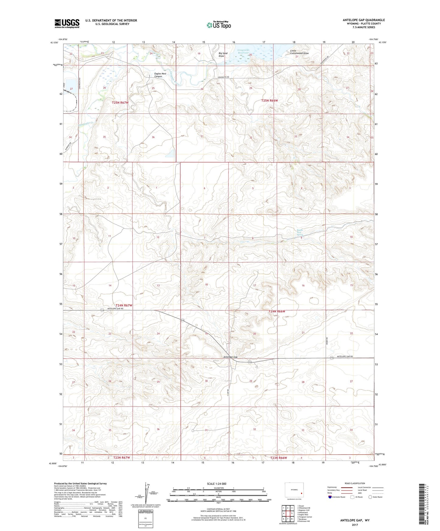
2021 topographic map quadrangle Antelope Gap in the state of Wyoming. Scale: 1:24000. Based on the newly updated USGS 7.5' US Topo map series, this map is in the following counties: Platte. The map contains contour data, water features, and other items you are used to seeing on USGS maps, but also has updated roads and other features. This is the next generation of topographic maps. Printed on high-quality waterproof paper with UV fade-resistant inks.
Quads adjacent to this one:
West: Wheatland
Northwest: Dwyer
North: Wheatland NE
Northeast: Register Cliff
East: Eagles Nest
Southeast: Dickinson Hill
South: Bordeaux
Southwest: Ferguson Corner
Contains the following named places: Antelope Gap, Antelope Grange Hall, Antelope School, Big Sand Draw, Chugwater Creek, Eagles Nest Canyon, Eagles Nest Spring, Little Cottonwood Draw