MyTopo
Argo Butte Wyoming US Topo Map
Couldn't load pickup availability
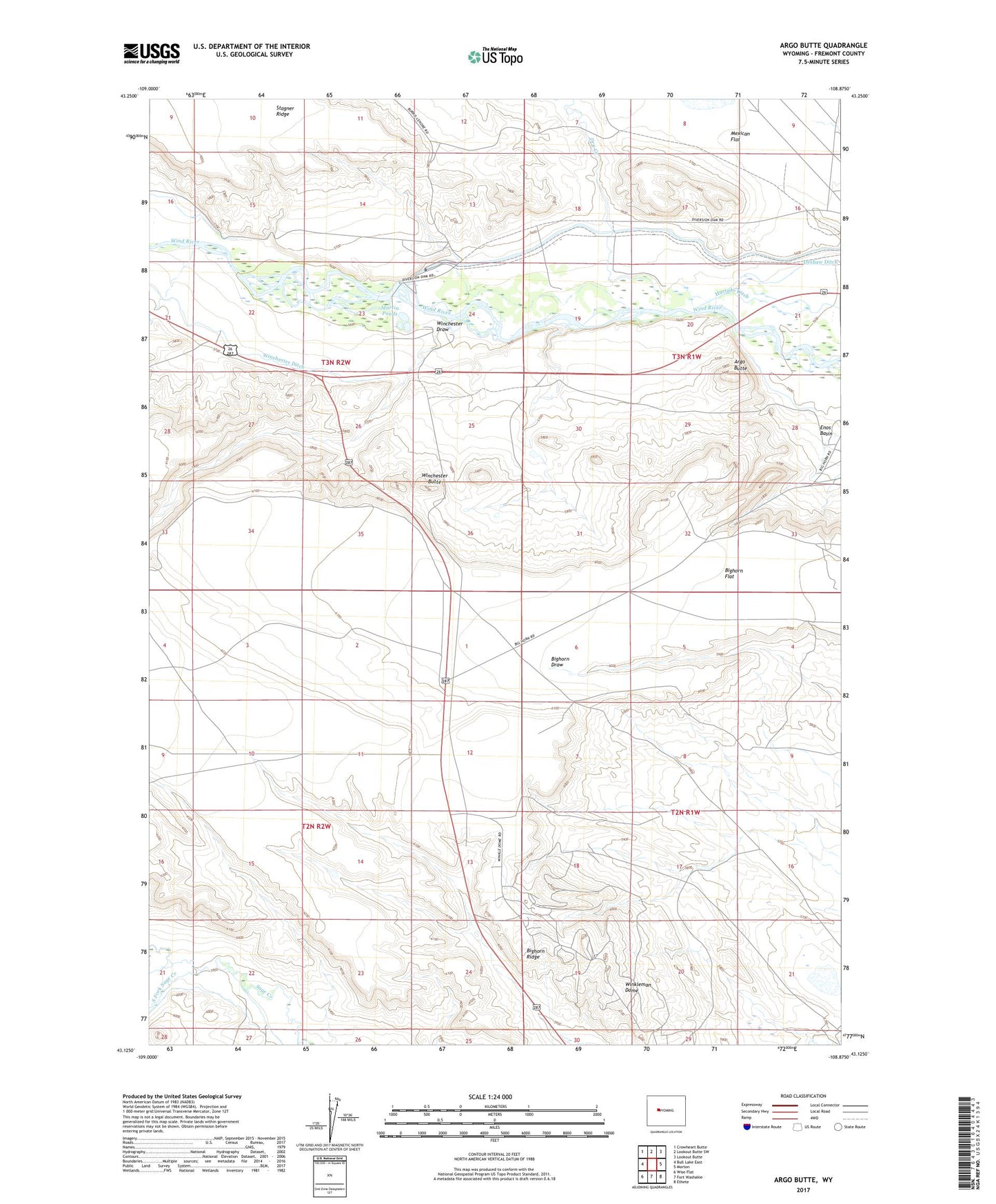
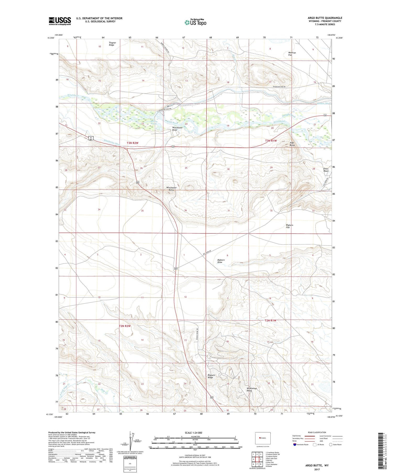
2021 topographic map quadrangle Argo Butte in the state of Wyoming. Scale: 1:24000. Based on the newly updated USGS 7.5' US Topo map series, this map is in the following counties: Fremont. The map contains contour data, water features, and other items you are used to seeing on USGS maps, but also has updated roads and other features. This is the next generation of topographic maps. Printed on high-quality waterproof paper with UV fade-resistant inks.
Quads adjacent to this one:
West: Bull Lake East
Northwest: Crowheart Butte
North: Lookout Butte SW
Northeast: Lookout Butte
East: Morton
Southeast: Ethete
South: Fort Washakie
Southwest: Wise Flat
Contains the following named places: Argo Butte, Bighorn Flat, Deshaw Ditch, Diversion Dam, Diversion Dam Park, Dry Creek, Martin Ponds, Middle Fork Sage Creek, North Fork Canyon Number Two Mine, North Fork Sage Creek, South Fork Sage Creek, Winchester Butte, Winchester Ditch, Winchester Draw, Wind River Diversion Dam, Winkleman Dome, Winkleman Dome Oil Field, Winkleman Dome School