
MyTopo
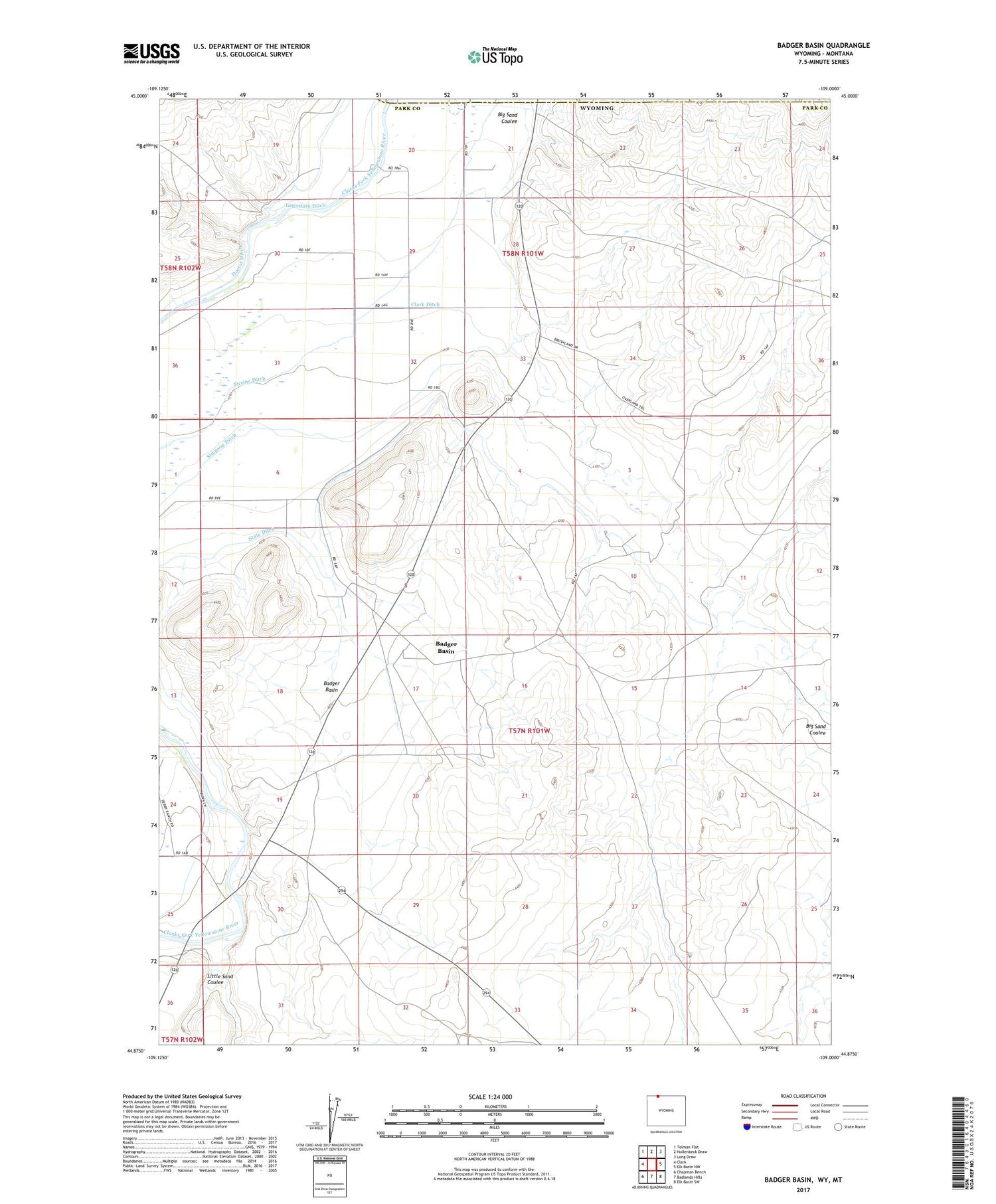
Badger Basin Wyoming US Topo Map
Couldn't load pickup availability
2021 topographic map quadrangle Badger Basin in the state of Wyoming. Scale: 1:24000. Based on the newly updated USGS 7.5' US Topo map series, this map is in the following counties: Park, Carbon. The map contains contour data, water features, and other items you are used to seeing on USGS maps, but also has updated roads and other features. This is the next generation of topographic maps. Printed on high-quality waterproof paper with UV fade-resistant inks.
Quads adjacent to this one:
West: Clark
Northwest: Tolman Flat
North: Hollenbeck Draw
Northeast: Long Draw
East: Elk Basin NW
Southeast: Elk Basin SW
South: Badlands Hills
Southwest: Chapman Bench
Contains the following named places: Badger Basin, Big Sand Coulee, Buck Springs Detention Dam, Buck Springs Reservoir, Chapman Creek Pit, Chesarek Ranch, Clark Ditch, Doctor Ditch, Interstate Ditch, Little Sand Coulee, Park County Fire Protection District 4, Pioneer School, Simpson Ditch, State Ditch, Walker Ranch


