MyTopo
Ash River SE Minnesota US Topo Map
Couldn't load pickup availability
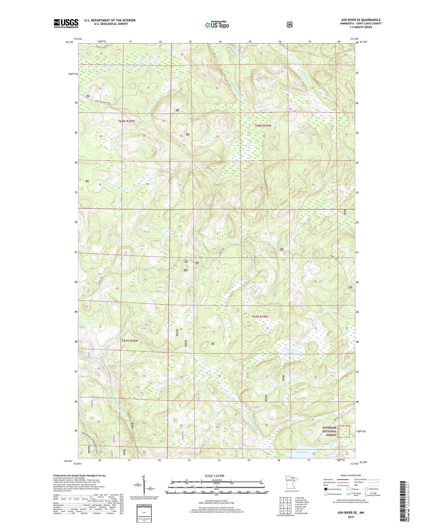
2019 topographic map quadrangle Ash River SE in the state of Minnesota. Scale: 1:24000. Based on the newly updated USGS 7.5' US Topo map series, this map is in the following counties: St. Louis. The map contains contour data, water features, and other items you are used to seeing on USGS maps, but also has updated roads and other features. This is the next generation of topographic maps. Printed on high-quality waterproof paper with UV fade-resistant inks.
Quads adjacent to this one:
West: Ash River SW
Northwest: Daley Bay
North: Ash River NE
Northeast: Namakan Island
East: Marion Lake
Southeast: Elephant Lake
South: Orr NE
Southwest: Ash Lake
Contains the following named places: Chub Lake, Corner Lake, Ninemile Creek