MyTopo
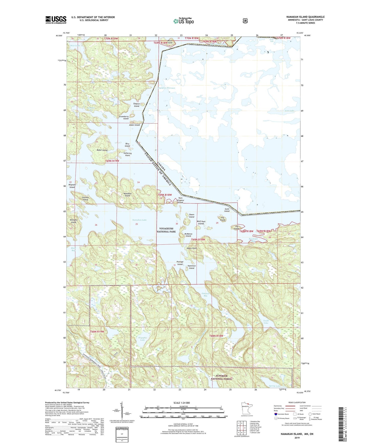
Namakan Island Minnesota US Topo Map
Couldn't load pickup availability
Also explore the Namakan Island Forest Service Topo of this same quad for updated USFS data
2022 topographic map quadrangle Namakan Island in the state of Minnesota. Scale: 1:24000. Based on the newly updated USGS 7.5' US Topo map series, this map is in the following counties: St. Louis. The map contains contour data, water features, and other items you are used to seeing on USGS maps, but also has updated roads and other features. This is the next generation of topographic maps. Printed on high-quality waterproof paper with UV fade-resistant inks.
Quads adjacent to this one:
West: Ash River NE
Northwest: Kempton Bay
North: Kettle Falls
East: Blind Pig Island
Southeast: Johnson Lake
South: Marion Lake
Southwest: Ash River SE
This map covers the same area as the classic USGS quad with code o48092d6.
Contains the following named places: Alden Island, Bivo Island, Fox Island, Gagnon Island, Gehering Point, Gold Island, Hamilton Island, Hoist Bay, Johnson Bay, Johnson River, Jug Island, Junction Bay, Kettle Falls, Kettle Falls Dam, Kubel Island, Magie Island, McManus Island, Mica Island, Namakan Island, Namakan Lake, Namakan Seaplane Base, Net Lake, Postage Island, Randolph Bay, Sexton Island, Sheen Island, Sheen Point, Squirrel Narrows, Stevens Island, Strawberry Island, Tooth Lake, Twin Alligator Island, Voyageur Narrows, Weir Lake, Wigwam Island, Wiyapka Lake, Wolf Pack Islands