MyTopo
Daley Bay Minnesota US Topo Map
Couldn't load pickup availability
Also explore the Daley Bay Forest Service Topo of this same quad for updated USFS data
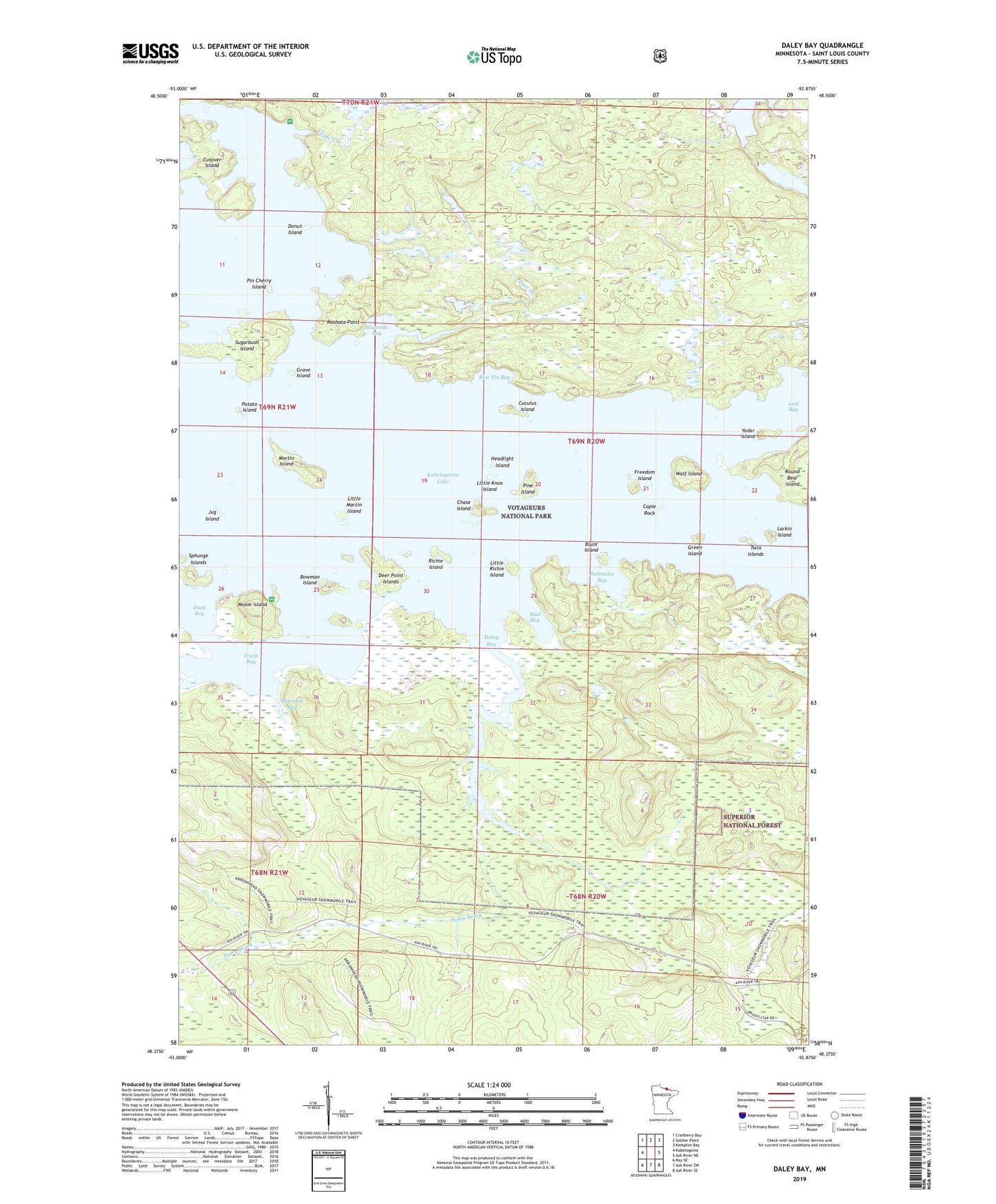
2022 topographic map quadrangle Daley Bay in the state of Minnesota. Scale: 1:24000. Based on the newly updated USGS 7.5' US Topo map series, this map is in the following counties: St. Louis. The map contains contour data, water features, and other items you are used to seeing on USGS maps, but also has updated roads and other features. This is the next generation of topographic maps. Printed on high-quality waterproof paper with UV fade-resistant inks.
Quads adjacent to this one:
West: Kabetogama
Northwest: Cranberry Bay
North: Soldier Point
Northeast: Kempton Bay
East: Ash River NE
Southeast: Ash River SE
South: Ash River SW
Southwest: Ray SE
This map covers the same area as the classic USGS quad with code o48092d8.
Contains the following named places: Ash River Trail, Blue Fin Bay, Blunt Island, Bowman Bay, Bowman Island, Capie Rock, Chase Island, Clyde Creek, Cuculus Island, Cutover Island, Daley Bay, Daley Brook, Deer Creek, Deer Point Islands, Donut Island, Freedom Island, Grave Island, Green Island, Headlight Island, Irwin Bay, Jug Island, Larkin Island, Little Knox Island, Little Martin Island, Little Richie Island, Little Shoepack Lake, Martin Island, Moxie Island, Mud Bay, Nashata Point, Nebraska Bay, Pin Cherry Island, Pine Island, Potato Island, Richie Island, Shoepack Lookout Tower, Slatinski Bay, Sugarbush Island, Twin Islands, Wolf Island, Yoder Island