MyTopo
Blair South Carolina US Topo Map
Couldn't load pickup availability
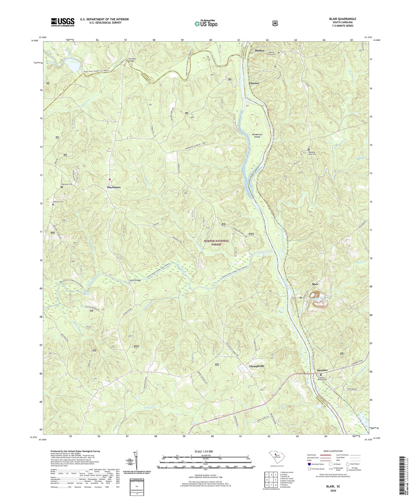
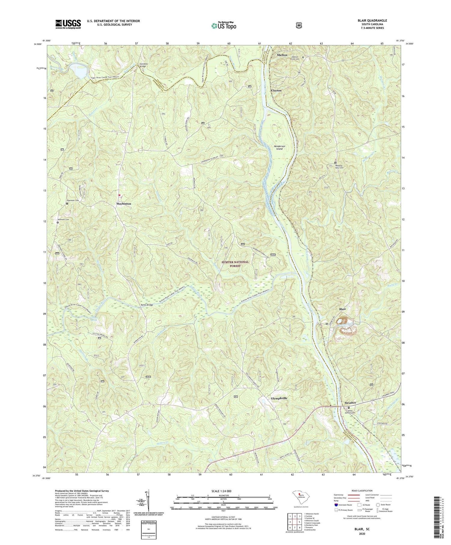
2020 topographic map quadrangle Blair in the state of South Carolina. Scale: 1:24000. Based on the newly updated USGS 7.5' US Topo map series, this map is in the following counties: Newberry, Fairfield, Union. The map contains contour data, water features, and other items you are used to seeing on USGS maps, but also has updated roads and other features. This is the next generation of topographic maps. Printed on high-quality waterproof paper with UV fade-resistant inks.
Quads adjacent to this one:
West: Whitmire South
Northwest: Whitmire North
North: Carlisle
Northeast: Carlisle SE
East: Salem Crossroads
Southeast: Jenkinsville
South: Pomaria
Southwest: Newberry East
Contains the following named places: Ashford Ferry, Beaver Creek, Big Dryer Creek, Blair, Blair Quarry, Blairs Ferry, Broad River Scenic Area, Broad River School, Cane Creek, Clayton, Clayton Ferry, David Sims Ferry, Duffs Branch, Ebenezer Cemetery, Ebenezer Church, Elizabeth Church, Elizabeth School, Enoree River, Gilliam Spring, Glymphville, Gordons Bridge, Greenshaws Ford, Henderson Ferry, Henderson Island, Hendersons Bridge, James Ashford Cemetery, Keitts Bridge, Keitts River, Kellys Creek, Lyles Ford, Lylesford, Maybinton, Maybinton Fire Department Sub Station, McClures Creek, Mount Pleasant Church, Mount Pleasant School, New Fellowship Church, Old Ridge Branch, Peters Creek, Pleasant Hill School, Quarters Branch, Rennicks Branch, Rocky Creek, Scenic Area Hunt Camp, Seekwell Cemetery, Seekwell Church, Seekwell School, Shelton, Shelton - Shivar Cemetery, Shelton Lookout Tower, Strother, Subers Creek, Trinity Church, Trinity School, Tyger River, Weeping Mary Cemetery, Weeping Mary Church