MyTopo
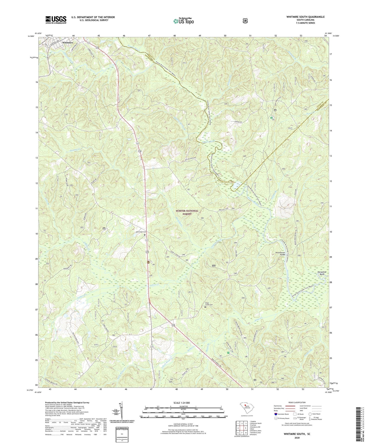
Whitmire South South Carolina US Topo Map
Couldn't load pickup availability
Also explore the Whitmire South Forest Service Topo of this same quad for updated USFS data
2024 topographic map quadrangle Whitmire South in the state of South Carolina. Scale: 1:24000. Based on the newly updated USGS 7.5' US Topo map series, this map is in the following counties: Newberry, Union. The map contains contour data, water features, and other items you are used to seeing on USGS maps, but also has updated roads and other features. This is the next generation of topographic maps. Printed on high-quality waterproof paper with UV fade-resistant inks.
Quads adjacent to this one:
West: Newberry NW
Northwest: Sedalia
North: Whitmire North
Northeast: Carlisle
East: Blair
Southeast: Pomaria
South: Newberry East
Southwest: Newberry West
This map covers the same area as the classic USGS quad with code o34081d5.
Contains the following named places: Asias Branch, Avery Ford, Bakers Cross Roads, Brazzlemans Bridge, Civilian Conservation Corps Camp F-6, Collins Branch, Collins Creek Hunt Camp, Colonel Brown School, Douglas School, Duncan Creek, Enoree Ranger District Office, First Church of God, Fosters Branch, Gilders Creek, Horseshoe Bend, Hunting Creek, Indian Creek, Indian Creek Rifle Range, Indian Creek Work Center, Kings Creek, Kings Creek Cemetery, Kings Creek Church, Kings Creek School, Laway School, Little Kings Creek, Long Lane, Long Lane Branch School, Long Lane Hunt Camp, Long Lane Lookout Tower, Long Lane School, McCollough Church, McCullough School, Means Branch, Mollyhorn School, Mollys Rock Recreation Area, New Hope Cemetery, New Hope Church, Pattersons Creek, Pentecostal Holiness Church, Renwick Grove Church, Saint Pauls Church, South Fork Kings Creek, Sulphur Spring Branch, Whitmire Division, Willow Oak Hunt Camp, Wilsons Creek, ZIP Code: 29178