MyTopo
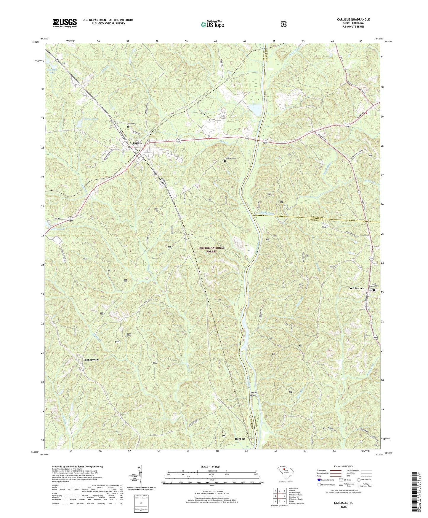
Carlisle South Carolina US Topo Map
Couldn't load pickup availability
Also explore the Carlisle Forest Service Topo of this same quad for updated USFS data
2024 topographic map quadrangle Carlisle in the state of South Carolina. Scale: 1:24000. Based on the newly updated USGS 7.5' US Topo map series, this map is in the following counties: Union, Fairfield, Chester. The map contains contour data, water features, and other items you are used to seeing on USGS maps, but also has updated roads and other features. This is the next generation of topographic maps. Printed on high-quality waterproof paper with UV fade-resistant inks.
Quads adjacent to this one:
West: Whitmire North
Northwest: Union East
North: Leeds
Northeast: Baton Rouge
East: Carlisle SE
Southeast: Salem Crossroads
South: Blair
Southwest: Whitmire South
This map covers the same area as the classic USGS quad with code o34081e4.
Contains the following named places: Brocks Creek, Carlisle, Carlisle Division, Carlisle Fire Department, Cool Branch, Cool Branch Baptist Church, Cool Branch Cemetery, Cool Branch Church, Coxs Creek, Fish Dam Battleground Monument, Fish Dam Cemetery, Fishdam Ferry, Fishdam Ford, Glovers Branch, Gus Jeter Lake, Gus Jeter Lake Dam D-2159, Hamilton School, Herbert, Herbert Hunt Camp, High Hill Creek, Hill Cemetery, Jeters Chapel School, Jeters Pond, Jeters Pond Dam D-2157, Johns Creek, Kelly Chapel, Kellys Cemetery, Leeds Volunteer Fire Department, Mineral Creek, Pride, Saint Lukes Church, Salinas Pond, Salinas Pond Dam D-2610, Sandy River, Shelton Island, Sims Chapel School, Smiths Ferry, South Sandy Boat Ramp, Town of Carlisle, Tuckertown, ZIP Code: 29031