MyTopo
Badger Peak Utah US Topo Map
Couldn't load pickup availability
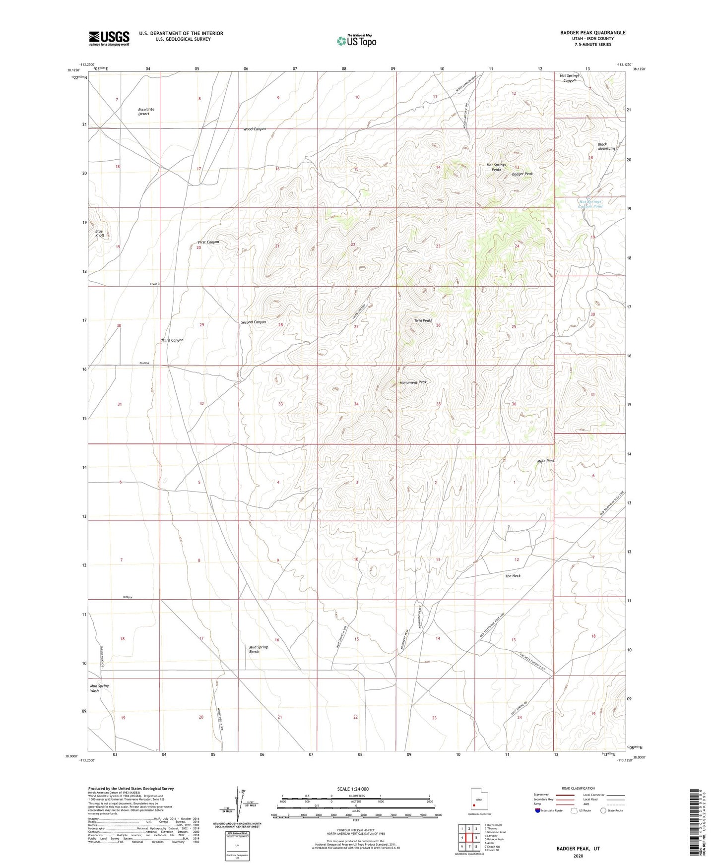
2020 topographic map quadrangle Badger Peak in the state of Utah. Scale: 1:24000. Based on the newly updated USGS 7.5' US Topo map series, this map is in the following counties: Iron. The map contains contour data, water features, and other items you are used to seeing on USGS maps, but also has updated roads and other features. This is the next generation of topographic maps. Printed on high-quality waterproof paper with UV fade-resistant inks.
Quads adjacent to this one:
West: Latimer
Northwest: Burns Knoll
North: Thermo
Northeast: Ninemile Knoll
East: Baboon Peak
Southeast: Enoch NE
South: Enoch NW
Southwest: Avon
Contains the following named places: Badger Peak, Casting of Lots Site, First Canyon, Hot Springs Canyon Pond, Hot Springs Peaks, Monument Peak, Mud Spring Bench, Mule Peak, Second Canyon, The Neck, Third Canyon, Twin Peaks, Wood Canyon