MyTopo
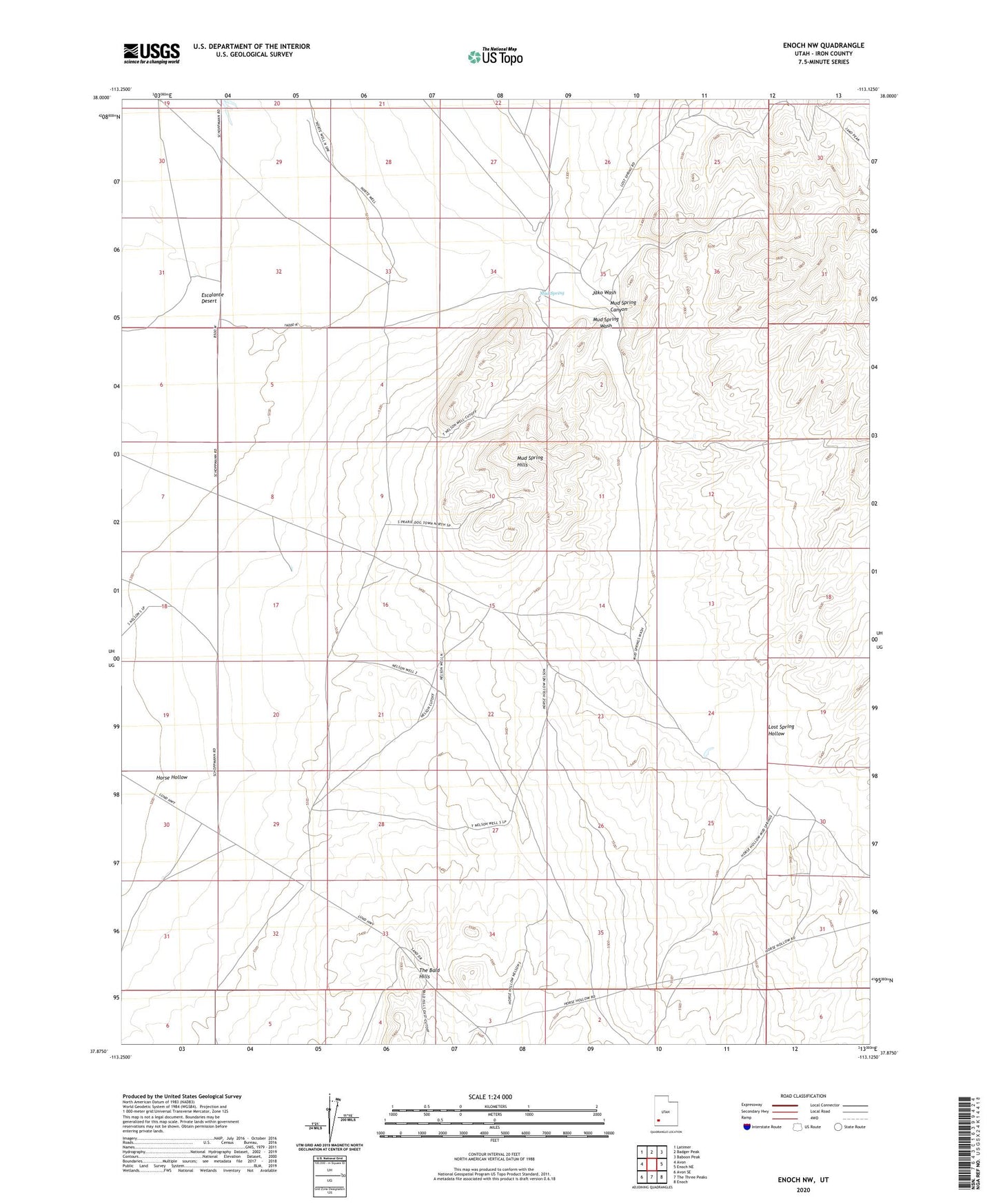
Enoch NW Utah US Topo Map
Couldn't load pickup availability
2023 topographic map quadrangle Enoch NW in the state of Utah. Scale: 1:24000. Based on the newly updated USGS 7.5' US Topo map series, this map is in the following counties: Iron. The map contains contour data, water features, and other items you are used to seeing on USGS maps, but also has updated roads and other features. This is the next generation of topographic maps. Printed on high-quality waterproof paper with UV fade-resistant inks.
Quads adjacent to this one:
West: Avon
Northwest: Latimer
North: Badger Peak
Northeast: Baboon Peak
East: Enoch NE
Southeast: Enoch
South: The Three Peaks
Southwest: Avon SE
This map covers the same area as the classic USGS quad with code o37113h2.
Contains the following named places: Horse Hollow, Jako Wash, Lost Spring Hollow, Mud Spring, Mud Spring Canyon, Mud Spring Hills, Norte Well, Stubbs Well